Dutton Alert

Bucksnbulls08

New Member
Messages
0
For those of you that are unaware, the United States Forest Service (USFS) is closing approx. 95% of all the roads on the Dutton Unit. Other forests are or will be under the same attack. I just spent the last 2 weeks traveling the unit and a vast majority of the roads are already closed while many more are marked for destruction. Many of us feel that this is an arbitrary attempt to limit the public use of a public resource and complete and blatant discrimination against handicapped and elderly persons.
I spoke with a USFS representative for the Powell Ranger Dist. in Panguitch. This individual identified the criteria for the selection of roads to be closed and many of the roads that are being closed do not meet the criteria. I was advised that Washington has dictated that each forest is allowed so many miles of road for every sq. mile of forest, roads need to be closed to achieve that goal. I was also advised that the intent was to closes less than 75% of the roads. When I questioned about the high percentage for the Dutton area, I was advised that the Powell Ranger Dist. in comprised of the Dutton and the Paunsaugunt, because the Paunsaugunt receives more publicity and public use by hikers and bicyclists that the decision was made to transfer a portion of the closures to the Dutton instead of the Paunsaugunt.

The USFS will allow vehicle travel off the roadway to a camp site, no more than 150' from the center line of the road, this includes woodcutting travel also.

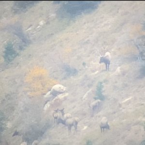
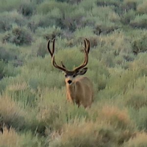
As a hunter, I can see the benefit to the wildlife with the road closure. In reality, the benifit will not be there as much because so many people ignore the closures and travel where they please anyway. The overall detriment will by far out weigh the benefits.

The USFS representative advised me that this was driven by the environmentalists in Washington and has no merit locally. The specific roads to be closed were decided by the Dixie Forest Supervisor Rob MacWherter, who has never stepped a foot on the Dutton nor does he have a clue about the area. I understand he has made the comment that no one uses wood for primary heating any longer, in regards to wood cutting for heating purposes, that is how far out of touch he is.

If many thought the Southern units were over crowded before, look out The congestion is going to get worse, with the only camping and parking being on the main road.

Currently the road from Antimony to Cottonwood is open and a small portion of the East and West Hunt Creek roads are open. These are closed not too far into the hills and all spur roads off these are closed.

I hope you are as disappointed as I am with our government agency that should be the steward of the land for the benefit of the public instead of limiting uses for the public. They are managing for the few special groups instead of the majority of public.

I urge everyone that is concerned with this situation to call the Dixie National Forest office in Cedar City or the Powell Ranger Dist Office in Panguitch and verbally file a complaint. We can only slow down this loss of public land by making our voices heard.

USFS advertises the "land of many uses", it is now the land of few uses.
USFS is quickly becoming Public Enemy # 1.

The forest nearest you will be next if not currently in action, so please go forth and scream!

JoeBucksnbulls08

Posts: 19
Joined: Sep 18, '08, 9:08
Private messageTop
 
yup, they are already shutting roads down on the Blue mountians in san juan, and on the elk ridge as well. Lots of roads and trails are being blocked off.
 
They are after all public lands, soon the US will be a big National Park or National Monument. I do not hunt from the roads but the roads give access to the bail off points. Now we will need to hike additional miles to reach our hunting areas. Yea!
 
I'll admit I've only been to the Blues once, but that was last weekend... I didn't see any roads closed where I was... It is a sad day when we no longer have access to hunting and camping areas... It happened to our family on the North Slope Uintahs. All of the places we used to hunt and camp when I was a kid, are closed off now...


"Therefore, wo be unto him that is at ease in Zion!" 2 Ne. 28: 24
 
Wish they'd close some of the roads around here. Be nice to hunt without having to deal with all the buttheads on atv's. Folks would have to do some walking and those that chose not to could go play billards or darts or something...
 
I just called the CC Forest Service office and thanked them for closing roads. In my opinion it is about time. There is no reason for a short road up every canyon. If you look at the closure map a lot of the roads are dead end roads that are a mile or less long.
 
Think SUWA is behind any of those roads being shut down?
I have seen a bunch of roads on the Manti being shutdown as well.
This is crazy, access to jump-off points need to remain open.
Bunch of WHINERS are setting policy back in D.C.
 
Was down there last week and they are closing more roads every weekend I am down there. Some look to be a good choice, just hope they don't go too far. We will see.
 
I have been reading the ruling on this and a lot of freedom is left up to the local district as to how this is implemented. Here is the link:
http://www.fs.fed.us/r2/recreation/travel_mgmt/travel-rule/finalrule.pdf

This is the implementation strategy for Colorado. If you read it closely you can see how some of the districts implemented the overall plan. It is very interesting once you get a handel on what they are trying to present.

http://www.fs.fed.us/r2/recreation/travel_mgmt/travel-rule/nepa/TMR_NEPA-Planning_9-22-06.pdf

I haven't found the one for Utah yet but I did get my hands on the Motor Vehicle Use Map for Ferron, Price, Sanpete Ranger Districts in Utah and things are very clear as to what routs are open and what they are open two.

Everyone should read both of these documents then look at how your local district is handeling these changes. The intent is good but I think some of the implementation is flawed because they are implemented by people in the district and they should have allowed for public input as stated in these documents.

HondoArcher
 
Looking at the map I am pleased. There is nothing like Hiking your butt off up Rock creek at 3 a.m. early in the morning glassing the country you worked so hard to get into only to hear the melodious sounds of four wheelers topping the ridge out of Cottonwood (where they should never have been). Bucksandbulls08 I just looked at the map and if you say that is 95% being closed off you are way out of touch the number may be more around 50% or a little higher. Also there are no shortage of trees in the dutton for firewood that fall within the specified regulations of 150 feet (50 yards) Ill take a guess and say there are probably about 10 million great firewood trees from the center line of the road in the Dutton Burned up in 02 and cured and ready to cut today. Its apparent you dont spend a whole hell of alot of time in the Dutton. Finally maybe I can have a hunt that isnt ruined by some lazy slob on an ATV.
 
I dont mind the road closures. I am actually for having less atv access. The problem is there will still be plenty of people using the closed roads. The signs will get knocked down and the only people not using the roads will be the ones that get a current map abide by the law. Nothing like walking up 3 mile road that is closed to atv's and have an atv pass you on the last quarter mile of it.
 
Lowcountry, I do spend a lot of time on the Dutton. I just spent the last 2 weeks traveling as much as possible and the 95% is far more accurate than 50% and that number was confirmed by the USFS representative that I spoke to. Not all the roads are closed yet but are in the process. Most of the roads have flags, markers and surveyor paint indicating the closure.
I too have been foiled, thinking I was a long way in, away from legal vehicle traffic to have a slob hunter drive within ear shot. If the roads are going to be closed, I hope that the USFS will enforce the closures, so when you think you are a long way from vehicles, you are.
 
wish they would closea few on several other units. i think some roads are fine but atv trails are gettin outta hand. there is hardly a canyoon without one anymore.
 
I spent the last 3 days down there, most of the roads that they closed off with the fence and rocks are one's that were already closed, or are little spurs that aren't really needed.

I would worry more about calf and fawn recruitment down there then I would about some trail closer.
 
Had friends down around Parwon this last weekend and they was told here a map and the following roads are closed,They was camped about 400yds up a small trail that deadsends in some aspens this 2 lane has been there for 20 yrs, they was told you can't camp more then a 150 ft from the center of the road. NO we aren't going to Block off the roads but will give you a ticket if you travel on them????????I don't understand.
How in the hell is some-one suppose to know not to go down a road that they been using for 10 years or more.
Another question 150 ft is this to the edge of camp or to the far side of camp,or the center of camp because some camps can get some sprawl going.
If you're going to close them Drop a tree or a bunch of them across them or a huge pile of dirt with huge rocks in them, Don't leave it up to some Boy Scout to give out a ticket.


"I have found if you go the extra mile it's Never crowded".
 
Bucksandbulls08 since you wont take my word for it. Take Founders. Or you can go to the General huntin page and look for yourself.


"Founder (2255 posts)
Jul-27-10, 04:08 PM (MST)
15. "RE: stand together dutton road closures"
Nicholas Glidden of the Dixie National Forest is in charge of getting those roads closed. He saw the threads on the site and sent me over a PDF file that give some insight on the road closures.
31% of miles will be closed and 59% of roads on the Dutton. Looking at the PDF, most are very short roads/trails of less than a mile. Some are logging roads that only FS will have access to.
I'm guessing that when it's all said and done, you guys who like roads and trails won't loose much, but a few calories if you hike.
Hopefully when all is said and done, there are a few little holes on that mountain where some bucks can grow old again.

Brian Latturner
MonsterMuleys.com"

Looks Like 31% of the Miles and 59% of the roads. Whoever you talked to in Panguitch must have saw the 59% backwards as 95%.
 
I'm actually glad they are closing more roads to atv's and motor vehicles. It will only improve hunting! Guys that are willing to get out of the truck/atv and hike may find bigger and better bucks and bulls in the years to come! There are so many short deadend roads on Dutton that I see this as an advantage to most hunters. There ought to be a few more super bulls that live a little longer if guys aren't willing to work a little bit for them!

The last time I was on Dutton there were so many posey's of guys running up and down the roads in trucks and ATV's trying to locate bulls for their buddies that it was a dust bath! There was literally 2 to 5" of dust on most roads by the end of the first rifle season. I think it will be great if hunters and their "posey" are kind of forced to hike rather than road hunt. It will likely be a little tougher for them to radio to their buddy where giant bulls are...so they can jump in the truck and haul butt over to shoot them! The larger the areas w/out roads the better!

I certainly hope Colo and Wyo follow suite...as mentioned above there is an ATV trail up just about every draw that isn't in a wilderness area and this ought to improve hunting for all but the guys that aren't willing to get out of their truck/atv!
 
LAST EDITED ON Jul-30-10 AT 07:33AM (MST)[p]Well put Jims. I know what you mean by posse's of ATV's. There is still plenty of access into the Dutton. Here is the New map open to Motor vehicles web address.

http://www.fs.fed.us/r4/dixie/projects/MTP/index.shtml

Click on Powell Ranger district for a map or any district you want to took look at.

Anyone can see the Dutton and other areas of the Dixie N. are Still very accessable certainly not a 95% closure of Roads.
 
I agree with Jims, I am looking forward to the deer and elk hunting imporving and I AM one of those guys that gets out and humps the hills, not a behind the wheel hunter. I have never had a problem fnding my own area of seclusion when I wanted to.

I am just concerned about what the USFS tactics and not including the public through proper advertisement in local publications that are read by people that may be affected by the changes or with public meetings that inform of specific intent.

I looked at the map and it appears to be fairly accurate by what I personally saw on the unit. There are several roads that were not indicated on the map that have been closed. There were a couple roads in "green" for everyone use, that I personally saw either closed or marked for clousure. I have been beyond looking at the map, I have been there.

I am looking at this situation from a more subjective stand point, I have removed my selfish desire to have more area to myself and have considered the bigger picture on how this affects the majority of the users. This is one more freedom that the Gov. is dictating to the public on how to "not use".
With an open mind, I wonder what is next? Soon they will be closing the land to hunting, or using a specific weapon or who knows what other restrictions may apply in the future.
We need to keep our eyes and our minds open to what is going on around us.
Good luck on everyones hunts this season.
 
>I am just concerned about what
>the USFS tactics and not
>including the public through proper
>advertisement in local publications that
>are read by people that
>may be affected by the
>changes or with public meetings
>that inform of specific intent.
>
>
>I looked at the map and
>it appears to be fairly
>accurate by what I personally
>saw on the unit. There
>are several roads that were
>not indicated on the map
>that have been closed. There
>were a couple roads in
>"green" for everyone use, that
>I personally saw either closed
>or marked for clousure. I
>have been beyond looking at
>the map, I have been
>there.
>
>I am looking at this situation
>from a more subjective stand
>point, I have removed my
>selfish desire to have more
>area to myself and have
>considered the bigger picture on
>how this affects the majority
>of the users. This is
>one more freedom that the
>Gov. is dictating to the
>public on how to "not
>use".
>With an open mind, I wonder
>what is next? Soon they
>will be closing the land
>to hunting, or using a
>specific weapon or who knows
>what other restrictions may apply
>in the future.
>We need to keep our eyes
>and our minds open to
>what is going on around
>us.
>Good luck on everyones hunts this
>season.

Bucksnbulls08, did you bother to comment on the plan when the comment period was open May 23-July 7 2008? How about when it was extended through July 22? If not, I don't think you have anything to complain about now. The Federal Government doesn't make a habit of skipping NEPA steps like public comment periods.

Hunters should be thankful for the USFS doing something to improve hunting.
 
I don't know about the hero bit Triple-BB but I am usually blunt and to the point in regard to issues that are important to me and others that like to hunt public land!

With all the current roads open to ATV's and 4 WD in Colo and Wyo their is currently a lot of hunting pressure on public land. Colo hunters have complained for years that game gets pushed off public land and onto private land where they are often off limits to hunting. With more numerous and larger parcels of roadless public parcels it stands to reason hunting pressure may actually decrease on public land and game may spend more time where they can be hunted by all of us?

Fewer roads mean less maintenance for BLM, forest service, etc...and maybe our dwindling federal $ would go directly to habit improvement and wildlife rather than road maintenance?
 
I know a couple ranchers from sweetwater ranch on the dutton unit said they've already baracaded some roads and signs no atv or motorized vehicles on public land our land, the ranchers cant even use there atvs for ranch purposes, time to sell the 4 wheeler and invest in a pack mule and a fence bye bye camper trailor, one thing after another with these guys from washinton
from intruducing wolves to closing down forest access, is there anyone representing us????????????????
 
i was just down last weekend scouting and was pleases to see the closures. cant wait to use an old logging road as a trail into a sweet drainage and not have to worry about some f 350 diesel come chattering by. maybe there will be less pressure for the real hunters who are motivated enough to travel by foot
 
Horse rentals should go over well up there in the next few years. Nice closed roads to ride on a trail riders dream. LOL


"I have found if you go the extra mile it's Never crowded".
 
It's not just in Utah. All National Forests across the US must implement a road closure plan.

Here in northern Kali. I talked to the forest supervisor. There has been a public comment period for a couple years now. He said that not all the roads will have "Road Closed" signs. Instead, a map will be issued that shows all the roads that are open. If you are caught on a road that is not clearly marked as open on the map, you will be cited. Everyone is required to obtain a map and follow it. The "I never knew it was closed" excuse won't fly.

We'll see if it's enforced. A big IF. Too much land and not enough personel to moniter it all.

Eel
 
Kinda sounds like intrapment no signs or baracades, do they charge you for the map? That does seem like they will have a hard time managing I am skeptical about there reasonings for doing this, it will benefit wildlife but on the other hand just shows that they can take away anything and regulate every aspect of our lifes, whats next a curfew in our own national forest?
 
Something sounds a little fishy in regard to having road closures where closed roads aren't somehow clearly marked? Every state I have hunted in the Western US (WY, CO, UT, ID, NM, NV, and even AK) all had baracades, closed road markers, etc. where motor vehicles were not allowed.

There are standard national park, national forest, and BLM markers, baracades, and signs that are used in every state and I have my doubts CA would be an exception? Things may be different on CA state lands but I don't think so w/federal lands?

I also believe it would be pretty tough to enforce road closures unless they are clearly marked? I'm all for closing motor vehicle access but the public has the right to be warned of closures with some type of physical markers or barriers!
 
READ post 17# from the rangers mouth it was said they aren't going to block the roads,They aren't even going to post up signs to say the road is closed as they cost to much. But if you are found on a close road you will get a ticket period.
The question is you are from Az and was in UT and you had been driving this road for 15 years how would you know it closed, without the map. You will have to poney up the money and buy a map for that area.


"I have found if you go the extra mile it's Never crowded".
 
GUYS I USED TO OWN A JEEP TOUR BIZ IN SEDONA AZ. GREAT ELK COUNTRY . WE DID WILDLIFE TOURS. HAD A PERMIT...SPENT 65,000 IN COURT COST WITH THREE OTHER COMPANYS FIGHTING WITH THE USFS OVER ROAD CLOSERS AND EQUITABLE DISTIBUTION OF PERMITS AND AFTER SIX MOUTHS OF BULLSHIT, WE AND THE GENERAL PUBLIC STILL GOT THE SHAFT. SAME OLD BULLSHIT. " WE ARE HERE TO SERVE YOU" AFTER ALL THE UNDER THE TABLE CRAP CAME OUT IN COURT, THE JUDGE STILL SIDED WITH THE USFS, BUT ODDLY ENOUGH WITHIN 6 MONTHS ALL OF THE LOCAL USFS STAFF WERE SENT TO OTHER DISTRICTS!...HUUUUUUUUMMMMMMMM
 
Ya we should have the right to drive on it unless its posted
that sucks that you lost in court

well that 65,000.00 probably could of been enough to get some
nice posts with a sign that reads road closed. I cant see it costing that much, shovel 20.00 fuel 100.00 per unit sign 10.00
post 40.00 labor goes with the job make em earn our tax dallors
instead of driving around stirrin up dust,
 

Click-a-Pic ... Details & Bigger Photos
Back
Top Bottom