Huntung GPS

Elkextreme

Active Member
Messages
151
Looking for a good hunting GPS for out west, I've been looking at the Garmin 64-64s and 64st.
Any other GPS suggestions is greatly appreciated.
 
I started using OnX maps on my iPhone last year and really liked it. I will likely never use a GPS device again.
 
OnXMAPS. I have a GPS and never is it anymore. Phone app is way better with aerial and contour background.

"Courage is being scared to death but
saddling up anyway."
 
Agreed with everyone else on the iPhone app. I have used both Gia GPS and On X. Both work great. Download the maps before you head out, keep and extra battery pack and you can stay out for days. I used mine for a week in the Uintas with just my phone. Worked amazing, never got lost.

www.utahscoutingservices.com
 
To the guys saying use a phone. Can you project a waypoint with a phone app? Can you name waypoints and add info to those waypoints?
 
I have the OnX on my phone and Oregon GPS as well. The phone works better in my opinion. Yes I added a waypoint to the location where I had shot my buck.
 
Just buy external batteries and bring your charging cord! On airplane mode with GPS on it should last a day or two.

I like Backcountry navigator for Android only. It was cheap and as good as on x. They are changing to a subscription deal, so might not be as cheap.
 
Yes the OnX app has awesome features for waypoints, including a newer feature that allows you to share waypoints with others via text or email which is very useful. I also like being able to mark and distinguish my waypoints with icons for elk, deer, camp, trailhead, etc.

I download my needed maps to the phone previous to my hunt & then run the phone on airplane mode which lasts a couple days. I also have a small Goal Zero charger that can provide 3 charges to my phone for a longer hunt.
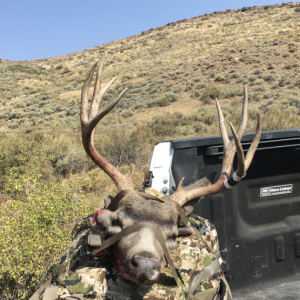
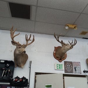
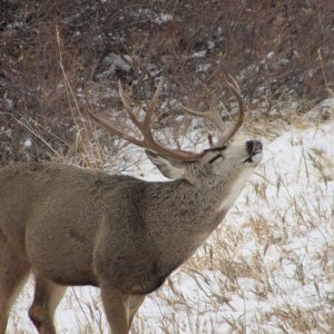
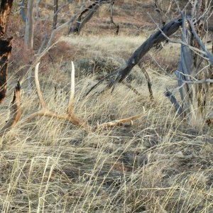
 
>To the guys saying use a
>phone. Can you project a
>waypoint with a phone app?
> Can you name waypoints
>and add info to those
>waypoints?

Yes and that is in cheap free download stuff.


4abc76ff29b26fc1.jpg
 
>If u have a way to
>charge your phone , the
>app crushes a gps

Solar charged external battery. Done.


4abc76ff29b26fc1.jpg
 
I am due for a new phone because my current iphone is junk. If I plan to eventually use the onx app should I consider a bigger screen (iphone plus) or a not-apple product? Apple is kind of on my $hitlist.

Thanks...
 
The bigger screen is nice but definitely not necessary. I have used OnX maps on an iPhone 6 Plus and now use it on an iPhone 8. I have not noticed enough difference to even matter.
 
>Will OnX work without a signal?
>


Yes-you download the map(s) you need previously to going on your hunt (with a signal), and then you can run those downloaded maps with your phone on the mountain without a signal & in airplane mode to conserve battery life. Works beautifully!!
 
To all the app users out there. I have used the chips for several years and am considering converting to the app. Is there a way to send google earth markups to the app? I have been researching it but haven't found that tidbit of information yet.
 
$30 a year for the basic app and $99 for the Elite version seems like a pretty expensive app for the phone. Any other options out there????
 
You can use the free version of the OnX maps app- it limits you to only one downloaded map & you can't see land ownership & some other features, but it definitely works. I have not paid a cent to OnX and used the app all last year for several different areas in Wyoming on an elk hunt and it was far better than any GPS device I have ever used.

I just figure I will use the free version until the need for land ownership & other features makes the $30 worth the cost.
 
The Garmin inreach explorer with SOS function is awesome. I used it on a solo hunt last year. You can text and send your location to loved ones. If needed, the SOS function could be used for grave situations. Gave me some piece of mind on my hunt.
 
>>Will OnX work without a signal?
>>
>
>
>Yes-you download the map(s) you need
>previously to going on your
>hunt (with a signal), and
>then you can run those
>downloaded maps with your phone
>on the mountain without a
>signal & in airplane mode
>to conserve battery life. Works
>beautifully!!

Thanks for that info.

I ain't to tech savvy so this might be a dumb question, but here goes anyway.

Wouldn't a signal be needed for setting and going to waypoints?
I do some spike hunts and at times I seem to have a little trouble finding my way back to my camp after dark.
 
x2 for OnXmaps. I pay 29.99 for my state and then pay 14.99 for a month access to other states when I hunt there (just remember to cancel subscription when back from hunt or charges keep occurring). Just remember to download maps ahead of time! I use the 10mile view when I download and find it is plenty of detail.

Solar charger keeps iPhone charged (and using in airplane mode like others stated).

I still carry my Garmin Etrex as backup and mark major waypoints (trailhead, camp, downed deer, creek crossings ect). I like redundancy :)
 
I use the Garmin 64s and the onxmaps chip.
I love it.


"Wildlife and its habitat cannot speak. So
we must and we will."
Theadore Roosevelt
 
I had the same question when I downloaded the app this year.
While you have phone signal you select and download the area maps that you will be hunting. Once you lose signal, satellite signal takes over like with your standard GPS.
I'm sure there is a better way to explain it, but I'm technologically challenged as well.
Marc
 
>I had the same question when
>I downloaded the app this
>year.
>While you have phone signal you
>select and download the area
>maps that you will be
>hunting. Once you lose signal,
>satellite signal takes over like
>with your standard GPS.
>I'm sure there is a better
>way to explain it, but
>I'm technologically challenged as well.
>
>Marc

Many thanks Marc.
I'm thinkin' I better get in on this OnX
Gig.

I appreciate everybody's input on this thread.
I always seem to drag my feet getting in on all this stuff but once I do I'm glad I did.
 

Click-a-Pic ... Details & Bigger Photos
Back
Top Bottom