BLM Access Problems

N

NM_Muley_Hunter

Guest
I need some advice. The area in NM where I hunt is mostly national forest, with some BLM land scattered around. For years, I (and 3 other guys in my group) hunted only on the national forest land, where the number of hunters is outrageous. The last 2 years, we have found some tracts of BLM land that hold more deer and fewer hunters. However, some of the BLM land in the area is land-locked by private land, so we have no access. After studying maps and arial photos, I found a couple of large chunks of BLM land that have very narrow strips of access from public roads - anywhere from 50 yards wide to 400 yards wide - and there are no fences to show the boundaries.

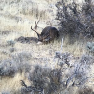
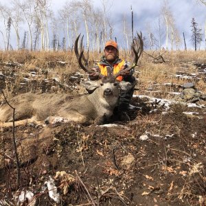
Using my maps and GPS, we hunted one of those areas this last season and the number of deer was much higher than anywhere else we've hunted. The problem is, when we were leaving the spot, we were stopped by a game warden. The rancher who owned the land around our access point reported us for trespassing. I explained to the game warden that we were doing everything possible to hunt only on public land, and showed him the maps and the gps. He investigated further, and no action was taken. However, in the meantime, we were worried so we did not hunt the spot again, and we wasted valuable time dealing with the game warden.

This next season, I intend to go back to that location (and some of the other access points we have found). I am trying to formulate a strategy to keep the same thing from happening again. Here's what I plan on doing:

1. Before the season, double check with the BLM to ensure that the land is still public.

2. Before the season, write a letter to each of the surrounding landowners stating where we will be hunting, that the land is public land, and that any harassment of us will not be tolerated (harassment of a hunter is a crime in New Mexico).

3. Contact the game warden's office to let them know where we will be hunting.

4. Carry maps, GPS, and copies of the letters while hunting.

What do you think? Is there anything else we can or should do? I appreciate your input.
 
You handled the situation perfectly last year and have a perfect game plan for this year as well. One thing you might do is take your GPS and your maps and clearly mark the bounds of the public land with corner markers (check if it is legal to do so before pounding stakes in the ground). If you have legal access to it, hunt it and hunt it proudly. If it is questionable then prudence would suggest getting permission or at least showing the rancher the public access ways, but I would wager that he knows those narrow strips are there. Its just a bully tactic.

Mike
at235.gif
 
Thanks for the advice, dakotakid. It never crossed my mind to mark the area out ahead of time. I may do that. I think you're right about it being a bully tactic. They are getting something like $1500 access fees, and they want to act as if the blm land is for the exclusive use of their hunters.
 
If your going to write letters to landowners I'd ask them if you can trespass through their land to get to the BLM land and let them know what your intentions are. If they don't let you send the second letter stating what you just said.
 
i know where you're coming from...

there is one area of about 4500 acres of blm i would like to hunt for muleys, but the boundary of private/blm is about 20 feet outside the county road ROW. the private landowner has "no trespassing" signs posted every 50 feet along the road for the entire 1/2 mile stretch where the boundary is that close to the road. i've been tempted to use a 10-foot pole and vault from the county road to the blm and hunt to my heart's content, but haven't gotten that desperate for a hunting spot, yet.

good luck,
berto
 
Very good information. You did the right thing. I agree with the additional advice given and offer a little more. Go to your county recorders office for plat maps. These are large maps (1 inch to 400 feet) and they show all the property boundaries. Shrink them down on a copier and carry them with you. No land owner will be able to argue with the Plat.

I was once kicked off of a property that I had permission to hunt on because the neighbors told me to leave. I did not know the boundaries well enough to defend myself. They were not marked and the neighbor wasn't going to tell me.

My job requires me to work a lot with property descriptions. I can draw property bondaries on a topo map. All I need is the property legal description, the program All Topo Maps, and another program called Deed Plotter. Let me know if you want technical information on making topo maps with property boundaries.
 
My hunting group had that same exact problem hunting in Wyoming unit 120 for deer. Land locked for alot of the area except for 1 land owner who wouldn't allow anybody to trespass because he wanted to charge you 3000.00 to hunt his dirt. We found some BLM ground next to his dirt and it was around 50-100 ft wide. Same thing land status maps, GPS and we went right in. We came out and he turned us in to the local gamey for trespassing. We showed the warden our maps & GPS and it wasn't a problem. He said we did our homework and did it right and then told us to kill some big bucks out from the greedy land owner. Side note, I have hunted unit 120 twice. A nice unit but land status is very limited. We haven't applied for that unit since 2000.

Gary
 
Good advice!

I've been doing the same thing for many years, great way to get away from other hunters and dastardly ATVs.

Many's the time someone has tried to kick me off public land. MAKE SURE you take a BLM 1:100,000 map (with all the sections colored appropriately) with the GPS coordinates of the public/private corners written on the map. Also, carry along copies of the letters you're going to write with the mailing dates on them.

However, I'd think twice about writing them and telling them where and when you'll be hunting. More than a few of these guys wouldn't think twice about driving their trucks all over the BLM and spooking the deer near the access points just before you arrive. I'd still write them and just tell them that, throughout the year, you and other folks will be hunting, shooting and having fun on the public land next to their private land, you'll leave fences as you found them, etc. Best to be kind up front and try to develop a good relationship, instead of starting off pushing them against the wall.

You don't owe them anything other than not bothering thier stock, equipment or fences. Its your land, they are getting to use it far below market value (which is a good thing, we need successful ranchers) and you are being kind by informing them that you'll be out there.

More mulie hunters need to use public land, way off the road, to get the nearby landowner used to the fact that they don't own it. Its also a great way to get a nice rack.
 
Let me ask you all a question about BLM lands and private lands;

Do you think it is your inherent right to use those public lands (I know easy question)if the BLM lands were mixed with chunks of private land interspersed at 3 different locations with the only access being 1. a bridge across a river (private) and a jeep trail that claims more tires than any I have known.Those are you choices in accessing BLM land

So what you have is ..private --> BLM-->> more private-->> BLM-->> final section of private. With the access roads crossing private first then BLM (BLM does not maintain the roads on the BLM portion.

We have problems with people coming in from the jeep trails side hunting our private and the BLM. So my thinking is to close off the sections of private road with gates and/or boulders and then they can walk into the BLM areas all they want.

As a private landowner I have that right correct ?
 
:) Of course, its anyone's right to use public land, its the public's. It would stink, however, if some slobs were trampling your land in the process. You probably can, and should, take some legal action against them.

I don't know much about this stuff, but here's my guess.

If you've allowed access for many years across your private land I think you might have some domain issues. Also, if its a public or recognized BLM road (with a BLM number) that the county or BLM maintains (doubtful) I'd be surprised if you could block off your private land access. However, I think you're right in being able to close off the road IF you own the land that the road crosses and no one else has a legal right to the road.

I'm a bit confused though. I didn't think anyone could cross private land to get to public land, thought that if it was surrounded by private land you'd be tresspassing if you crossed it. Especially with a private bridge.
 
NM Muley Hunter,

When you send that letter make sure you send it as certified mail. That way you can prove they received it and it sends the message to them that you are documenting your efforts to legally hunt public land.

BeanMan
 
Thanks, everyone, for your comments. I think I agree that the letters to the landowners should just state that I will be accessing the land at various times throughout the year. I would not put it above them (or the outfitters using their land) to attempt to scare off the deer or to harass us while in the field if we let them know when and where we'll be hunting. However, I do think it will be important to notify them for the sole purpose of ensuring that they know it is public land. I know that sounds strange, but I honestly don't know that they understand exactly where the public land ends and their private land begins. One of these ranches is something like 115 sections, with BLM land interspersed throughout.

I am also beginning to think that the most important thing for me to do is to notify the game warden exactly when and where I will be hunting. If he knows I'm there, and they call to report me, maybe he'll blow them off. I am thinking about sending a letter (certified mail) to the game warden's office stating 1) the dates we will be hunting, 2) the locations we will be parking and hunting (with a copy of the BLM map marked with the locations enclosed), and 3) the license plate numbers of our vehicles. Do you see any problem with this?

Hawkk33, I agree completely with mtA1. Because the public has used the road crossing your property for some length of time, there could be a public easement created across your property. However, there are many areas like you describe where I hunt (landlocked public land that previously had road access crossing private land). On almost all of those areas, the landowners have put up locked gates and no trespassing signs.
 
Thanks for the information fellas- Good luck with your problem as well. it was a good idea to send that letter to the guy certified -including all pertinent documents (maps of the BLM land backing up your rights to hunt that piece of property)
 
Here is a question for you all. I am faced with a similar situation this year and I want to know the gps coords of the corner points of the BLM land. What do you all use to get the exact corner coordinates? I have seen the 1:100,000 scale paper maps before. Do they list the coorrdinates? If not, I wouldn't think that eyeballing the coordinates would help your case much. Do the digital maps that the BLM sell let you get the coordinates off of them?
 
I use Maptech Terrain Navigator software and download coordinates straight into my GPS unit. I don't know about the BLM digital maps. www.topozone.com may give coordinates as well.
 
Topozone doesn't show land owndership as far as I know. I have other topomap software that will download gps coords. I am specifically looking for property boundry coordinates. Does Terrain Navigator show public and private land? I have never used that software.
 
No, Terrain Navigator is simply USGS 7.5 minute topo maps in a digital format, so it does not show ownership. But generally property lines and corners are the same as section lines, section corners, and 1/4 corners. If not, many times in the more open country, USGS maps do show fences, and in that case you can use the coordinates for the fence corner for the property corner.
 
Just a note, it's not as easy as it sounds nor as precise. It would be very difficult to use the available software, get a GPS point for a corner, and then punch it into a GPS and walk right to that point. You may be close (within 50 yards), but you will not be exact due to the accuracy of the software used and the accuracy of a handheld GPS.

I'd recommend, punching in the midpoints of 2 corners along your access road and aim for the middle so you don't get in trouble. If you are dealing with a whole square mile section, it shouldn't be a problem, but when you are talking about walking through quarter sections be careful of where you are or you could be tresspassing.

Good luck to all, public land is public land, but private is private as well.

Time to practice with the pole vault!

Nino
 
_Droptine_,

I use the Maptrails State Explorer BLM Edition CD. It color coordinates private/public land for Colorado and a few other western states. It is a useful program that will interface with your GPS. The only downside is that the resolution quality of the maps is not great. What I do is locate important points, record the Lat/Lon, and then use my National Geographic Topo program which has much better quality maps.

Maptrails is a very useful tool for me and costs $50.

www.maptrails.com

Cheers,

BeanMan
 
The 1:100,000 are a poor way to get GPS coord, it can be done, but not with much accuracy, especially where land ownership and trespassing may be an issue.

I use the BLM 1:100,000 to see which sections are public, then go to my National Geographic topo software and click on the section corners (still in 1:100,000 mode, but not BLM) to get the coordinates. I then write the coords, in UTM mode, in pen on my map and had load them into my ancient Magellen GPS.

Looks like the maptrails product is not only less expensive than the national geographic, but already has public ownership, state and federal. Way cool and WELL worth the money. Thanks for the link.
 
I am aware taking coordinates off Terrain Navigator isn't precise enough for land surveying purposes, but for hunting it is plenty good enough. If I'm within 50 yards of the line I think that's good enough. If there are no corners, no fence, nothing marking the line, then chances are the landowner isn't going to know exactly where that line is either. How can they get you for trespassing if the landowner doesn't even know where the line is?
 
I have to disagree with the letter sending campaign.

The landowners arent going to give a crap about the letters. It'll just make them mad. You already got the warden to concede you have legal access, and you can bet the landowner knows it.

If I were you I wouldnt tell anyone about what you found. I would avoid contact with anybody else on this whether landowner, other hunters, whatever.

You got a gem there bud. Dont rub anybody's nose in it. Just be respectful, hunt and enjoy for as long as you can.
 
I think if the landowner is leasing any land from the goverment then a deal should be made to give the huners a path so they may ascess the land that is open to hunt maybe a little less problems that way
 
I would also say bag the letter writing thing. All you could be doing is giving them time to think of ways to ruin your hunt. By driving off the game or making parking difficult etc. Hell, you might even find them hunting on it or camped on it on the opener. I would just let the game dept. know and that should take care of it. Of course, carry your maps and GPS.

Mike Henne
 
I guess those are the chances you take. If it were me, I would want to know that I was 100% on public land.
 

Click-a-Pic ... Details & Bigger Photos
Back
Top Bottom