FishLake Archery, 2010

WapitiBob

Long Time Member
Messages
5,549
LAST EDITED ON Jun-02-10 AT 05:54PM (MST) by Founder (admin)[p][p align=right]Thread Views Counter....[/p]

FishLake Archery 2010


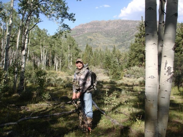
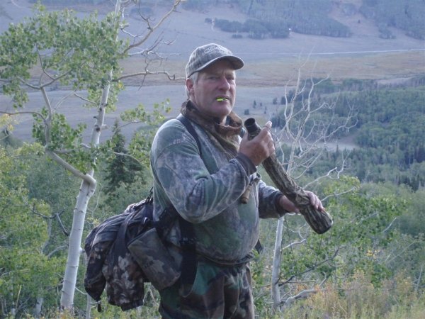
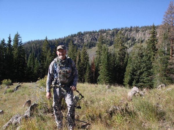
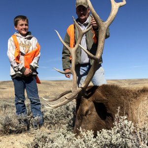
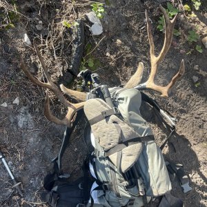
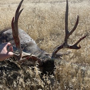
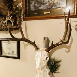
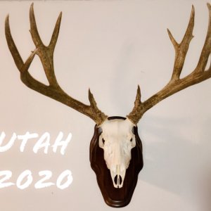
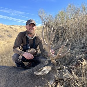
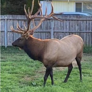
I unexpectedly hit the Elk Lotto in 2010, drawing a FishLake Archery Elk tag with 5 NR points.

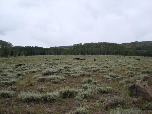
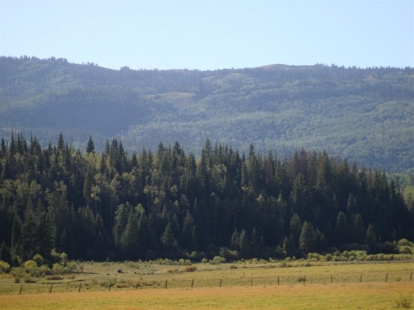
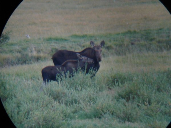
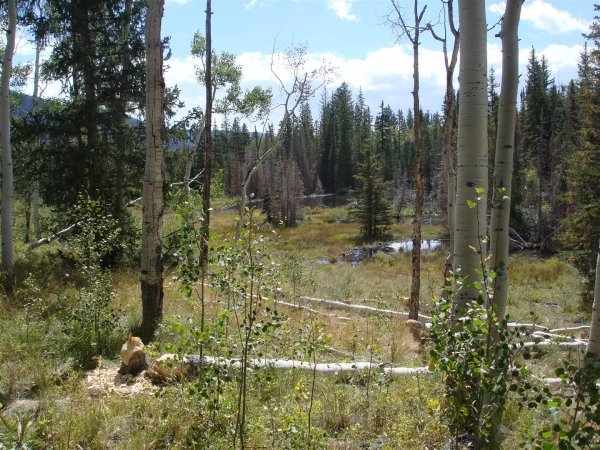
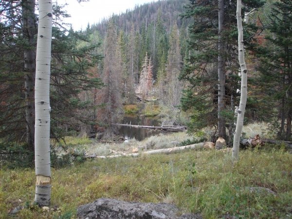
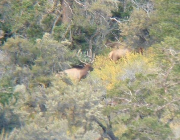
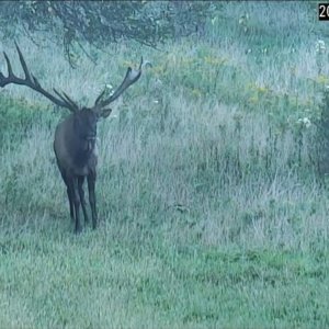
I have Bow hunted Elk in Eastern Oregon for 35 years in addition to Bow hunting NM the last 4. A lot of MonsterMuleys readers are skilled in the art of draw odds, scouting and hunting Elk in Utah but I'm not one of them. I have a good grasp on the odds but the "hunting methods" used by those that are successful in UT are different than the methods I have used up here in Oregon. From what I have seen and heard, scouting in Utah tends to be geared more towards locating individual Elk by glassing terrain versus finding a general location where the herd likes to congregate.

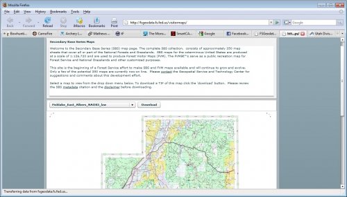
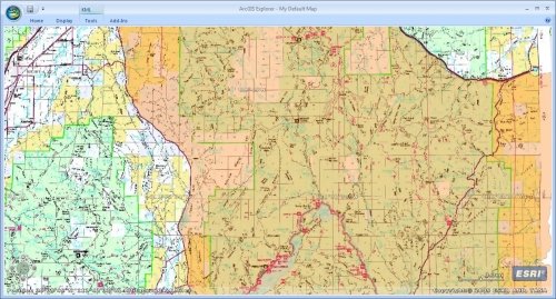
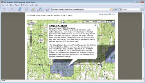
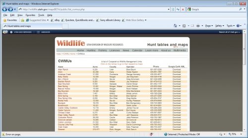
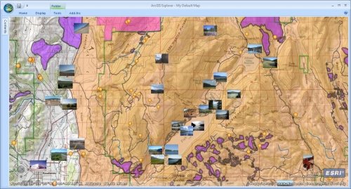
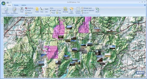
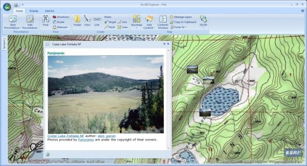
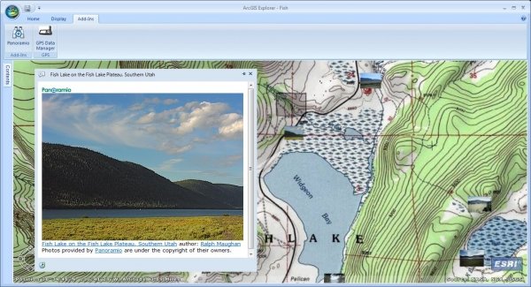
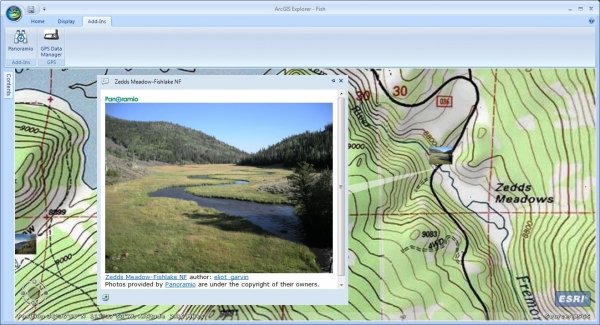
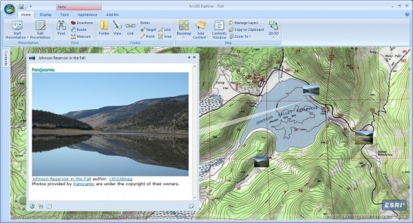
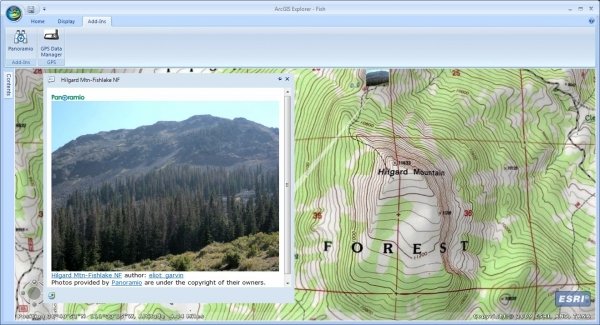
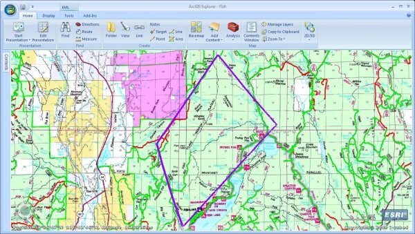
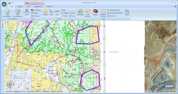
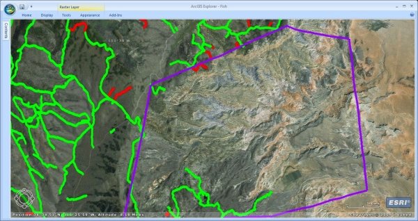
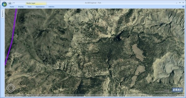
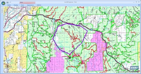
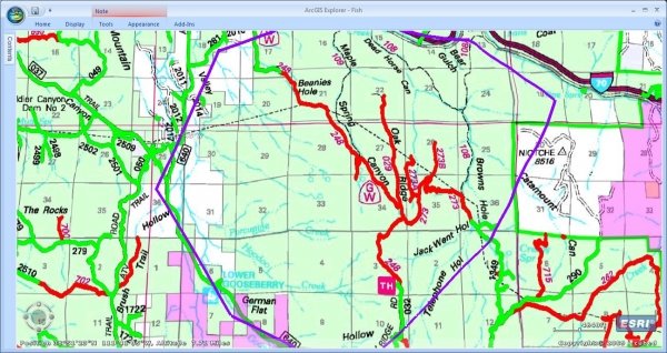
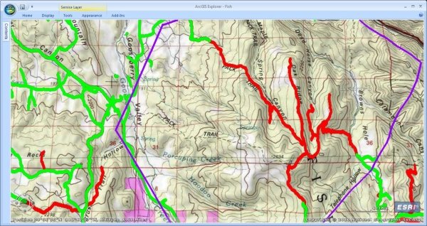
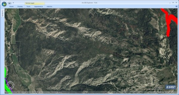
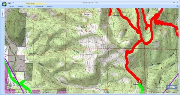
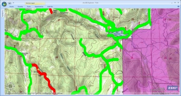
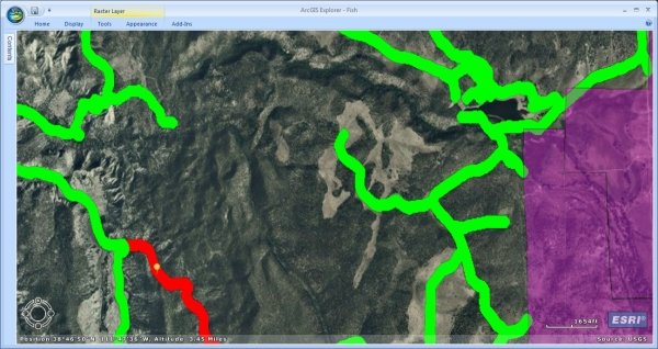
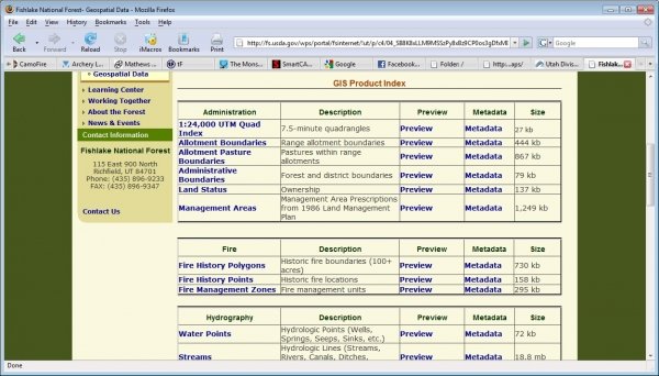
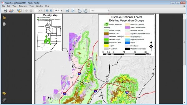
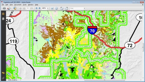
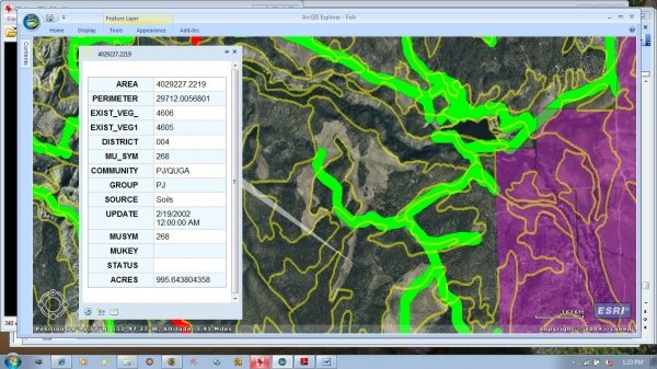
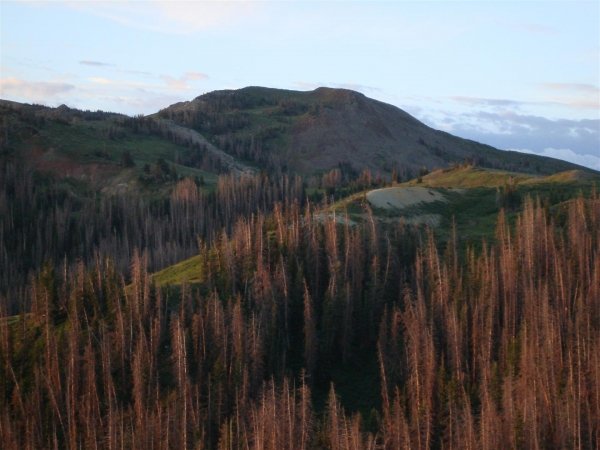
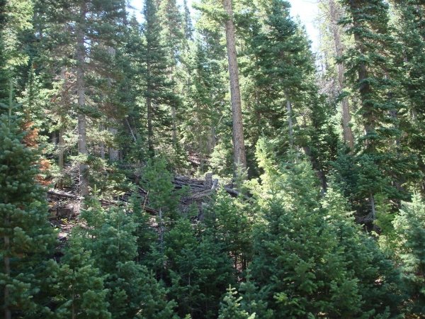
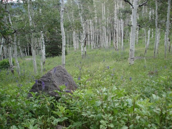
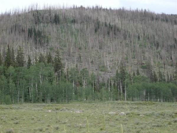
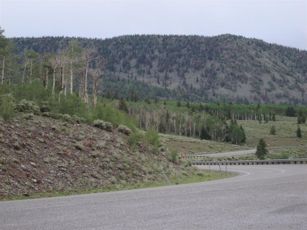
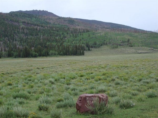
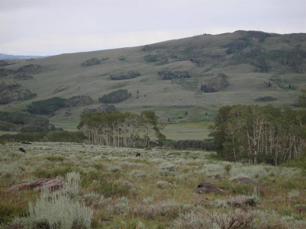
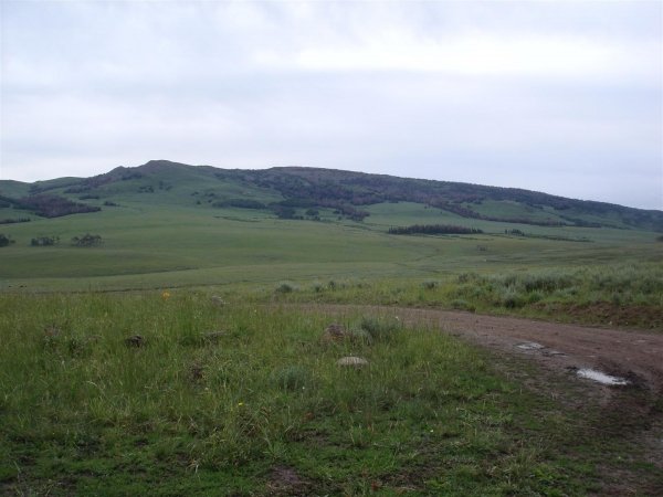
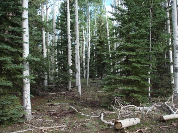
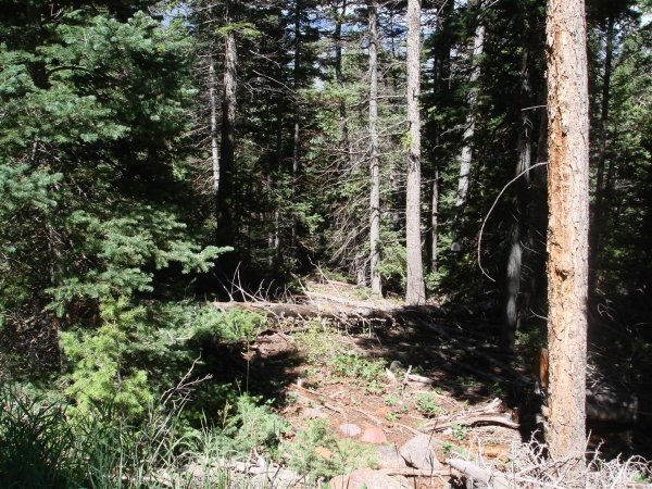
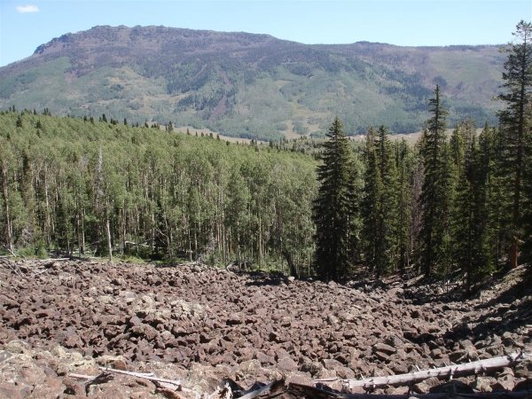
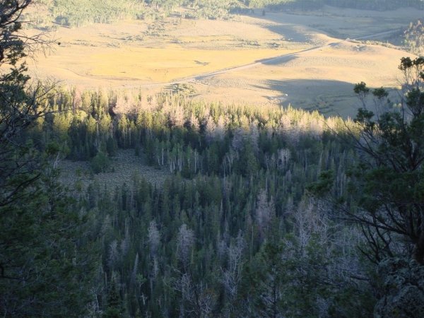
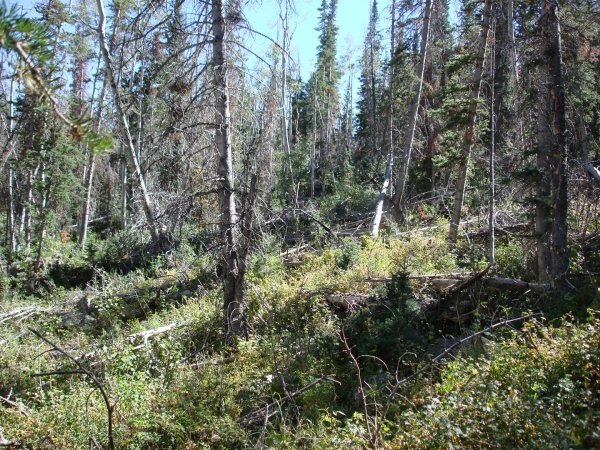
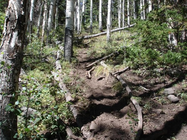
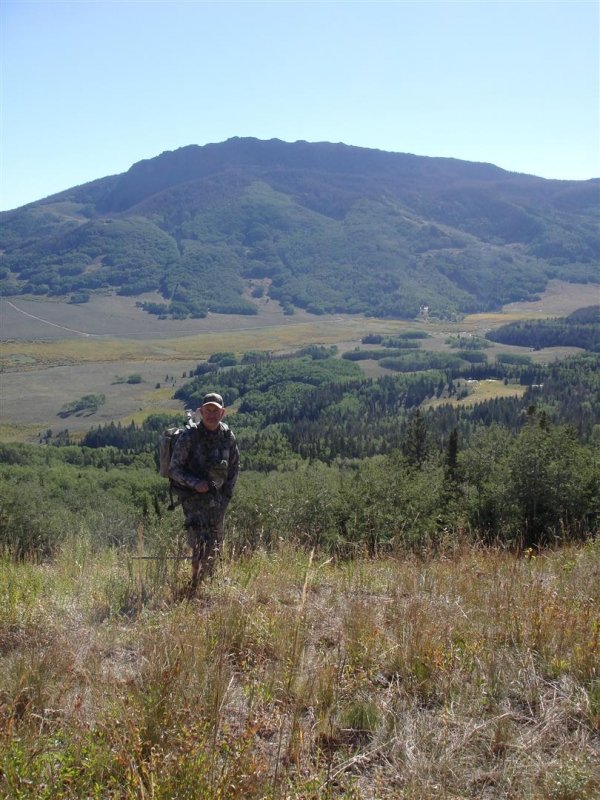
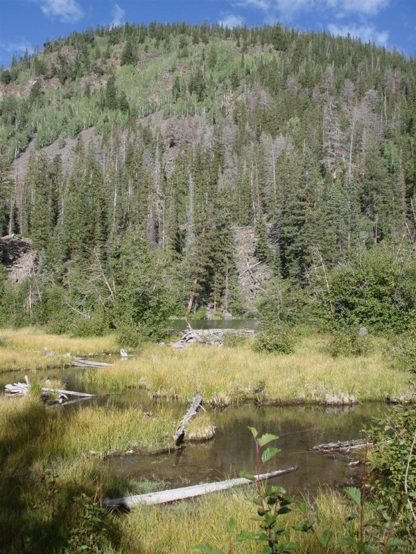
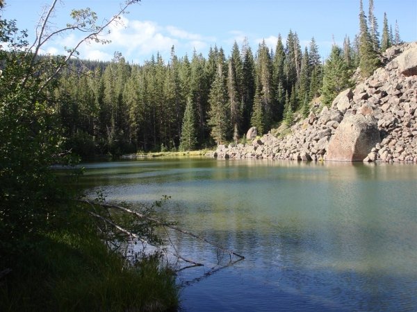
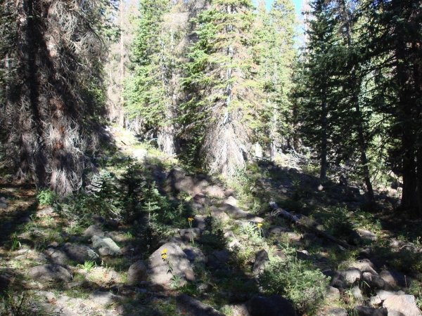
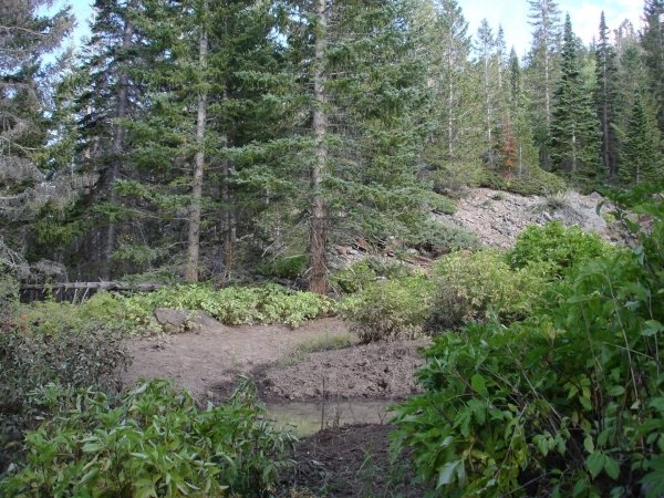
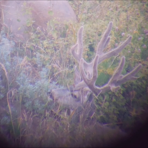
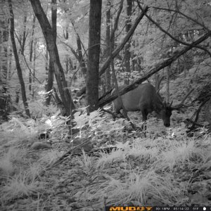
I don't really do much scouting for Elk in Oregon. We just go to a spot and hit the ground running. We have a rough idea where we think some animals might be but we usually don't spot them first. I started to do more scouting after my first year in NM though. The country was open enough to be able to spot the animals from a distance and when you did spot them, they didn't take off running and keep going for a half mile. The last few years I turned to the Satellite Imagery and GIS Data Sets that are available on the Internet for the majority of my long distance Scouting. Picking out likely spots, and then looking them over in person once I get down there. In addition, I have never spent much time behind glass spotting animals, other than Antelope. The terrain up here doesn't lend itself to glassing very well and none of my hunting mentors or partners ever employed that method.

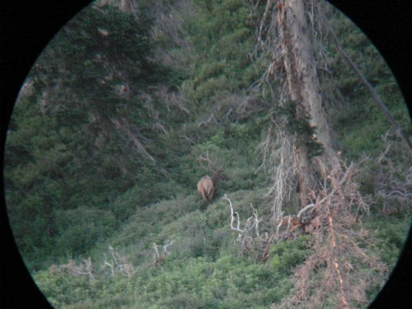
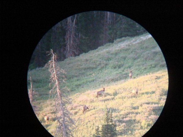
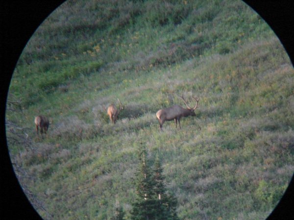
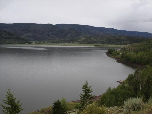
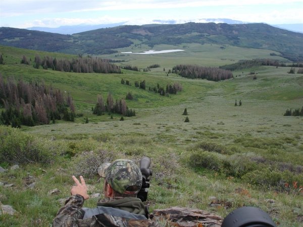
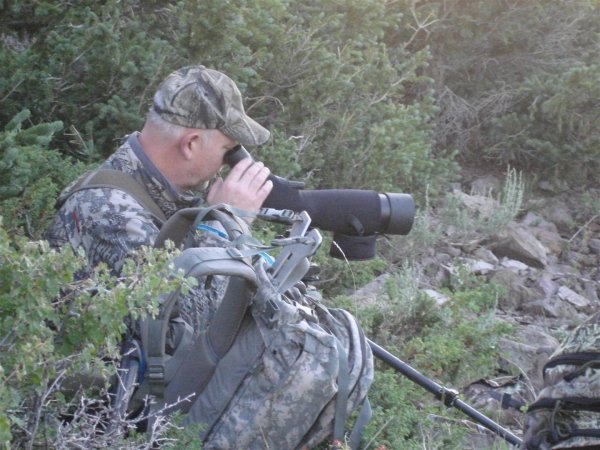
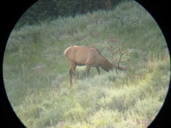
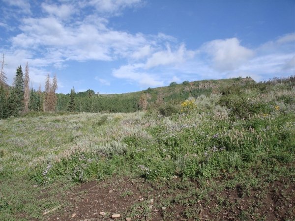
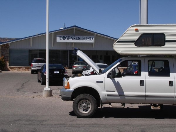
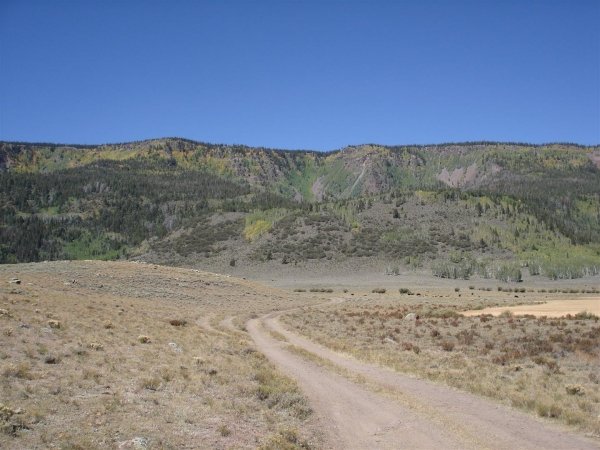
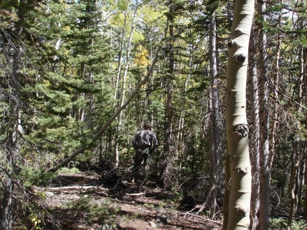
I'll be doing a lot of Internet Scouting because of the 15 hour drive from home but plan on several trips to the unit where I'll scout on foot, getting a close look at promising areas. For this hunt I will also be doing a lot of glassing with the spotting scope. I have Paul Kendall?s ?Never Enough Glassing? so hopefully he can lead me thru the finer points of using my new spotter.

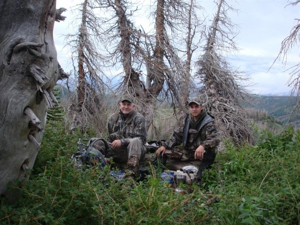
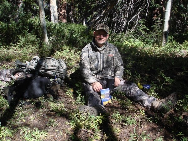
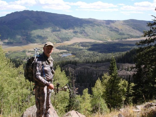
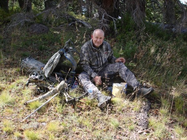
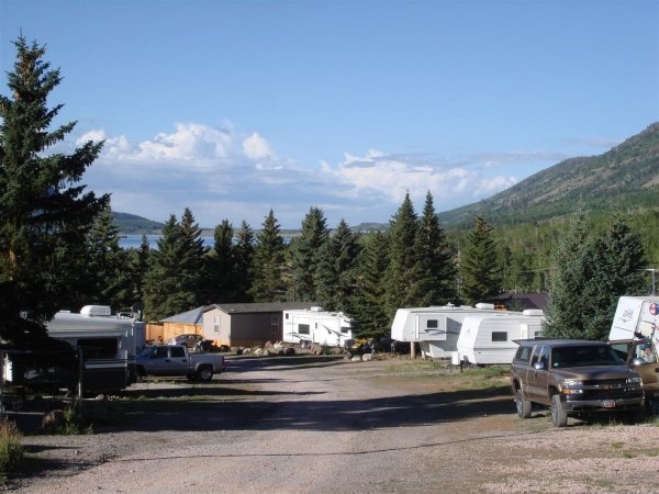
This will be a ?Do it with Friends? type hunt. I have a hunting buddy that will probably come down with me, and my Wife will come down for a week or so. I have also received some tips from a couple of internet friends I met here on MonsterMuleys and they'll be there in Spirit.

I'll bring you along, from the beginning of my adventure and hopefully those like me, who have limited Utah Elk experience, will learn what worked and what didn't, so when you get that Utah Bull tag, you'll have a better idea of what to expect. I'll also post a few videos showing how I scout from my PC, which will get you started "Internet Scouting" if you're interested and have a hunt coming up.

I'll do my best to convey what I experience as the preparation and hunt unfold. I hope you find it worthwhile.
 
Where to Apply


Heading into the 2010 Utah application period I was unsure where to apply for my Elk tag. In the past few years, I applied to Boulder and Dutton. I had been reading a lot of current and older posts wherein the different units were discussed. A lot of ?which unit is best? type threads. The San Juan unit always came up as the best, with the other ?top end? units being Boulder, Dutton, and a cpl others. At some point you need to ask yourself, do you want to hunt or just apply. I decided I wanted to hunt rather than keep applying to the few top end units that were going to require more than ten years to realistically draw. I looked thru the posts trying to find an ?upper mid tier? unit. A unit with good numbers of Bulls, a decent chance of a 300 Bull, and with 5 points, I would be within a couple points of the max pool.

I knew an acquaintance that drew a SW Desert archery tag last year and he had a great time. Lots of Bulls and he ended up taking a good 300+ bull. Not many tags though, making it tough to draw. A friend of mine was looking into the Wasatch with great interest. He heard good things about it and was leaning hard towards applying for that unit. The Wasatch is often mentioned as having the most bulls but also the most pressure, from hunters and non hunters alike. I was also intrigued by Predators thread detailing her FishLake archery hunt. She saw a lot of Elk, had tons of bugling action and had a great time. FishLake seemed to be getting good press with lots of Elk and bulls in the 300 range.

I enjoy hunts where I have a lot of bugling action as opposed to very sporadic bugling but larger Bulls. A unit with lots of Bulls and some of them being 320 is what I was looking for, and a lot better than what I've been hunting in Oregon lately. Based on my overall hunt criteria, I decided to look at Wasatch and FishLake. Pulling up the 2009 Bonus Point and Draw Statistics, I looked over the numbers. I had a 1 in 33 chance for Wasatch and a 1 in 20 chance at FishLake. These numbers don't reflect the Bonus Point affect on odds and with 5 points, I would have a better chance at a low draw number than someone with fewer points. It was a lot easier to just look at available tags compared against the applicant pool, disregarding the complexities of the points. With the odds pretty much ?poor? for either hunt I opted to go with quantity and applied to Wasatch.

Later in the year, the UDWR adopted new guidelines and increased the allotted tags for both Wasatch and FishLake. Because of the ?rounding down? method Utah uses for max point tag distribution, there would be 3 tags in the ?at large? pool instead of the 2 tags allotted for 2009. Had the UDWR only issued one tag, it would have gone to the max pool and would have done nothing for my draw odds. I recalculated the odds for both units and with the FishLake ?straight? odds going down to 1 in 13, I decided to change my app. I paid the $10 and switched to FishLake. I waited like everybody else and then just before the announcement date, started checking the credit card account. I saw I got hit by the UDWR and the hunt was on. I had been struck by lightning two years in a row. (I drew our Walla Walla bow tag last year with 1 in 100 odds for the four random pool tags.) I based my Utah odds calculations on the ?recommended? tag numbers posted by the UDWR. The actual tag numbers may have been different and it's entirely possible my numbers were way off. Whether my numbers were right or wrong, didn't really matter now, I drew the tag and was heading to FishLake to do some Elk hunting.

Suddenly it was time to start gathering data and looking over maps.
 
LAST EDITED ON Jun-12-10 AT 09:15PM (MST)[p]
Data Acquisition

As I mentioned in my ?Where to Apply? Blog, I looked at odds data when determining where to apply. What I forgot to mention is that I looked at more than just odds. I spent a lot of time on the internet looking over threads that dealt with both Wasatch and FishLake units. I downloaded Forest Service maps, Topo maps, looked at satellite images, and pulled up some pictures of the terrain in both units. Having never been to either unit, I wanted to get as much info as I could with regard to terrain, vegetation, quality of animals, and quality of the hunt before I applied. Being from out of state, you have to do most of your research on the internet and calling friends. I certainly didn't want to go in blind, but as is the case with most non resident hunters, getting familiar with two units from 15 hours away is a challenge. This Blog will explain how I gather my data. I use this data prior to applying and continue to use it up to and throughout the hunt, adding to it constantly.

Gathering all this data does take a little time and effort. I start by downloading two free mapping programs. I use ArcGis Explorer but occasionally use Google Earth. I prefer Explorer because it will handle files that the free version of GE will not. Once these apps are installed I don't need to install them again. They are always on my box and I just save the different maps or ?places? I have created to a folder on my PC. The following is how I created my FishLake map.

I start my mapping program and set a default view so whenever I open the map; it goes to the same spot. I then go to the FS Clearinghouse and download the FishLake Forest maps. The clearinghouse is located here:
http://fsgeodata.fs.fed.us/visitormaps/
The Clearinghouse doesn't have all the Forest Service maps but they appear to have several Utah Forests, and lucky for me, they have FishLake. Side note: Google Earth will not automatically place and scale this map. It has to be done manually.

This is the Clearinghouse web page:

6438clearinghouse.jpg


Once the FS map is loaded up, I go to the ESRI Map Services web page and load their Topo maps, http://services.arcgisonline.com/ArcGIS/rest/services . I use the NGS_TOPO_US_2D maps. These maps are streamed to your box as you pan around the unit, but nothing is saved to your drive so you're not going to fill it up. They also change scale as you zoom in and out. These are by far, the best online Topos I have seen yet.

The ESRI Services screen:

5531esri-services.jpg


This is what my map looks like after I have added the FS map and the Topo map server:

4697fs-topo-mix.jpg


Now that I have my FS map and Topos, I add the unit boundary. Utah is up to speed here and has done a good job with both boundary and CWMU maps for use in Explorer or GE.
Utah boundary maps are found here: http://wildlife.utah.gov/mapsBETA/public/list_boundaries.php

This is my FS Map with the unit boundary overlaid with some transparency.

1838unit-boundary.jpg


Locating the CWMU areas for FishLake (or your unit) is pretty straight forward. The UDWR has an interactive map that shows all the CWMUs. You zoom in /out and pan over to your unit area and click on a CWMU. Clicking the ?CWMU? in the map will pop up the CWMU name and information. The interactive map does not show the unit boundaries. I need to know where my unit is located within the Forest, so I download the FS map and the unit boundary first. I add any CWMU that I think might be in FishLake. I can always delete any maps I don't need.
The interactive map link is located here: http://wildlife.utah.gov/cwmu/generalMap.php


Below is the interactive map, zoomed in to FishLake, and I clicked on one of the CWMU?s to popup the description. I also changed the map ?type? to ?USGS? by clicking on the appropriate map type icon in the upper right of the map.

705cwmu.jpg


I write down the name of the CWMU and then go to the CWMU Map section and download the individual CWMU Map Overlays. You can get to the individual Map section by clicking on the ?CWMUs? tab at the top of the Interactive map web page. You can also find the Individual map here:
http://wildlife.utah.gov/mapsBETA/public/list_cwmus.php

Here is the individual Map page.

9801ind-cwmu.jpg


After loading the CWMU overlays, I download ?data sets? for the FishLake forest. These data sets can contain a bunch of useful info. Fire history, water tanks and springs, MVUM open roads and trails, and land ownership differences.
FishLake data sets are located here:
http://tinyurl.com/287hjon
(This is a shortened alias to save space)

Here is the FishLake data set page:

3964datasets.jpg


These Data Sets will be ?zipped? and when expanded will contain a ?shape? file and its support files. Side note: The free version of Google Earth will not import these files.

To get a look at the terrain without actually being there, I add the Panoramio plug-in to Explorer, or turn on the Panoramio Layer in Google Earth. What this little gem does, is download pictures that people have taken, tagged with GPS data, uploaded to the Internet, and places them in the correct location on my Map. I can now look at the actual scenery, for a given spot, and compare it to the Sat image and Topo for the same area. It ?ties it all together? so to speak.
The Panoramio add-in link is found here:
http://www.arcgis.com/home/item.html?id=91f81d9a1ae64b0cb069a7786ffdc787

Here is a map showing the Panoramio pictures added:

2876panaramio.jpg


Once I have all this data added to my map, I go back and read all the notes I have saved up regarding FishLake. I familiarize myself with areas that have been talked about and give the unit a ?once over?.

As I wrote in an earlier Blog, It's not my intention to point out anyone's hunting area. I'll try to keep things as "general" as I can, yet still convey what I'm doing. Also, in the course of my research, I have been given areas to look over. I really appreciate that help and I won't betray their trust by mentioning those areas.

I will post a video that shows how I create this map. It will use this Blog as a guide and you can follow along, step by step. I will also show where to get data for other states, so you can make maps for your particular hunting areas.
It will be created for those that have very limited computer skills.
 
LAST EDITED ON Jul-23-10 AT 07:50PM (MST)[p]


I have uploaded the first videos. The first vid shows how to install ArcGis Explorer to your PC. The second shows how I add the National Forest map. The Clearinghouse doesn't have all Forest maps so they may or may not have the map you need. You can use the link I provided above, and look at what they have.

These videos are posted on Vimeo. They are too large for MonsterHuntClips.com.

Chapter one:
http://www.vimeo.com/12523841

Chapter two:
http://www.vimeo.com/12525320

Chapter three:
http://www.vimeo.com/13465999

Chapter four:
http://www.vimeo.com/13085835

Chapter five:
http://www.vimeo.com/13589851
 
FishLake, what does it look like?


Now that I have my map setup with my initial layers, I want to see what the country looks like. If possible I would drive down and spend a few days getting to know the ?lay of the land?. That's not going to happen for a while but I still want to see what the country looks like.
A lot of the Forum members have posted stories of their hunts here on MonsterMuleys. I use the search feature to find them, then read thru them again. Some have picture, some don't. Reading thru the posts and looking at the pictures gives me a rough idea of the country. Next, I pulled up my map, turned on the Topo layer, then turned on the Panoramio pictures. These are pictures that people have taken, added GPS data to, then uploaded to the Internet. You can install the add-in to Explorer or if using Google Earth, turn that layer on.
After I get Panoramio set up, I zoom out and tell it to download the pictures that are within the map view.

It ends up looking like this:
9162panoramio-1.jpg


I zoom in closer and start comparing the pictures to the Topo.
I don't start in any particular spot; I'm just trying to get a feel for the place.
In this instance, I see there is a picture of Crater Lake. From the location and the contents of the picture I assume the picture is from the West side ridge, looking at the ridges to the East. The Topo shows some fairly small ridges. I zoom in and click on the picture to see how big the ridges really are.

Crater Lake:

2433craterlake.jpg


I notice another picture posted up near Widgeon Bay and pull it up.

1401widgeonbay.jpg


This Bay picture is tagged next to the hwy, looking across the lake so I assume it's the backside of the ridges, West of Crater Lake. If it is, I have a good view of those ridges between Crater Lake and Widgeon bay, an area that has no easy access according to the Topo. It might be worth another look later on.

Here is a pic from Zedds meadow. By looking at the stream it appears this picture is looking South, down stream. Again, it shows a little bit of the country, Vegetation, size of the ridges, etc. Just a little something to familiarize me with the area.

Zedds Meadow:

9345zedds_meadow.jpg


Here is one looking back across Johnson Valley Reservoir:

413johnsonvalley.jpg


I'm beginning to see this is bigger country than the map leads me to believe.
Hilgard Mt. doesn't look too bad, and then I see it's over 11,000 feet and pull up a picture of it.

Hilgard Mt.:

7323hilgard_mt.jpg


I continue to look at all the pictures I can find. Most of them are around the Lake because that's where the Hikers and Tourists tend to be. The pictures may not be in the correct place but I just make my best guess as to whether they are correct or not. Until I get there in person, these pics are the best I have. The country is a little different than most of the places I have hunted, but after looking at the pictures, it's not as ?foreign? and I'm starting to get a feel for it.
 
Dissecting the Area

Once I get the basic overlays on my map I do what most hunters do, I look for isolated pockets. I'm not sure it's so much as finding un-pressured Elk as an attempt to just getting away from other hunters. We all understand there will be areas that hold
fewer numbers of Elk and we can deal with that. What bothers me and those I know the most, is having other hunters move in on us when we're working a Bull. Our first instinct is to find isolated pockets, away from roads and trails hoping there won't be people in there. To do that, I turn on the Unit layer, FS map layer, open roads layer, and the open ATV trails layer on my map. I zoom out a ways and just look. I don't focus on anything, just look and pretty soon there will be places that catch my attention. It's real possible there isn't an Elk within 10 miles of these places but this is where I start marking up my map. I mark the largest areas first, and then work down.

This is our FishLake map when I zoom out.

8061get_away_1.jpg


Remembering that the roads are green and the trails are red, we can see some spots that we can circle.
The first area that sticks out is NW of FishLake.

8233get_away_2.jpg


Once I circle a spot I'll zoom in for a closer look. I turn off the FS layer and turn on the Topo layer.
This is what it looks like:

5317get_away_3.jpg


In this instance, I see the two trails running off the end of the road. Other than that, there isn't much for access in there and lots of ground you could cover. What stands out is that the ridge running the length of the Lake has the main road under it. Everybody and their dog will be spotting Elk up on that East facing slope. The Cirques area seems to have the same potential problem, too easy to spot game from the main road.
The head of Tasha Creek however might be OK. It's on the backside of the main ridge so the Elk won't see the resort and road traffic, and its several miles up from the valley floor. The problem I see is that the trail runs right down the creek from the top. The morning thermals will be going down the draw so if somebody decides to drive up the road and bail off down the trail, they'll bust everything out ahead of them. I would look at coming up from the btm in the dark, getting on the ridge above the lake and glassing across at first light. You could then head down to the creek and up the other side, coming in under or from the side of any Bull over there.
The other place I would look at is the West facing slope between the Hightop ridge line and the CWMU. Unfortunately the access runs right along the bottom for most of its length. It appears to be an ATV trail rather than a road so that may help a little.
As I mentioned earlier, it's real possible there isn't a Bull within 10 miles of these two spots but the process I use to find areas starts out as above. I find a random spot based on the lack of roads and trails, I zoom in to see if there are other trails that may be on the Topo, then I ask myself where would the Elk be and why, how would I hunt it, and how can I get messed up by other hunters that are also in the area.

Going back to my map I see a couple spots over on the East side of the unit and zoom in.

540get_away_4.jpg


When I get in closer I see the streams are designated as ?intermittent?. I turn off the FS layer to see the vegetation. It doesn't look good at 8 miles up. I also see that the roads and trails stop at the edge of the main vegetation. I'm pretty sure that's not by chance, there's a reason for it.

7327get_away_5.jpg


It looks dry and arid when I get closer:

1651get_away_6.jpg


I'll mark it and drive out to look at it. I've killed some Bulls up here in our Pumice flat/Lodgepole Pine country so I won't discount it completely but again, there is a reason the roads all stopped at the transition points.

I zoom back out and turn the FS layer back on. I see a spot up North that has a couple ATV trails but no roads to speak of.

2607get_away_7.jpg


When I zoom in I see there is a main road running along the West side of the area but there is private land preventing access. The trail runs down the top of the ridge, so there is a chunk of land that is a couple miles wide by about 5 miles long that only has easy access from the trail.

3481get_away_8.jpg


I turn off the FS layer and turn on the Topo layer, looking for other details that may not be on the FS map.

2981get_away_9.jpg


I see a pack trail running down the middle of the area cutting it in half. So, it's not as good as it looked before but still not too bad. I turn off the Topo and look at the terrain.

3131get_away_10.jpg


It looks a little dry but there are fields down in the private on the West side, and ?maybe? no access from that side. The animals that are in there should come down to the private and feed, then move up. It's open enough for glassing so it is probably worth a trip in there and side hill the canyons, glassing to see if there is anything in the area.
I turn the Topo layer back on, then turn on the ?Water? layer. I zoom in to get the better Topos to display. I see several springs up near the tops and if those actually have water in them, the area might hold some Elk. I also see a possible access area off the lower road.

4715get_away_11.jpg


As is the case down in the South East corner, this area is drier and has few trails. There are trails all over this unit and for some reason these last areas have few trails. There is a reason for it, but with nothing but maps to look at, I can't determine what it is. I'll have to ask around when I get down there before season, then take a look in person.

After I look at the larger non roaded areas I go back and look at the ?regular? open areas. These are areas that may be only two or three square miles in size. It sounds small but if there are Elk in there, two square miles is a lot of country.

2160get_away_1.jpg


I look at each of these areas, one at a time, using the same process as before. Why would they be there, are they just passing thru, how would I hunt it and how might somebody else mess up my hunt. I will zoom in and turn off the layers so I can look at the roads and vegetation. Just because there aren't any roads doesn't necessarily make it a good spot. We?ve already seen that no roads might mean arid conditions.
You can see from the map above that there are plenty of areas that need a closer look.

After going over the ?regular? spots, I zoom in and start panning over the map looking for what I call ?drive by?s?. Up here, after a few years of pressure the Bulls smarten up and sometimes move to small areas bounded by busy roads. Hunters discount these areas and simply ?drive by? on their way to those deep canyons that they assume hold all the Bulls. There is criteria I look for in Eastern Oregon and it very well may not work in Utah, but I'll at least go thru the motions, seeing if it's a viable option once I start hunting.

To find these "Drive By" areas, I look at my map for an area that's at least one mile wide and two plus miles long, bounded by roads, generally with one spur road or open ATV trail going up the center. The vegetation needs to be dense enough that a 30-50 yard shot would be the max yet open enough that you can see roughly 100 yards. It sounds contradictory but remembering you can see thru some of that vegetation will clear it up. The Bulls feel hidden yet can see danger approaching. Up here the typical vegetation in an area like this would be a mix of small Doug or Grand Fir, 5-30 feet tall with some decent 24?-30? Ponderosa Pine mixed in. If I can find a few of these spots on the map, I will drive past the center road or trail and brush out the tire tracks. If I check it the next day and nobody has been there, I prepare to hunt it the following day. I want the center road/trail to have no activity for two days. Oddly enough I have had more successes than failures in these little spots.

Here is an example of what I look for, although not perfect, will show you the basics of what I'm trying to find; A single road or trail going into a decent sized area that if left alone for a day or two, will provide a secure spot for Bulls that have been getting pressure from other hunters.

2672get_away_12.jpg


I then check the Satellite image to see the extent of ground cover.

1842get_away_13.jpg


Everything seems to check out. There may be no Elk here, there may be tons of them, I have no idea since I have never been here before.
But, there is one more thing I can do. Going back to our FS GIS dataset page http://tinyurl.com/287hjon

9137datasets.jpg


I can preview the ?Vegetation? shape files. This is a pretty slick setup the FS has done here. They have cataloged all the vegetation types for the District.
Clicking on the ?Preview? link will load up the .PDF file.

9068get_away_14.jpg


Zooming in will then show us the different types of Vegetation; Oak Brush, Aspen, etc. and their locations.


5652get_away_15.jpg


I can't really distinguish our spot even after I zoom in but I do know I want to add this feature to my map. The question is, how well will it work in our map?

I download and extract the shape files, then use the ?add content? to bring in the shape file. I have to really shrink down the lines to get the display I want but once I do, I can see this is really a slick overlay. They have marked all the different types of vegetation for us. Granted, there will be errors but as a scouting tool this is pretty nice.
Zooming in to the last area we were looking at, we can see the different vegetation areas they have marked for us.

5772get_away_16.jpg


When we left click inside one of the areas, a descriptive box pops up and will list all the data associated with that particular polygon. The Vegetation type is listed in the ?Community? field.

9709get_away_17.jpg


The .XML file that is included as one of the support files has the descriptions and abbreviations listed within it. You can double click on the .XML file and it will open in Internet Explorer so you can read the descriptions. IE by default will block the file from doing anything and will pop up a message saying as much.
The vegetation referenced above is Pinyon-Juniper/Gambel Oak.


I mark all the promising spots on my map so I can refer to them when I get down to the unit. During my actual scouting trips I will take a closer look at the terrain and vegetation. I'll also head out with the spotter and try to see what the areas have for animals. Obviously I can't just start at one end and glass the whole unit; I have to whittle it down into manageable pieces. The above is how I do that.
 
LAST EDITED ON Aug-27-10 AT 08:33PM (MST)[p]LAST EDITED ON Aug-27-10 AT 08:31 PM (MST)

Boots on the Ground

Now that I have some areas picked out, I made plans for a trip to the unit. I work four tens, getting off at 1:00 AM. A co worker asked to tag along so I had a driving partner. We went home, took showers, met up to load gear and headed out. We made it a couple hours before the bed rolls came out. Up and off again at 6:30, we hit Salina around 7:00. Going up GooseBerry was quit a site. I have never been in the high altitude Aspen parks before and it was beautiful country. I found a wide spot, pulled over and grabbed the glass. Jordon walked 50 feet, looked up and spotted 5 Bulls. We ?bivied? next to the truck that night and at first light were looking over the 5 Bulls from the evening before. There were ten Bulls in the two draws below us and another seven up on top, moving across. Not too bad for just showing up.

565boots1.jpg


5069boots2.jpg


4356boots3.jpg


316boots4.jpg


After looking over the Bulls we head out to just ?dissect? the area. We go to each area that I have some interest in. Doing so gets me familiar with the roads, where the camps might be, and how the terrain actually looks compared to my Topo, Sat images, and Panoramio pictures.
Did I mention camps? There are campers all over this area. I would say 20-30 on this weekend. Some were hunters we had met on the road, others were fishing the creeks, and still others were out riding ATV?s and enjoying the outdoors with friends and family.

Going back to the last chapter of the Blog, I had marked some areas that I wanted to look over. No particular reason other than how they looked on the map and Sat images. One of those was the area North West of FishLake. The East facing ridge is a whole lot bigger than it looks. I drove around to the back side and went down one of those ATV trails mentioned in the Blog. It looks like a really good spot to hold Bulls once they get pressured, but it's thick in there.

6595boots5.jpg


Down in the bottom the vegetation turns to Aspen. What's odd is that in this area, the young growth is only 10? tall but the limbs start at ground level. You can't see 30 yards. I hadn't seen that before.

We head to another area and over there, the Aspen are more of what I would call a ?standard? Aspen stand.

8652boots6.jpg


On the way we meet a few people and we chat for a few minutes. A couple of them have Bull tags and others have Cow tags. Everybody is seeing the same group of Cows that are feeding up above the main road and not much else. We don't mention the Bulls we have seen. They?ll get busted out of there opening weekend if they haven't moved off before then and even though it can't be a real secret where we were, there isn't any sense in having a bunch of people go in there and rustle them up.

We head down the main road again looking things over.
The Cirques area I talked about in the Blog looks really big when you're standing in front of it.


2960boots8.jpg


Across the road there is an old burn that is starting to fill in.

7629boots9.jpg


We swung down past the Reservoir and headed up some other main roads.

7282boots10.jpg


5685boots11.jpg


This is the back side of the burn shown earlier. Nice, big country. A mix of Fir, Aspen, and Boulders?

618boots12.jpg


Over on this side they were moving cattle. There were a bunch of separate camps, separate groups, all herding cattle in the same direction. Like they each had small groups going to the same place.
There is more open country on this side and a bunch more cattle.

3682boots13.jpg


4961boots14.jpg


At this point I had a pretty good lay of the land and a decent idea where I would start my hunt. We spent Sunday morning spotting a group of bulls up off the main road, then drove around with no real destination.

6607bulls_15.jpg


That Mt. House sure was good.
This next picture is looking right down behind were we were sitting.

7688bulls_16.jpg


We?re up above the ?main road? herd in this next picture. There was a group of small bulls just out of sight from the road. Nothing big but Jordon had seen more Bulls in 1 ? days than he had seen in his life so we were enjoying the time just looking at Elk.

7965bulls17.jpg


5396bulls17-2.jpg


5138bulls18_.jpg


8114bulls19.jpg


We spent the last bit of our time just looking around.

2004bulls19-2.jpg


8888bulls20.jpg


2509bulls21.jpg


2306bulls22.jpg


I'm heading down on the 1st or 2nd and will stay until I'm done. We'll be at Bowery Haven in our Lance camper, driving a white CrewCab with Oregon plates. They don't have internet so I'll have to figure out a way to update. Stop in and say hello and we can swap stories about the one that got away.

2391bulls23.jpg
 
On behalf of WapitiBob, whom I had occasion to speak with today:

Very quiet, bulls are not talking much, but he's had a couple opportunities that just did not come together. He is hoping with the cooling trend things will start heating up. In short- "this is nothing like New Mexico".

Bob will update when he returns with photos and blog!

Pred
 
I delayed posting my hunt out of respect for those archers that may have been hunting the same areas I was frequenting. I didn't hunt any ?secret spots? or ?honey holes? on this trip but there is no sense in drawing attention to an area when others may be hunting there also. I spent most of my time in the center of the unit and the latter part of the hunt was spent in a location I found with ArcGis Explorer and mentioned in an earlier Blog. It was pretty easy to see where I was hunting since there are only 4 non resident tags and this crew cab is pretty hard to hide.


9/1 ? 9/2

We left Bend about 12:30 in the afternoon. We stopped at my brother?s place and picked up my Camper. It's exactly 850 miles from my front door to FishLake Lodge.

18739-2-1.jpg


We made it to Idaho before things started to go sideways. The truck wouldn't start after getting fuel. We managed to dump the clutch and get it going. A couple hours down the road we stopped and cleaned the battery terminals and it fired right up. Around midnight we stopped for fuel and it wouldn't start. We were hoping the added trailer was just pulling the batteries down so we stopped for the night at Schwab?s in Ogden. They checked the battery the next morning and all was good. It started at their shop several times. We fueled up and it ran fine. It finally quit starting at Scipio. I called the Ford shop in Richfield and headed there after dumping the clutch again. We had to push it out of the station this time. The guys replaced the Starter Relay and all was good with the exception of the ding to my wallet.

18689-2-2.jpg


We got camp setup at Bowery Haven, introduced ourselves to Jeff, and headed out to check an area I will call ?The Hand?. Several camps on the North end changed our plans to come in from that direction. Actually, close to 10 camps. There were camps in every spot available. Lots of Gen season guys and lots of families set up for the last long weekend before school starts. On the way out we stopped the truck to spot the opposite ridge and low and behold, pointing the spotter towards the hill and bringing it into focus revealed a dandy bull. We headed back to camp and decided to come in from The Thumb.
This is where we will be heading the first morning of my Utah hunt.

39829-2-4.jpg
 
LAST EDITED ON Sep-20-10 AT 11:10AM (MST)[p]9/3

We got started later than I would like but headed up The Thumb before light. We hiked maybe ? of a mile when we heard the first bugles on our side of the Valley. They were up pretty high. We saw tons of sign as we worked our way up the hill. We called the first bull in at about 10:00. A little spike came in to about 5 steps and hung around for several minutes. We continued working our way up the hill and got into 3 bulls bugling. The largest of the three was only a couple hundred yards straight across a little cut. He answered all of our Cow calls, wanting us to come over to him. We played with him for 30 minutes or so then concluded he was a mid size Bull. We moved up another 50 yards or so and when he bugled we really hammered him with the Cow calls. He came running in at that point. He stopped at roughly 50 yards. He was an average 6x based on the scouting from earlier in the year. Fifth and sixth points were maybe 6?. I put him at 260-270. We called him in at 11:30. Not too bad for the 3rd of September.

Some of that terrain was a jungle. This was one of the few trails in there.

32159-3-1.jpg


48939-3-2.jpg


This was Allan trying to get thru the Jungle.

65389-3-35.jpg


Take a wrong turn and it was a little tough to say the least.
We were up near the slides and continued across the face of the main ridge.


46109-3-3.jpg


We worked our way up to a saddle, above the slides, and threw out a few bugles and cow calls. After a few minutes we took a couple steps and bumped out a small bull that had come in silent. Freshly rubbed with white antlers, he looked like a little 4 or 5x. There were a few other bulls bugling in the area so we marked them as our ?go to Bulls? and headed out. A bull bugling at mid day was a pretty good sign. We finally made it back down, no worse for wear.

29049-3-4.jpg


Three big trailers were parked by our truck when we got to the bottom. We said hi and walked past. One of the guys came up when we were about to leave and asked about our tag. They were Cow hunters and doing some scouting for two of the guys that had Rifle bull tags. They asked where we wanted to hunt and they would stay out of the area. They also wanted us to stop by on occasion and they would update us on any Bulls seen. Rich was commenting about his resident draw odds so I printed them out for him. I'm not sure if it's a good thing or a bad thing that I have this computer everywhere I go. We updated them on some Cows we had seen and it looked like we made some new friends.


9/4

We went to another area I was told about. I'll call it ZigZag. Another late start and we managed to get the truck parked right at first light. A Bull bugled right across the opening from us and another bugled way off to our left. A couple more bugles and the Bull out in front was off and moving out. We hiked and hiked. We never heard another Bugle and saw few tracks. This place was a rocky mess. It should have held some Bulls and we were thinking we had walked right past them in the morning and that they were down low. There sure wasn?t anything up on the plateau.

70059-4-1.jpg


The truck is parked next to the shadow that runs out into the clearing, in the center of this next picture.

1169-4-2.jpg


89669-4-3.jpg


For the evening adventure we tried to do some spotting of the upper reaches of the Hand. The smoke had moved in and you couldn't see much. We ran back down to ZigZag to listen for bugles to confirm the Elk were actually down low in this area. We got there right before dark. A few minutes after parking a herd of 14 ran out into the clearing. One spike and a little 5x were in the herd. There were a few intermittent bugles but nothing to get real excited about. There were 2 rigs parked there and they had been hunting the low meadows. They were the ones we saw pull in behind us this morning and turn around. It turns out the one hunter with the Bull tag was dropped off and his partner went around the corner to spot for him. They had seen some mid size Bulls in the morning and came back for more.
We?re going to hit the Hand again tomorrow, coming in further to the North. We are heading up to the tops again. These Elk are just past the ?convenience level? of most hunters. There aren't any Spike hunters that will go thru the brush and most Bull hunters will give up before they get to where these Bulls are.
I keep hearing they will come down but for now these guys are up high. They?re not up high as in ?elevation? but up high relative to the ridge they are on. They?re 1/3 to 1/4 of the way down from the top which is pretty much a standard for Elk where I have hunted in the past. They have broken up their bachelor herds and are singles now which helps. Hopefully we can find a bigger one.
 
Thanks Lisa.
It was a pleasure to meet you. Hope all is going well up at Strawberry.

PS; things did change ......
 
9/5

The wind is howling at about 40mph. With no bugling and no weather we just did some scouting today. We looked over some areas that I drove to when I was last here. Nothing was spotted.
 
9/6

The Spike hunters and Labor Day campers were swarming the lower elevations so we decided to try up high this morning. We have been hunting way back in so this was just more of the same.

15279-6-1.jpg


Getting there was a challenge. A couple guys parked down from us then followed us in. That always starts the day off right. They peeled off once we got into the lower Aspens. The Spike hunters are staying below the ?first layer? of brush that the Elk seem to have put between themselves and us.

63669-6-2.jpg


There were some Elk in the area but there are also some Cattle. We talked to Shanon, the Cowboy who has the Allotment up here. He echoed what we had seen so far. With the extended heat and no rain most of the Elk Cows had moved out leaving only a few Bulls. He said the same was true for the other areas of the unit. Randy, the Spike hunter echoed that the elk they had seen the first day had been pushed out onto private.
There was some old sign up in this area but not much else. So, rather than the Bulls being beyond the ?convenience? level, they just aren't here in any quantity.

44439-6-3.jpg


We got up to the top without hearing a thing. I haven't heard a bugle in the last two days. It's starting to look like an Eastern Oregon hunt with a whole lot more brush.

36429-6-4.jpg


We did manage to find a few Wallows. We set up and called for a while with nothing happening. As we left I decided I needed a picture so back down I went. I snapped this next picture then bugled just for the heck of it.

10509-6-5.jpg


The brush popped and I knew there was an Elk close by. As soon as I was next to a tree he had already run up to a group of trees about 35 yards away. He raked and tore up the mud hole for a minute or so. I had no shot as is usually the case. All I needed was two more steps. He figured something was up and moved off. He was a good bull with approx. 12? 5th?s and 6th?s. I put him at 300 ish and was going to drop the string if I had the opportunity.
I didn't see any trail cameras so nobody has been there or they had already been stolen?

We hunted across the tops for a while, ate lunch and filled the bladders with the Hiker Pro.

749-6-6.jpg


81379-6-7.jpg


We dropped down lower and hunted back to the truck, which is parked right below the cabin in this next picture.

3909-6-8.jpg


With no bugling and no weather we went glassing in the evening. Spotted these Moose in a meadow and took their picture.

73269-6-9.jpg
 
A little too brushy for me. I've never been in so much blowdown. And those limbs are sharp too. My shins are cut to ribbons.


I'll get more posts up tomorrow.
 
9-8

We finally got into Bugling Bulls this morning. We got on them about a ? mile in. We followed them thru that darn blown down mess and then up the hill. Then the hill got steeper. 10,000 feet sucks when you live at 3000. We got way up on top and the terrain benched out with a little aspen draw in front and to the left of us. I thought we had them once I saw the aspens and the more open terrain. As is usually the case, the groaner just kept on moving. We followed the top of our ridge around in a half circle, right to left, hoping to get ahead of them but had no luck. They slowed down once they got to a little flat and we hung up as well. They bugled a few more times as we sat and ate a sandwich.
We decided it was time to get out of there and remembering back to my internet scouting, I recalled a trail in that canyon. We started down off the ridge and saw a small lake and went to investigate. There were a couple wallows right on the edge. Evidently these bulls can enjoy a good view while they take a mud bath. We wandered around till we found the trail and headed out. No tracks in the trail were a good sign.

23239-8-2.jpg


93489-8-3.jpg


On the way out we stopped to bugle off then end of a little point. He answered directly under us. Holy smokes, 11:00 and he bugled less than 100 yards from us. He moves to our right and gets up on the ridge to our right, still 100 or so out in front. I get on the trail and move down a little bit. Allan moves back and cow calls. If the bull moves across the trail to get downwind I have him. If he comes side hill off his little ridge, directly in I have him. Then I see antler tips. Nice bull. I think 7x then see there is no 7th point. Weird, he's broke back like a 7x but only a 6x. Then I realize he's staying back from the edge of his little ridge and moving up, a little at a time. I have no shot. He moves a little and I move a little. He works the 30 yards up the ridge to get even with Allan and it maybe 50 yards across the 2 little ridge tops. He turns and faces Allan then turns back, lays his head back and prances off. Those antler tips all curled up like a dead spiders legs. Damn, that was a nice bull. Up here our 6?s have a ?traditional? fork at the back end. This guy was broke back, whale tail style. A beautiful bull for sure.

We headed on out and passed a busy Beaver?s home.

6419-8-5.jpg


46919-8-6.jpg


These guys really put the wood down. We hunted on this end for most of our remaining season and would see the work these little guys did on a daily basis. What was interesting is that they fell one tree right at the entrance into the ponds and stripped the bark off of it the next night. They didn't remove much bark from any of the other trees they had fallen, just this one.
We ran into Stanley and his Grandson on our way out. They were checking on cattle and we had another nice conversation. Stanley is beginning to believe us now when we tell him where we have been walking. We had 6-8 bulls bugling, one good 6, and nobody around on this hunt. We?re not getting into a lot of bulls on this hunt. That and the blowdown is making it a little harder to get motivated.
I dipped my boot tips into the creek to wash off some mud and they sucked up water like a sponge. Lowa Zephyr GTX. What a disappointment. Super light and flexible, leaking like a sieve.

3228zephyr.jpg


These boots had some real promise. The lacing eyes are sewn in and spread the load over a larger area. You can skip lacing eyes to modify the fit. Bypass the lowest eye and open the toe box. Skip the 3rd eyelet and it will relieve pressure off the forefoot. Oh well, they suck water like a sponge and will have to go back.
 
LAST EDITED ON Sep-26-10 AT 04:24PM (MST)[p]9-9

The wind was blowing about 40 so we went to Salt Lake City and I returned my leaking Lowa Zephyr boots. I swapped them for a pair of Lowa Renegades in wide width. They?re a little heavier and stiffer but they have more volume which will allow me to use my Sole insoles. Heat molded, these insoles really work.

6527renegade-ii.jpg
 
9-10

We headed out early and again went to the south end of the Hand. We had a couple Bulls bugling out ahead of us but we just couldn't get on them as we moved up the hill and thru the brush. We found an older trail that was semi open so it wasn?t too bad. We were a little more to the North than we had been previously and were on some fresh sign. We kept moving slow and figured they were not too far ahead. We hit a great little bench, lots of fresh sign and stopped to plot our next course. I looked over to the right and there was a bull looking down at us, two cows off to his side. I guess we were pretty close to them. They trotted off and then several bulls that were part of that herd started to sound off as they moved away. We gave it a few minutes then moved over to the lake side of the finger ridge. Two little bulls bugled down on the flats below the lake but weren't too interested. When we moved off the hill they clammed right up. We ate lunch then headed out, using the main trail. We again stopped on the ?knob?, the one where we had the nice bull under us a couple days earlier. We called once and boom, a bugle from the little side ridge where the previous bull had been. It was 12:00 noon and this guy bugled pretty well. This time I moved over to the same ridge he was on and started side hilling towards him. The blowdown wasn?t very thick but this side of the hill was dry and noisy. I moved in to about 75 yards, keeping track of him as he bugled. I located him behind a house sized thicket and with his view blocked, moved in closer. Stepping around the last little tree my pack rubbed a dead limb and made a little noise. I'm not sure if I cussed out loud or not, but a Cow stepped out and looked down my direction, crap. She was pointing up the hill and I figured the bull would follow when she moved out. There was an opening I could slip an arrow thru if he stopped long enough. She moved up and he was right behind her but after a few feet he turned 90 and headed straight away. I saw he was a 5 or 6 and really wide. Freaky wide for the length of beams he had. He went a few yards then realized the cow went up the hill and turned to follow, never stopping.
Another close call, but not close enough.
When I was side hilling this right hand ridge, I crossed that rock slide the earlier bull had gone through and ran into a good trail and wallow. The pieces are starting to fall together here. There were two bulls, still up and moving around noon, in the same spot over the course of a couple days. I remembered the bull from a few days earlier had moved up the hill a little before he came back down and moved to get across from Allan. He had gone past the wallow on the trail but turned back. These bulls are crossing right here, using the wallow then heading up to the flat on top to bed down. It's later in the day because they are stopping in the potholes to feed a little more and we're catching them as they cross the trail. We talk about it some more, look for cameras and evidence of tree stands from previous years. It doesn't look like anybody has found this spot. I mark it so I can pass it to somebody next year and we head out.

http://www.monstermuleys.info/photos/user_photos/64409-10-1.jpg

This is a slam dunk for an early season bowhunter next year. ?Snag32? has first dibbs but if he doesn't draw I'll pass it to somebody else. I wish I had found this earlier in our hunt.
 
LAST EDITED ON Oct-03-10 AT 01:33AM (MST)[p]LAST EDITED ON Oct-03-10 AT 01:31 AM (MST)

LAST EDITED ON Oct-02-10 AT 09:39 PM (MST)

9-11


We are going to let the South end rest today and run through the North end of the Hand. This area is a lot more open but we don't know if there are Elk here or not. We have to run through it to either add it to our spots or remove it from the list. We head up and know pretty quick there isn't anything in the lower 2/3.

About half way up I tell Allan, ?Really, this place is full of bugling Bulls?.

77189-11-1.jpg


This location is going to be a bust and in an effort to salvage something we head slightly South as we get to the upper 1/3. We'll end up just north of our "go to Bulls" from the first day. It's another heck of a climb but at least there isn't much blowdown. Seems like it's uphill getting in here and up hill getting out. We head up and decide to stop and call from that same little open knob we were in a few days earlier. We stood at the edge of the trees to the left in this next pic. After some bugles and cow calls we heard some limbs crack. We set up and Allan continued to cow call. A small 6x came out of the trees and bugled. He took his time crossing this little clearing, stopping once to rake the little bush that you can see behind me in this picture.

86149-11-3.jpg


He dropped down below the hill as he came in, giving me an opportunity to draw. He continued in and stopped at less than 20 yards, broadside and wide open. I had already decided to let him live. If this was Oregon I would have dropped the string but not here. At this point the hunt was a success. I had a dead bull and a punched tag if I wanted him.
We had been to the south so after hearing nothing in that direction we headed to the north to clear that section once the bull moved off. We stayed up high, just under the top and got into thicker vegetation. The same sub alpine stuff we see on the south end but a whole lot dryer. No moisture at all.

87889-11-4.jpg


We didn't see anything that made us want to come back so we marked the spot off the list and headed out.

That evening I headed out late and went up above Stanley's to see if anything was up there. I got into 3 bulls as soon as I topped out. A small spike came in to 15 yards and hung out for the duration. A decent sounding bull bugled up under the rocks but shut down after a couple bugles. Another bull started raking down the draw and I worked him for over half an hour. He would never get closer than 100 yards and I never did see him. The spike stayed around until I left at dark. I added the spot to the list and we kept an eye out for other hunters going in there. If it was getting hit it wasn't getting hit very hard. Stanley parked his rigging in there and maybe that deterred people. We stopped and talked to Stanley almost every day on this hunt. He, his son Shanon, and Jeff at Bowery Haven were great to talk to.

Stanleys place...

9139-11-5.jpg
 
9-13

The bulls were going off again by the wallow from last night. They headed out early and we got caught in a waist deep blowdown mess. We couldn't get to them and then couldn't get out of the blowdown. They swung to the North as they topped out. We waited all day but they never came back down. They are moving about a quarter mile north, then south every other day. On the way out we had a few bulls bugling down low for the first time this season. They were quite a ways below the potholes. We tried to work them but the whole day was a bust. Hiking out the trail we got caught by some cows in the Big Meadow. The bull started bugling as he followed the cows. This was the first time we had seen a bull with a herd of cows and they were a lot lower than the other elk we had seen. We have never seen Elk in this or any other meadow along the trail so it just put the exclamation point on a really crappy day. It wasn't the day we were expecting after passing on two bulls the day before. We also found a trail that cuts across the lower end of the timber patch we have been working. We'll try there tomorrow.
 
9-12

Today we went back up to the south end of the Hand. We are getting in to bulls and nobody is around. We park on the main road, head up the trail at 5:30. When we get to the ?flats? the Herd is off to the right. They have come down the finger ridge to the north of the lake and were feeding in what we later called the ?pot holes?. They?re starting to move back up and from previous encounters we know they're going to be moving faster than we can through this jungle.
I head straight in and once over the first little bump find the going is not too bad. Small house sized pot holes, Fir and Aspen, small 4? Aspen whips, not too much rock and some Juniper shrub. I can maneuver and move in on two bulls bugling. One is the groaner we've heard a few times before. He is the one we followed up the ridge back, over the top, and down into the lake area. Another bull is under him and closer to me. They are about 150 yards apart and bugling back and forth every few minutes at the most. I sneak across towards the groaner and after maybe 100 yards the bull to my right bugles and he's not 100 yards away. I check the wind, step in front of a fir, nock an arrow and give him 2 soft cow calls. He bugles instantly. I hear him coming and he pops up from the backside of the pothole. He tops out and heads straight down into the little living room sized bowl I'm in. I see he's a 5x but super wide. I think he's the same bull I saw a few days ago. His cow must have left him for the groaner and he's following him around. When he hits the bottom of the bowl I draw back. There is a little rise in the center of the bowl and he comes right up it and stops facing me. He?s on the back side of that little rise and is pointed ?uphill?. He?s not 10 yards away. My sight is set on 30 and I put the pin 6? below the point where his mane ends. ?Yep, this is where I should aim for a frontal shot.? I hold and hold and he just stands there. After about a minute of stare down he decides to leave. I give a squeal and he stops broadside, wide open, a few feet further away. I reset the pin location, note the great width of his 5x rack, pull my head away from the string and say ?it's your lucky day? and let down. He heads out and I walk over to meet Allan back by the trail. I tell him what transpired and he gives me the look. ?Isn?t that the wide bull you were going to shoot a couple days ago?? ?Hmmm, I guess I forgot I was going to shoot him. I decided to let him live as soon as I saw him this morning.?
We follow the herd up the ridge back but can't get on them. We stop on a familiar point that gives us a vantage of the lake, lake flat, and the main ridge across from us. We get those same small sounding bulls going on the flat and once again, as soon as we get down there they shut up. We can hear a few more bugles coming from the opposite ridge and figure they are using the crossing we found, heading up and on to the flat to bed. We head over there to see if we can get something going. We pass the wallow and find their trail.

76579-12-1.jpg


Once we get to the top and catch our breath, we check the wind and do some calling. Right away we get a bull going to the East. I move closer and Allan stays back. It takes a while but the bull starts to come in. I can hear a limb snap every once in a while to let me know he's still around. I get a glimpse of him at about 50 yards but he eventually moves off. The wind has started to swirl because of the rising temps and he was close enough I couldn't move away. We continue to the East to get an idea of where we are and after a few hundred yards see that we are up above the highway. These bulls might be heading over to Stanley?s. It's mid day and too brushy to really do much so we break out the mountain House, eat lunch and take a dirt nap. Allan wants to try my Sitka so I give him my Traverse. He puts it on and I snap a picture to see how it looks in this terrain. It looks pretty good to me.

18019-12-2.jpg


The only calling that is working at this point is to have the caller stay back. The bulls will bugle pretty well doing that. If I can slip in close, under 100 yards and give a couple soft cow calls the bull will usually come in. It's then a matter of brush and thermals/wind. The classic bugle them in or cow call them in just isn't working.
We nap till about 5:00 then head north to the edge of the ridge. We bugle and the groaner sounds off at the top of his ridge, on the other side of the trail. A few more bugles and we can tell he has started down his ridge heading to the pot holes. We work our way off the ridge, down to the trail then try to figure out where to head them off. They hang up about half way down and we head in. Just over the first hump we hit a little meadow and wallow. It's brushy enough we can't go much further and the bulls have hung up on a small ridge just in front of us, maybe 200 yards. We decide to just sit the wallow and see what happens. Two bulls bugle constantly and other Elk are snapping limbs. At about 6:30 the brush starts snapping as an Elk comes in. He comes down the little hill at the edge of the meadow and I see he's a standard 5x, the last point curling up. He pops out of the brush at 20 yards and walks into the meadow, stopping a couple times before he plops down in to the wallow. This is my first wallowing Elk in person so it's pretty neat to watch. I don't even consider killing him, just too small at this point. The two bulls are still bugling and then I hear the brush popping as an elk comes down from where one of the bulls had been bugling. I assume it's a nice one. I spot him as he skirts the timber on the lh side of the meadow. Sheesh, he's a dink 6x5. The 5x in the wallow is bigger and gets out of the wallow and moves to the edge of the timber in front of the 6x5. You can see from his body language he doesn't want any company. When the little 6x5 gets to the left of the 5x, the 5x lays his head back, curls his lips and starts hissing at the little bull in the trees. The small bull skirts around the meadow and hangs up in the trees, never coming out. The 5x goes back to wallowing and after 30 minutes or so they both move back up the ridge they came from. The bugling bulls are still sounding off and continue till it's too dark to see. We move out assuming the bigger bulls came in after dark.
I passed on two bulls today. Both were dead bulls although I didn't draw on the wallow bull. Again, if this was Oregon I would have dropped either of these but I'm still hoping for a bigger bull. We?ve seen them so we know they're here. It's just a matter of putting it all together.
 
LAST EDITED ON Oct-15-10 AT 02:34AM (MST)[p]LAST EDITED ON Oct-15-10 AT 02:32 AM (MST)

9-14

After yesterday we were down in the dumps. Being old and beaten up we slept in, then went to Richfield for some groceries and money.
We?ve had decent luck mid day so when we got back to camp we decided to head out and see if anything was up on top. We got up fairly high, (11,200?) and had some pretty good views.

19199-14.jpg


60489-14-3.jpg


We move down the length of the ridge, bugling, hoping a bedded bull will sound off but don't hear anything. There isn't enough solid cover up here for the bulls. Maybe early season before the pressure builds up but not this late in the year. As we move down the ridge, the wind picks up quite a bit. When it's blowing at 30 mph you can't hear a thing and it gets a little cold too. We huddle under some trees but after an hour or so we're freezing. We head over to the West side of the ridge and get out of the wind. I crack open the JetBoil and in a few minutes were eating some pretty tasty grub. In the past, our lunch consisted of sandwiches and some trail mix. This Mt. House sure beats that stuff. Yes, the JetBoil adds some weight but I'm a convert now. After our late lunch we work our way through various patches of timber and then on down to the truck. Another hunt goes by and nothing to show for it.

92859-14-4.jpg


Later that evening we decide to do some glassing. We stop at the Dam and notice a few guys doing the same thing. Earlier in the week there was a small bull above the road that a few people were glassing so I assume that's the case here. Oddnut1 (Kirt) comes over and introduces himself after he recognized my truck. A little head pops out of his truck to tell him ?daddy, I see the Elk?. He has the rifle tag and we talk about what we've been seeing. Hopefully he can get into some Bulls. After setting up the spotter I see the Elk up in the rock and Mahogany. This time it's a 5x6 and a good 6x. I took the truck around the corner and hiked up the hill to try and get ahead of them but there wasn?t enough light to really do much but see where they were headed.

40599-14-5.jpg


I've now met Predator and Oddnut1 while here and it's great to meet them. They really helped me on this hunt and I sure do appreciate it. We head back to camp to plan another day of hunting.

I want to apologize to Kirt (OddNut1), I got him mixed up with Ryan (CarbonNation) when I originally typed up and submitted this Blog entry. I hope you and the family had a fun time down there. It looked like the kids were enjoying themselves.
 
9-15

Today we headed up the South end again. We?ve heard some decent sounding bulls down here and figure it's worth another shot. We have a good bull off to the South of the potholes and head over. We get right on him before we do anything. We know he's close and set up. Allan lets out a few cow calls and he screams back and is less than that magical 100 yards. A few of his cows call back and they're close enough we should be able to see them. The bull screams again right below us and this bull should be coming in. Then he bugles 150 yards out. Good grief. Allan bugles at him but he keeps going. He heads right up the steep face and I try to get up there ahead of them. Grabbing brush to try and pull myself up, I go as fast as I can, sucking air like nobodies business. I manage to get to the top without seeing stars. I head across the flat thinking they will move over towards Stanley?s and the darn things turn and head up to the top of the knob. I just can't seem to catch a break with these things. We catch our breath and discuss the events, trying to learn something from them. These bulls just don't care about much of anything. We?re going to need to find a bull that's trolling for cows to be able to connect with one.
We head down off the ridge and get onto a couple bulls in the potholes. We can't get close enough to do any good and eventually pull out. We move up towards the lake and hang out till evening. We only have a few days left so I start taking pictures and notes so I can do a review of my gear and the hunt. I open my pack up to take a picture of the layout and notice the hook is broken off my 3 litre bladder. Not a big deal but I wouldn't think that thing would break.

7389-15-1.jpg


I'm carrying my Jetboil every day and before I left home I added some foam strips to take up the interior space so it wouldn't rattle.

29789-15-2.jpg


80139-15-3.jpg


We head out and hear a few bugles off to the North. They have again moved over to that side. We checked the wallow that had the two bulls from earlier in the week and it hasn't been used. We don't get into any real action and head out. It seems like these bulls bugle best every three days. As we approach the big meadow we stop to look, just in case. To our surprise there is a bull in the creek. The wind is blowing left to right so I skirt along the tree line and close in on him. I take it slow, one step at a time. I get within 50 yards of him but only get a glimpse as he has moved back to the timbers edge. I hang tight and wait for him and one of his cows gets my wind and they all blow out, another close one.

We head out and talk about options. I decide not to try and learn another area but we wonder if there are more bulls down the road. We had talked to the flagger when we came back from Salt Lake City several days before and we know nobody is hunting the far North end. The road is closed and nobody can enter or leave the camps if they were in there. The only access is by ATV trail. We decide to do some late night bugling to see where we stand. With no real pressure in here there really ought to be some bugling on this end.

We started our expedition below ZigZag. We get a groaner going at the base and we move on. We get two bulls going across the road from the hand, where they have been all season. We hear absolutely nothing from there all the way to the far north end, past the construction. I'm really disappointed in the lack of Elk in the area. I could have killed a bull but the bugling makes the trip for me. The interaction with the Elk just isn't happening here; and it's not just us. Everybody we talk to is really having a hard time. We seem to be doing OK compared to the guys we talk to so I can't really complain. We head back down the road and stop below Stanleys. We get two bulls going and one is another real groaner. The bull below ZigZag starts to go off again also. We leave them bugling back at each other and decide to hunt hear in the morning.
 
9-16

We went to Stanleys Place today. We aren't hearing very many bulls here, very few in fact but we're by ourselves. Stanley has some of his cattle rigging parked here so it seems to keep everybody away. It's a small place to hunt and it won't take much to mess it up. When we got there we could hear two bulls fighting. The sound was echoing off the hill in front of us and the bulls were actually way across the flat. We also had two bulls bugling up in front of us on the ridge. One was slightly to our left and the other was off to the right. We could get up on the little ridge in front of us and we would be between the two bulls.
We did just that, getting up on the short ridge and screamed with our cow calls every time one of the bulls would bugle. We never bugled, just used the cow calls to sound as excited as we could. Both bulls were headed up and into a central area on the back ridge. If we could get one of them to think the other was coming in, it just might tip the scales and send him our way, thinking he had to get to us before the other bull. I moved off towards the bull to the North, trying to pinpoint his location. The southern bull must not have cared for that because he started down off the hill. He was coming in from well over ? mile and was moving fast. I ran over and setup about 75 yards in front of Allan and waited. I had a small opening in front of me that he should enter or try to skirt getting to Allan and I had good shots in all directions except the 180 degree arc behind me. I wasn?t too worried because the short ridge dropped off to the truck about 25 behind me and should be a natural barrier. As the bull came in Allan moved off to my right. The bull should come right into me.
The plan worked perfectly and the bull was coming right for the opening. At 50 yards the bull stopped and screamed again then turned straight left. What the heck? He should have come past the opening, on either edge depending on how far under Allan he wanted to be. I watched as he walked straight towards the edge of the ridge. He was a good 6x with a 340 ish frame. He stopped at roughly 35 yards, on my left side and slightly behind me. The wind was good so it was odd he would go that far around us. He wants to go WAY around. I had no shot and wouldn't get one if he continued but there was nothing I could do at this point but watch. For some reason he bolted but only went a few yards. He may have crossed the path we took getting to our setup. I moved into the opening in front of me and he had stopped at my left shooting lane with just his head exposed. My bow was up and ready to draw. I figured he would start walking thru the lane, going back the way he came and I could stop him. I looked over the lane making sure it was clear, figured he was 35 yards and noted I was set on 30. When he started to move I gave him a couple of those goofy ?eeeyugh? sounds we do with our voices and he stopped after a couple steps. His head was past the lane behind brush and his vitals were wide open. I put the 30 pin 6? high and dropped the string. The arrow was on its way to the biggest bull I had ever had come to a call and he was dead on his feet. Then I heard a sound I have heard a few times when shooting tournaments. It was the unmistakable sound of an arrow tweaking a limb.
The bull took off like he was shot out of a cannon. What a dejected feeling. We stood there and looked down that lane and it looked clear as glass. When we walked down and stood in the bull?s tracks there was a little dead Fir off to the side and one of the branches was out in the lane. It was darker down there and I just couldn't see it from the opening I was shooting from.
The other bull had headed up to the center of the back ridge and had quieted down. We decided to head to the truck and go get a burger at Bowery haven. On the way down the highway we notice the lake is like glass and stop to take a picture. The wind can really get whipping up thru the valley and this was the only time we saw it this calm.

99289-16-2.jpg


We wanted to leave Stanleys for tomorrow morning so we hunted the South end that evening. We had a few bulls going but they have been ?disturbed? and aren't interested in us.
All the camps are empty now and we haven't talked to anybody that has tagged out. One guy and his son were out glassing so I stopped to talk. The son had missed a bull but that was the highlight. They had stands at the bottom levels of the ?hand?. We never did see them or even know they were in there. Then some joker stops and starts shooting across the meadow. Some people just don't really care if others might be out hunting.
 
Post Hunt Assessment

Looking back on the hunt and my preparation, I would do some things differently. The Internet Scouting worked very well. I had the most action in an area I had located using my computer. The vegetation overlays also worked OK. Not great but once I had been to the area, I could connect the overlay with what the vegetation actually looked like.
The biggest mistake however was not getting out ?deep? into the hunting areas. As you noticed in my Blog, I spent too much time looking at summering Elk and I only drove to the different hunting areas to locate them. That was a big mistake. Out West here where I hunt, Elk are almost always 1/3 down or 1/3 up on the ridges. It was no different in FishLake. When I started hunting and worked my way up to that ?1/3? area, the brush was just a mess and I wasn?t prepared for it. With the amount of feed, water, and security they have up there, they don't need to go 20 feet. The brush makes it impossible to make any time getting around and you can't get up on the bulls if they are moving or you want to sneak in. You just can't get around like in other areas out West. As mentioned, these bulls don't need to go anywhere. I kept hearing they would ?move down?. Some of the bulls moved down to feed then moved back up as you would expect but they were few and far between. When the bulls finally did move down, it was evident that the bulls moved down to mange their cows. There were only a few days of season remaining at this point and the bulls had been hunted. The area these herds moved down too was broken up. Aspen, Fir, potholes, and rocks gave them security but it was open enough they could see and keep the cows managed. It was still thick enough a 30 yard shot was about the limit. The more open Aspen/grass areas just didn't hold any Elk.

I needed to get out and get to the top 1/3 of those ridges. It's easy to just glass and look places over from the road and in my case that was a big mistake. Had I gotten up to the top, I would have encountered the brush and could have made adjustments. I can also assume I would have found several of those wallows/water holes and could have setup on them for the early part of the season. They were getting hit on a regular basis in August and early September and nobody was hunting them.

Hunting pressure appeared to be light. Every wide spot in the road had a trailer parked in it over Labor Day. It sure looked bad but it didn't hurt the hunting that I could tell. If they were out in the woods hunting, they were close to the road and not up where we and the bulls were. We saw lots of ATV use but it was confined to roads and designated trails. We never got jammed by another hunter when we were working a bull nor did we hear other hunters bugling in the woods. We did have a cpl follow us into the woods one morning but they peeled off before we got into the trees.

I was really disappointed in the quantity of animals. We didn't see any cows to speak of until the last week. On our best days we only had 6-10 bulls bugling. I hunt NM yearly in an ?upper mid tier? unit and 6-10 bulls would be a poor day of hunting. I went two days without hearing a bugle in FishLake. That's really bad for a unit with a max point pool in the 7-10 point range and I have not had that happen in 5 years in NM. The quality was pretty good. We saw 5?s and 6?s that wouldn't touch 300 but I was real close to two bulls that were every bit of 320. I saw several others in the spotting scope that were that big or bigger so they are there.

The hunt itself seems to be an ?opportunity? hunt rather than a ?quality? hunt. The archery hunt, with the low numbers of bulls holding up in the blowdown/brush, becomes dependant on the rut for its success if the hunter follows ?conventional? Archery Elk hunting tactics. If this hunt ended on the 25th of September it would be a totally different experience. The Elk numbers may not be there but there, but with the bulls lower down tending the cows you would be able to move around to get in on them. It wasn?t easy maneuvering but it was a whole lot better than up above. Knowing that these bulls will hang up in the brush until the rut kicks in, I would prepare differently. I would NOT draw that LE tag without spending at least one year hunting this unit. I would pick up a Spike tag and spend the last week of August finding the wallows and water holes that are hidden up high on the ridges, setup on them and get things figured out. I would then come back for the last week of the Spike season. You?ll learn the terrain and vegetation but more importantly you'll learn where the bulls are holding up and how they move.

With a 5 year wait period and hundreds ahead of you, chances are you'll never draw this tag again. Only spending a few days scouting before the hunt and then expecting to learn the country and the Elk patterns while on the hunt really lowers your odds. Knowing what I know now, next year would be a slam dunk, but I can't hunt next year. By going down before you draw, spending ample time in the unit, you'll be in the position to ?know what you need to know? when you draw the tag. I would do everything I could to put the odds of success in my favor.
 
9-17

We went back up to Stanleys for the last hunt. When we got to the top of the front ridge, a few cow calls brought yesterday?s bull to life. We could get him to come in part way but he would come in way down wind, close to 200 yards out. If the caller moved at all the bull would move off. We brought him in twice but just couldn't seal the deal. The main road down below was almost bumper to bumper with guys stopping and glassing for Bulls. The rifle hunters had arrived.
We headed out, went back and loaded up camp. We said goodbye to the gang at Bowery haven and started the 850 mile drive back home.
We stopped in SLC for dinner and I had one of the best steaks I have ever had. Luckily we got there early; there were dozens waiting outside by the time we were done.

65449-17.jpg


The hunt was a success in that I could have tagged out, but it sure wasn?t the hunt I thought it would be. Knowing what I know now, I would do things differently. I'll give my Non Resident assessment of the hunt as well as how I would approach that hunt if I drew the tag again. Perhaps it will help somebody in the future.
 
You have insufficient privileges to reply here.

Click-a-Pic ... Details & Bigger Photos
Back
Top Bottom