Hunting new units.

NMPaul

Moderator
Messages
8,092
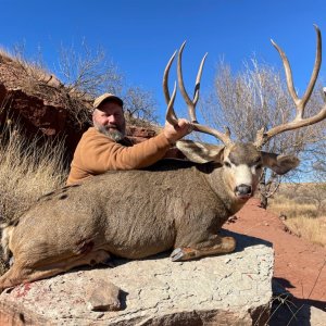
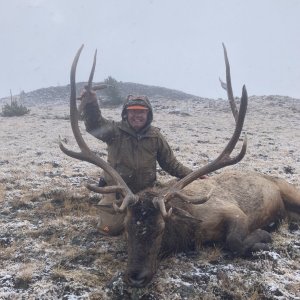
All of us hunt a unit for a first time at some point. Some of us hunt new units every year. This seems to be a hot topic, so I thought I would start a thread where people could share ideas on how to attack a new unit. Last year my son and I hunted 3 new units. This year we will be hunting at least 4 new units. 2 in NM and 2 in other states, and if we get lucky in the draws possibly more.
First thing I do is buy good maps. My favorite map is USGS, but, it has to be backed up with a current forest map that shows relevant roads. In some states Natgeo makes great maps. I have had mixed results with custom maps. I normally go into a unit with at least 2 maps of the same area. Also, it is a must to have GPS with land ownership for the unit you are hunting.
Once I have the maps, I sit with them and look for areas that are similar to areas I have had success with in other units.
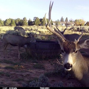
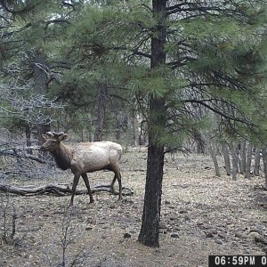
Some guys are really good with Google maps. I am trying to get better, and really used it a bunch finding waterholes in the AZ elk unit I hunted last year.
Next, I request the list of previous tag holders from Huntinfool. This is more helpful than anything else. I call those that have had the tag in the past and talk about their hunt. For me it is not just about where to go, but, where to stay, road status, what weather to expect, do I need to bring a 4 wheeler, expectations etc. I cant imagine anyone not having a membership to either Huntinfool or Epic outdoors just for this reason if nothing else. I hear people say they do not want to spend $100 a year, and they spend 10 times that on other stuff that wont help them nearly as much.
Next schedule a trip to the unit in the summer if you can. Couple it with a fishing trip or shed hunting trip just to learn the area. We did that on one of our out of state hunts last year, and plan on doing it this year also.
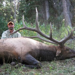
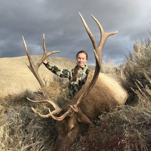
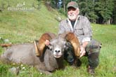
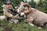
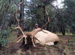
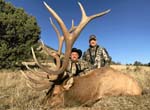
Then of course the one everyone freaks out about. Post up about your tag on social media. Quite often you will find someone you know or a friend of a friend that has experience in the unit or may no somebody that they want you to talk to. Every year I help people that need some help on a unit I have hunted here in NM or in other states. Last year Zach and I were in on 12 different elk kills. A couple were with people I had never met until that day. Don?t let other people tell you what is acceptable and what is not. Do what feels right for you.
I am sure some others have some good ideas on how to attack a new unit.
 
I agree. Do your due diligence before asking for help. I would not put in for a hunt that I could not at least scout a couple times, and spend time in the field. That is the biggest part of the experience, LEARNING. Whether it be new game, new areas, or meeting new people. I just do not agree with the people who cannot scout, do not want to take the time to learn a new area, or are just looking for the easy route. I help people all the time on here, or in person when it comes to hunting. Just depends on how you come across about it.


*We are all in the same boat, just
wishing to be hunting right now!*
 
Do it in whatever order you want. Ask for help first or whatever. Nobodies business.

If you are applying in lots of states it would be foolish to scout units before you apply for them.

If your personal rule is to scout before you apply, that is your rule and does not have to be anyone elses rule.
 
LAST EDITED ON Apr-25-17 AT 10:58PM (MST)[p]A new mapping tool I recently learned about are the unit maps available from toprut.com.

http://www.toprut.com/maps/

These are free, import into Google Earth. They obviously have the hunting unit boundaries, and layers with land ownership, and ALL of the USGS maps. Very useful when you can overlay topo with satellite images.
 
Good stuff. Hard to get away from paper maps for me, but, definitely a place for computer mapping.
 
LAST EDITED ON Apr-26-17 AT 06:22AM (MST)[p]LAST EDITED ON Apr-26-17 AT 06:22?AM (MST)

I look up outfitters in the area first. I next do my best to determine what ranch or property they hunt. A lot of the time they have an address listed. Next I figure out where that property is then see what is public near or in that property and then it is time for boots on the ground. Doesn't always work, but has given me both barbary and deer spots. Also look up the land owner tag list and work it the same way.
 
NMPaul I like your logic and use similar steps myself.

I drew a Utah elk tag back in 2014 and soon discovered everything you stated to be extremely important. I went to the unit early and found a lot of really good bulls in June. Being 12 hrs away I used trail cams to keep tabs on those bulls until season. Because I found elk early I only focused where they were on my limited scouting trips and did not reach out to other(Past) hunters because I thought I knew better and had figured out what nobody else had. When I arrived for the hunt I soon found out I had made a mistake. The bulls in that unit shed their velvet and moved up to 20 miles to where they would rut. I eventually found them and was able to get into the elk but it took me a while to find the elk and then even longer to find access. Overall due to my arrogance i lost several days searching for elk and trying to learn different parts of the unit.

So I guess to sum it up my advice for hunting new units is to scout and learn the unit as best you can (primarily terrain and access points) and do not get as caught up looking for animals early in the summer as they will move in most cases.
 
Great post Paul. I would add acme mapper 2.1 and mytopo.com as 2 more great tools I've used for escouting a new unit. Helps me get an idea of roads, trails, and general areas that look like they would hold game. One of the first things I will do is use those to find areas that look to be at least 1-2 miles from roads where I'm likely to get away from other hunters with a little extra work. Then I scout when able.
 
WRONG! I am yet to find many images on any maps showing a deer or an elk. Even Google earth don't show many elk. As for scouting new units, I've never killed a single animal in a new unit that I found on a scouting trip more than a month before my hunt. In my opinion its a waste of time! I ask about units on MM and hope someone shows pitty and gives me GPS coordinates then I hunt there and blab them out to the world on future threads.

Here is how to have success in new units, drink all summer, don't scout, ask for advice but don't take it, get there the day of the hunt preferably hungover,drink a few before you leave the truck,light a cigarette to open your lungs up, blow your new elk call that you found on sale and have never used, cover yourself in cow in heat urine, then follow a truck with vortex emblems on it and park next to them and start hunting! Success shall be yours!

If I missed anything please feel free to add! LOL!
 
Biggest bull I've seen in NM came down off the hill next to my truck, while we were standing there, walked over to the gravel road, turned right and started walking down the road to the hwy that was about 1/4 mile away.
 
I think you misunderstood me paul. I meant scout before the hunt, NOT before applying.

*We are all in the same boat, just
wishing to be hunting right now!*
 
Can definitely happen! Very cool.

>Biggest bull I've seen in NM
>came down off the hill
>next to my truck, while
>we were standing there, walked
>over to the gravel road,
>turned right and started walking
>down the road to the
>hwy that was about 1/4
>mile away.
 
Good post Paul.
I'm a map ho. Now a 'puter scouting ho too.
Using both the systems mentioned for goggleE & another sat. viewing site,Flashearth.
With Inciweb not having old burn maps,having the most recent sat. views to show that burn & blow down is now covered in aspen or oak, is good. So glassing will be real hard,let alone eyeballing.
I go to pretty much the same places now after hunting all over NM & the west. Still collecting & upgrading topos I have worn out in my pocket. FS road maps & BLM too.
Now I have a GPS & onxmaps w/ownership ,a must in NM IMO.
All this,knowing the units,campsites& usually where the critters were sometime in the month before or the whole pre-hunt season,and I can show up 2 days early & wind up on plan B,c.....just due to the place is crawling when I had it to myself for 4 yrs....lol.
Hunting public lands. Know several camp & hunt spots. Be prepared to improvize,move camps need be.
I'm with Bob.
Seen some bruizers cross the road with a map on the hood....or into the next unit. lol
Learned to let folks bird dog for me too.
 
>I think you misunderstood me paul.
>I meant scout before the
>hunt, NOT before applying.
>
>*We are all in the same
>boat, just
>wishing to be hunting right now!*
>

Sorry, I did.
 
I am perfectly ok with people asking for help. I will help anyone that is willing to put time in on their own. I just do not like the people who are looking for spots because they are too lazy to do it on their own. That is part of the fun, exploring new places. It feels great to find what you are looking for.

*We are all in the same boat, just
wishing to be hunting right now!*
 
Great post idea and thread Paul! My offer still stands to help you with your upcoming hunt if wanted/needed.

One question I have is what GPS/Land status software do you recommend? Also, I know a few guys who use some apps on their phones that work in similar fashion. Anyone have suggestions on landowner/status apps for phones? I have an archery antelope tag in August and it's always tough to pinpoint your exact location on a paper map, especially if there are no fences or roads as a reference.

Jeff
 
Being old school,knowing the service in most of NM sucks & pc idiot ,I use a Garmin Oregon 450T w/onxmaps chip w/LO status.
That & map & compass..
 
>Great post idea and thread Paul!
> My offer still stands
>to help you with your
>upcoming hunt if wanted/needed.
>
>One question I have is what
>GPS/Land status software do you
>recommend? Also, I know
>a few guys who use
>some apps on their phones
>that work in similar fashion.
> Anyone have suggestions on
>landowner/status apps for phones?
>I have an archery antelope
>tag in August and it's
>always tough to pinpoint your
>exact location on a paper
>map, especially if there are
>no fences or roads as
>a reference.
>
>Jeff


Jeff, WapitiBob is the expert on gps state/ status/ landownership maps. he always answers any questions I have.
 
Great post Paul. I too like to use the paper map, I'll get lost on the app maps LOL!
To add to your post I like to call and talk to the Bio, and wardens in that area/units, and talk with my fellow MM members for sure

Joe


"Sometimes you do things wrong for so long you
think their right" - 2001
"I can't argue with honesty" - 2005
-Joe E Sikora
 
I will chime in on this one.

1. As already mentioned, Google Earth is an awesome tool. Utilizing the available GMU layers from the NMDGF, or other sources mentioned above can be a great way to identify areas that you want to scout out when you get there in person. A feature that hasn't been mentioned is the historic imagery, looking at the unit over a 5 to 10 year time period can give you insight into which dirt tanks have water during the time frame you will be hunting, as well as help identify areas that have burned in previous years that may now show up green, but potentially offer more forage for deer or elk.

2. If you can't scout it out at all prior to the hunt, at a minimum you should arrive 2-3 days before your hunt to do some scouting. Might help identify areas with high hunter densities (which can be good or bad, depending on your style of hunting). Also will let you identify access roads that may be too muddy to be passable and change your focal areas.

3. Spend time at the USFS district office or BLM office if at all possible. Try to identify areas where they have been doing forest treatments for wildlife benefit.

4. I would highly recommend looking at the harvest data NMDGF provides for new units. Look at your hunt and examine hunter success and rating for the past several years. Low success typically means less animals and more work will be required by foot, but don't ever make the mistake of thinking "hunter success in this unit is 10%, so I have a 10% chance of getting an animal". In reality, it means that 10% of hunters had what it takes to get an animal in that unit.

5. Asking folks for general info or starting points can be helpful, in my opinion I would prefer that the information was shared in PM's rather than publicly viewable posts. One person making the mistake of identifying a specific canyon that will yield excellent hunting translates to a lot of forum scanners learning about it if it is posted in a publicly viewable fashion.

6. In general, when I go hunting I am there for the challenge, the experience, and the opportunity to disconnect from our increasingly electronic and connected society. The goal is always to get an animal, but there is much more to be gained from such an adventure. Enjoy the challenge and be grateful that you have the opportunity to even be out there.
 
I go just to get away from this screwed up city. Drink a few cold ones, relax and if a deer happens to walk threw camp and volunteers to die then that's a plus. Lol.
 
I'm just waiting for Bugle to chime in and get mad at everyone for spilling the beans on scouting tactics....

Personally, I really like time spent in the unit I will be hunting. I usually try to cover lots of ground just getting an idea of game concentrations, looking for sign, old rubs, etc.... Then, once I have a few areas in mind that I am pretty sure hold some game, I pick those areas apart in more detail with Google Earth and other tools to get a feel for specific land marks, canyons, tanks, burns, etc... once I find those I return to the unit to hang cameras, hike, and start to strategize based on said land marks and features.

I have never been good at initially identifying areas that hold game through Google Earth alone. I have tried and it seems like I pinpoint areas that should be good and then when I get out there, I don't find squat. That's why I like getting a gross feel for the area first and then start using e-tools once I know where some animals are.

Hunt Hard. Shoot Straight. Kill Clean. Apologize to No One.
 
LAST EDITED ON Apr-28-17 AT 04:18PM (MST)[p]>I will chime in on this
>one.
>
>1. As already mentioned, Google Earth
>is an awesome tool. Utilizing
>the available GMU layers from
>the NMDGF, or other sources
>mentioned above can be a
>great way to identify areas
>that you want to scout
>out when you get there
>in person. A feature that
>hasn't been mentioned is the
>historic imagery, looking at the
>unit over a 5 to
>10 year time period can
>give you insight into which
>dirt tanks have water during
>the time frame you will
>be hunting, as well as
>help identify areas that have
>burned in previous years that
>may now show up green,
>but potentially offer more forage
>for deer or elk.
>
>2. If you can't scout it
>out at all prior to
>the hunt, at a minimum
>you should arrive 2-3 days
>before your hunt to do
>some scouting. Might help identify
>areas with high hunter densities
>(which can be good or
>bad, depending on your style
>of hunting). Also will let
>you identify access roads that
>may be too muddy to
>be passable and change your
>focal areas.
>
>3. Spend time at the USFS
>district office or BLM office
>if at all possible. Try
>to identify areas where they
>have been doing forest treatments
>for wildlife benefit.
>
>4. I would highly recommend looking
>at the harvest data NMDGF
>provides for new units. Look
>at your hunt and examine
>hunter success and rating for
>the past several years. Low
>success typically means less animals
>and more work will be
>required by foot, but don't
>ever make the mistake of
>thinking "hunter success in this
>unit is 10%, so I
>have a 10% chance of
>getting an animal". In reality,
>it means that 10% of
>hunters had what it takes
>to get an animal in
>that unit.
>
>5. Asking folks for general info
>or starting points can be
>helpful, in my opinion I
>would prefer that the information
>was shared in PM's rather
>than publicly viewable posts. One
>person making the mistake of
>identifying a specific canyon that
>will yield excellent hunting translates
>to a lot of forum
>scanners learning about it if
>it is posted in a
>publicly viewable fashion.
>
>6. In general, when I go
>hunting I am there for
>the challenge, the experience, and
>the opportunity to disconnect from
>our increasingly electronic and connected
>society. The goal is always
>to get an animal, but
>there is much more to
>be gained from such an
>adventure. Enjoy the challenge and
>be grateful that you have
>the opportunity to even be
>out there.

This is a great post. Happy hunting ????
 
>I'm just waiting for Bugle to
>chime in and get mad
>at everyone for spilling the
>beans on scouting tactics....
>
>Personally, I really like time spent
>in the unit I will
>be hunting. I usually try
>to cover lots of ground
>just getting an idea of
>game concentrations, looking for sign,
>old rubs, etc.... Then, once
>I have a few areas
>in mind that I am
>pretty sure hold some game,
>I pick those areas apart
>in more detail with Google
>Earth and other tools to
>get a feel for specific
>land marks, canyons, tanks, burns,
>etc... once I find those
>I return to the unit
>to hang cameras, hike, and
>start to strategize based on
>said land marks and features.
>
>
>I have never been good at
>initially identifying areas that hold
>game through Google Earth alone.
>I have tried and it
>seems like I pinpoint areas
>that should be good and
>then when I get out
>there, I don't find squat.
>That's why I like getting
>a gross feel for the
>area first and then start
>using e-tools once I know
>where some animals are.
>
>Hunt Hard. Shoot Straight. Kill Clean.
>Apologize to No One.


^^ No sir I'm just gonna say I really like Mq1's post ,?
 
Great thread Paul, if drawing a unit I'm not familiar with I will contact the biologist,Huntin fool list, now the Epic guys and post question on social media. Generally you can get a few folks pointing me the same general direction. Then I'll purchase the 1/24000 maps that cover the area I'm interested in. Once I receive maps I'll mark all existing road and trails the map shows. As we all know those maps are updated and many roads/ Trails shown are blocked etc and many not shown on map are actually there. Time for my first road trip. I'll travel lots of roads mapping what actually is there and reflecting changes on the maps. Then I'll look for areas that can be accessed along ridge lines or not to difficult walking that can get me away from anyone just looking for an easy hunt. I've found often if your willing to say cross one somewhat difficult canyon the stuff behind is untouched. In scouting for elk country in June/July in not really looking for elk but for last years rubs. Love finding tanks and springs that don't have a road going to them and go there?
 
Good post there Servehim,


Joe


"Sometimes you do things wrong for so long you
think their right" - 2001
"I can't argue with honesty" - 2005
-Joe E Sikora
 
Great post. One thing I like to do is take a highlighter and mark the roads. It does 2 things - shows you areas where you might be able to get away from the roads and also is quick and easy to find when you pull out the map on a hunt.

I'll use google earth and mark about 10 different spots I think might be good based on intel from Huntin Fool, other hunters, etc. I'll figure out the best way for me to access those points, and I study them pretty good via google earth.

The best thing you can do though is be in the unit. Either the year before, in the summer, or the days before. The days before sounds easier said than done. Tack on 3 days scouting prior to a hunt, hunting 6-9 days, plus driving time to and from and it's a pretty tough grind and tough to be away from family and work for that amount of time.
 

New Mexico Guides & Outfitters

H & A Outfitters

Private and public land hunts since 1992 for elk, mule deer, sheep, pronghorn, black Bear & lion hunts.

505 Outfitters

Public and private land big game hunts. Rifle, muzzleloader and archery hunts available. Free Draw Application Service!

Sierra Blanca Outfitters

Offering a wide array of hunt opportunities and putting clients in prime position to bag a trophy.

Urge 2 Hunt

Hunts in New Mexico on private ranches and remote public land in the top units. Elk vouchers available.

Mangas Outfitters

Landowner tags available! Hunt big bulls and bucks. Any season and multiple hunt units to choose from.

Back
Top Bottom