OnX first timer

Wiszard

Long Time Member
Messages
10,897
Just bought OnX Maps for my 2 Utah hunts this year. What do you feel is the best use for this? Knowing where private property is? Figuring out the best way to get into the area you want to hunt? Using its waypoints? I am making sure that I utilize it to the best of my abilities and its uses. It works well even without cell service is what I understand. Anyone ever have trouble with it? Thanks in advance!

Steve
 
Yes, yes and yes. Great tool, just make sure if it’s the phone app that you preload (off grid) your area while you have service then you can use it even without service on airplane mode to save battery.

This ^^^^

Plus use the tracker every time you go out. It can help you navigate your way back much easier than being a dot on the map.
 
THIS is the type of info I was hoping for. Thanks you guys for the tips.
Bruin- Looks like things are heading in the right direction for kids getting back sports-wise. Looking forward to UCLA softball grabbing another Championship this year. Good luck on your hunts this year.

Steve
 
I love On-X maps. Loading offline maps for remoate areas, using tracker to track my route and distance, using the maps to locate unknown water sources, and reviewing recent fire history are a few of my favorite things. It is also very easy to send waypoints to friends and family.

Hawkeye
 
I love OnX-I mark waypoints where I see animals I might consider shooting, also mark rubs, wallows, and other sign that is helpful to remember. I love the “track” feature to mark your path, especially if you are bloodtrailing a wounded animal.

as was mentioned, download your needed maps before your hunt and then run your phone in airplane mode to conserve battery. The private property boundaries are awesome if you have questionable property in your unit. I have loved that feature when hunting Wyoming antelope.
 
It’s a great tool that I use a lot. I also wish it didn’t exist.
Hello Cohunter,
We just returned from our Az Archery Elk hunt and were skunked for the first time ever! Yes, it was extremely warm & dry and the bulls were not talking!
We met a super nice guy using this app. OnX shows every trick tank in the area to EVERYBODY! 3-10 cameras on every one of them. Hunters sitting on every one of them! Dozens of people up & down the roads! All this activity in an area that we always had mostly to ourselves. Yep, OnX is truly an amazing tool! I too wish that it didn't exist!
 
Be sure your phone has enough space available on it to download maps. Mine didn’t and I had a terrible time trying to figure out why it wouldn’t. Once I cleared up enough space, it copied, saved and downloaded the 10 mile grid I wanted with no problems. That’s another nice feature, being able to download 5, 10, or 100 mile grids. Depending on how much resolution you need. For me the 10 mile is perfect.
 
OnX is surprisingly accurate in terms of property lines.

However, it appears that whatever tool they use to grab the parcel boundaries from the County doesn't properly display certain easements. For example, it shows access thru my private property, which is a no-no. :)

It also appears to struggle with certain land status, such as "school sections" here in Colorado.

Beware. And I also wish it wasn't so good.
 
I really like the tracker feature. I drove around my neighborhood a bit with the tracker feature on and can see how useful that will be if you spend all day in the field and hope to get back to the truck at night. Sometime waypoints just don't cut it.
 
I've just started using OnX this year and love it. Most of my advise are things that have already been mentioned:
- tracker is a great feature; remember to start it at the beginning of each hike, then stop it when you get back to camp
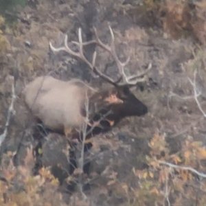
- ability to toggle back & forth between topo, satellite imagery, & hybrid (both topo & sat) was a lifesaver on a recent Colorado elk hunt
- remember to download offline maps of your area before you head out; I like to get a low resolution map of the entire area, then higher resolution maps of each specific area I plan to hunt
- use phone in airplane mode to save battery; if you're backpacking, make sure to take extra battery packs to keep your phone charged
- I like to mark waypoints on my computer before I leave home (troughs, ponds, springs, possible spots for camp, trail cams, glassing, etc.); these should automatically sync to OnX on your phone and make finding these places much easier while you're out hunting
- if you're adding a lot of waypoints, it helps to use the different types and colors to keep them organized (like red for roads, blue for water, etc.)
Good luck! If you find any other useful features let us know.
 
Was just looking at my OnX this morning and noticed they have a 3D feature now! the imagery just got a whole lot better.
 

Click-a-Pic ... Details & Bigger Photos
Back
Top Bottom