Wasatch Mountains/Strawberry Big Bull Elk

J

jbear

Guest
I drew my archery big bull tag not expecting to. I am have trouble locating elk this year. The elk are not where I normally go. I like to hunt the west side of the lake generally. Please help, I am not after a monster just a bull.
 
jbear,
If you have been scouting the "west side of the lake" I can't imagine that you have not found any elk. From Indian Creek to Clyde Creek, there are tons of elk. Every water hole I have ridden up on has been hammered with elk tracks. They are crossing "the ridge" going back and forth just about every night. If you can't find elk where you are looking I don't know what to tell you. You should be able to litterally walk down almost every draw and find fresh elk sign. If you get high enough and spend some time glassing you will find elk. Good luck.


It's always an adventure!!!
www.awholelottabull.com
 
I believe that my problem is that Iam expecting them to be lower than they are. thanks for the info.
 
I probably mislead you a little there. They aren't "high" per say. I have just gotten on a high vantage point and have litterally seen elk in every direction. If you spend a little time up high and glass the surrounding country you will do just fine. Be patient and find some water early on. Another place you may want to try is the drive from Charleston up over the top to AF Canyon. I have not been up there this year but I did see a lot of elk up there last year and some real smoker bulls.

It's always an adventure!!!
www.awholelottabull.com
 
If Jims telling you about the Wasatch, you better take it as gospel, that guy knows it better than anyone and he does not have a forked tongue.

"Another place you may want to try is the drive from Charleston up over the top to AF Canyon."

I beleive this is called Cascade Springs and the Snake Creek areas of AF canyon, excellent places for elk.

Good luck! :)


48288e6577d023b6.jpg
 
>That's what it's called. I
>wasn't being vague on purpose.
> Sorry. Sometimes I
>talk and think that everybody
>knows what I'm talking about.
>
>
>It's always an adventure!!!
>www.awholelottabull.com

I certaily knew what you were talking about Jim, you always see me in your rear view mirror! ;-)
48288e6577d023b6.jpg
 
I agree with what's been said. If you're at strawberry, pick a draw or canyon. Find some pine trees. Chances are there are elk bedded in them. Hike up the creeks and bottoms of those draws and they'll be full of elk and sign.

It will be easier in a few weeks once they start singing a bit more. But...I was up there scouting (I have the tag too) a few weeks ago and the smaller bulls are already sounding off. They started at about 7:30 the evening I was there.
 
I too have that tag, Ive been looking and seeing a ton of elk. However 2 1/2 weeks ago I watched 15 bulls one morning 3 were smokers. I returned this last weekend and only saw 4 bulls none of which were over 300.

For you spike hunters there are plenty this year saw 5 last night.
 
Indian Reservation Boundaries

Looking at my maps, it appears that from Strawberry Ridge to the Reservoir is within the Ouray Reservation Boundaries. It struck me as strange as I thought the reservation was east of Strawberry.

Whole, can you shed some light on that? Is the map incorrect?
 
RE: Indian Reservation Boundaries

LAST EDITED ON Aug-04-09 AT 01:17PM (MST)[p]LAST EDITED ON Aug-04-09 AT 01:16?PM (MST)

He is talking more to the west of the "Reservoir" not the "reservation".

Just south of the turn off to the visitor center!!

(between the VC and to the marina turn off, all the way to the south and west to Indian cr)
 
RE: Indian Reservation Boundaries

>Looking at my maps, it appears
>that from Strawberry Ridge to
>the Reservoir is within the
>Ouray Reservation Boundaries. It
>struck me as strange as
>I thought the reservation was
>east of Strawberry.
>
>Whole, can you shed some light
>on that? Is the
>map incorrect?

The Indians do have some ground east of Poison Ridge and out on the big flat on the north side of "the narrows", east of the island.
48288e6577d023b6.jpg
 
RE: Indian Reservation Boundaries

Slams got it right. There is a small patch over by Poison ridge that's Indian ground but everything from the waters edge west to Diamond Fork is public ground. There is quite a bit of private ground Southeast of Heber, left hand fork of Hobble Creek Canyon, and on the West side of Diamond Fork Canyon. The nice thing about the Wasatch is that the vast majority of it is accessible to anybody that wants to hunt it. The short answer to your question is nothing around Strawberry Ridge is private except for a few cabin sites just west of the the Marina.

It's always an adventure!!!
www.awholelottabull.com
 
RE: Indian Reservation Boundaries

Thanks Slam and Whole for letting me know about the private ground. I was up Mud and Clyde Creeks tonight, and it's clear that it is all public land.
 
RE: Indian Reservation Boundaries

I was on the Wasatch last night in the Strawberry area and the elk came out of the woodwork right at dark!
This heat and that giant moon and NOT our friends right now!


48288e6577d023b6.jpg
 
RE: Indian Reservation Boundaries

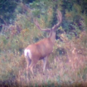
Had a friend come across the Rays valley road last night, right at dark, he said he stopped and glassed a few of the pockets from sheep creek to hobble creek turn off and said he quit counting at about 300 head of elk!!!

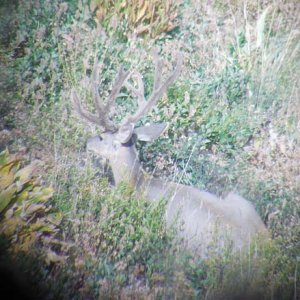
A couple pretty decent bulls on the "west" side of the road just after (north)of the diamond fork junction!! Then a few more after starting down Hobble!!

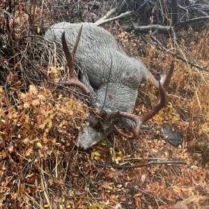
Another friend said he saw two "huge" (was his expression)six points on the southeast side of US-40 just as you start down the hill from soldier creek turn off to Currant creek last thursday morning!!( day break)

Sounds like lots of bulls on the wasatch are being seen from the roads, gggeeeezzzz I can only imagine what would be seen 2-3 miles in on foot/horse!!
 

Click-a-Pic ... Details & Bigger Photos
Back
Top Bottom