Hello guys, a newbie here.
A buddy and I drew mulie tags for the 2nd season this year. It is both of our's first trip to ever hunt in Colorado. I am no stranger to the mulies, but all of my previous experience has been either the far west Texas mulies or up in the plains of the Texas Panhandle. This trip is sort of a bucket list hunt for both of us, 28 years in the making. Neither of us has ever had the opportunity to hunt outside of Texas, and we are trying to make the best of it that we can.
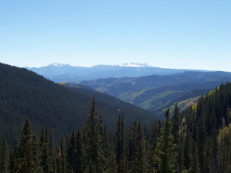
Ive been studying this unit pretty hard through just about every resource available through the internet. As of right now, i do feel like i have a general feel for the unit. But i kinda have a feeling that it may all go out the window once i see the vastness of this place.
We are planning to backpack in a day or 2 before the season starts, and get as much scouting in as we can in that short time. We plan on hiking in a good ways in an attempt to get away from other hunters as much as we can, and plan to hunt for about 6 days in the backcountry. We plan on being in as good a shape as we can possibly in, and we have already started preparing for it.
Im pretty sure this will be a combo hunt for us. We drew the mulie tags, but i will likely get an OTC elk tag as well.
I am hoping i can gain some knowledge through you guys about our unit. I know unit 74 is a very rugged, and mostly higher elevation unit, consisting of just about all public land. What i dont have a great deal of understanding of is the patterns that the elk and deer have.
Hunting outside of Texas is new to me, but i do know the basic rule that when it starts to snow and get colder, the animals will migrate to lower elevations. But is there really anyway to differentiate "elk country" from "mulie country", so to say? I know they might be intermingled to a certain extent, but is there anything that you might look for when targeting each species? Are the deer in places where the elk arent, and vice versa?
Being more specific, is there any general areas of this unit, or elevations, that tend to hold each species? I realize that this has a great deal to do with the weather, and each animal probably has their own corridor when traveling from high to lower. But what i do know about this particular subject is very minimal, any tips or pointers, not matter how big or small, would be very beneficial to me.
Not looking for any secrets here by any means, just maybe a push in the right direction. We were considering using the Hermosa Trail Head and hiking north toward the central part of the unit, East of Hermosa Creek, and perhaps setting up camp several miles in. Also, I see on Google Earth, there is another dirt road on the West side of Hermosa Creek (a GOOD ways west) that runs a much farther North into the unit, and maintains a pretty high elevation the whole way in. Would this be a good way to enter the backcountry? Or is it even possible to use this road? I do apologize, I never could determine the name of this road, but it does seem to be a pretty prominent road on the Google Earth imagery.
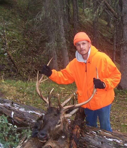
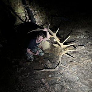
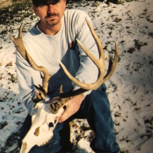
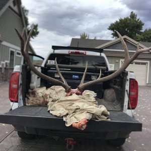
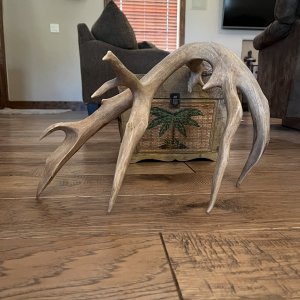
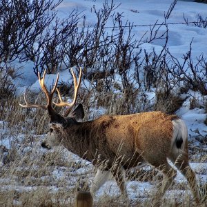
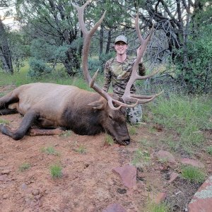
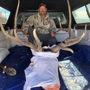
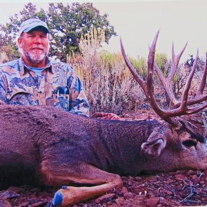
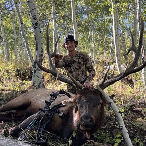
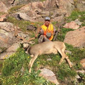
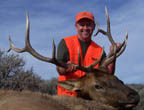
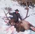
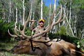
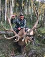
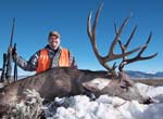
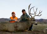
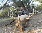
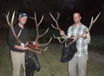
Lastly, if anyone has any personal experiences, and/or pics of a successful hunt within this unit, I'd love to hear or see it!
Thanks
A buddy and I drew mulie tags for the 2nd season this year. It is both of our's first trip to ever hunt in Colorado. I am no stranger to the mulies, but all of my previous experience has been either the far west Texas mulies or up in the plains of the Texas Panhandle. This trip is sort of a bucket list hunt for both of us, 28 years in the making. Neither of us has ever had the opportunity to hunt outside of Texas, and we are trying to make the best of it that we can.
Ive been studying this unit pretty hard through just about every resource available through the internet. As of right now, i do feel like i have a general feel for the unit. But i kinda have a feeling that it may all go out the window once i see the vastness of this place.
We are planning to backpack in a day or 2 before the season starts, and get as much scouting in as we can in that short time. We plan on hiking in a good ways in an attempt to get away from other hunters as much as we can, and plan to hunt for about 6 days in the backcountry. We plan on being in as good a shape as we can possibly in, and we have already started preparing for it.
Im pretty sure this will be a combo hunt for us. We drew the mulie tags, but i will likely get an OTC elk tag as well.
I am hoping i can gain some knowledge through you guys about our unit. I know unit 74 is a very rugged, and mostly higher elevation unit, consisting of just about all public land. What i dont have a great deal of understanding of is the patterns that the elk and deer have.
Hunting outside of Texas is new to me, but i do know the basic rule that when it starts to snow and get colder, the animals will migrate to lower elevations. But is there really anyway to differentiate "elk country" from "mulie country", so to say? I know they might be intermingled to a certain extent, but is there anything that you might look for when targeting each species? Are the deer in places where the elk arent, and vice versa?
Being more specific, is there any general areas of this unit, or elevations, that tend to hold each species? I realize that this has a great deal to do with the weather, and each animal probably has their own corridor when traveling from high to lower. But what i do know about this particular subject is very minimal, any tips or pointers, not matter how big or small, would be very beneficial to me.
Not looking for any secrets here by any means, just maybe a push in the right direction. We were considering using the Hermosa Trail Head and hiking north toward the central part of the unit, East of Hermosa Creek, and perhaps setting up camp several miles in. Also, I see on Google Earth, there is another dirt road on the West side of Hermosa Creek (a GOOD ways west) that runs a much farther North into the unit, and maintains a pretty high elevation the whole way in. Would this be a good way to enter the backcountry? Or is it even possible to use this road? I do apologize, I never could determine the name of this road, but it does seem to be a pretty prominent road on the Google Earth imagery.
Lastly, if anyone has any personal experiences, and/or pics of a successful hunt within this unit, I'd love to hear or see it!
Thanks