BLM Public Accessible Roads

highfastflyer

Very Active Member
Messages
1,553
Trying to find out what roads are accessible to the public on a BLM map. I understand you can access any BLM or state land sections coming off a major highway or county road. I was told any solid red line roads on a BLM map are normally accessible where they cross public lands, does anyone know if this is the case? In my unit area 48 antelope there are lots of checkerboard lands but also quite a few solid red line roads. Anybody have any experience on BLM maps?
 
LAST EDITED ON Jul-25-18 AT 06:02AM (MST)[p]I believe you need to be very careful crossing any private land, even if the red line road shows up on a BLM map which crosses over private and into public. Official state and county roads are ok as you mentioned, but anything else could and often is off limits through private unless you have permission.

48 is a great antelope unit but with all the checkerboard it can be tough accessing the public spots and hence the reason it's not too hard to draw as a non resident.
 
Not all solid lines are accessible, or didn't used to be....Been a few years since I saw those maps..Just know some of those roads are privately managed.
I would start at the wg&f hunt planner and look at the interactive maps. Then go to the Wyoming Office of State Lands and Investments website to view a map showing accessible state lands. Designated county roads can be viewed by going to county websites and looking at maps showing these roads.
 
Thanks for helping. The G & F website is almost worthless as it doesn't show what roads are public and what are private. The county website, especially Carbon county is quite helpful but doesn't show public access off BLM roads. I have the Medicine Bow map and it shows quite a few solid line red roads which may or may not be public accessible hence the question I asked regarding solid lines. I guess I will have to stop in at the Rawliins BLM office and ask if they can help me out. Many of these solid line roads cross public and private in the checkerboard areas. I know the dashed line or two track roads are not public accessible but just trying to get a handle on which BLM roads are actually legitimate BLM roads or just some private road which crosses many BLM sections in the checkerboard lands. Confusing unless you can actually drive out there as a local and check them out and even then you never know if the sheriff might be hiding behind the next bend in the road watching. I wish it were easier but I guess better to try and learn now before the season than get a trespassing ticket during hunting season. Thanks for the help and if anybody has any ideas on solid red line roads please pass along your advice or experience. The state of Wyoming lands website doesn't show some State sections as being public accessible if they come off BLM roads which makes it a poor resource.
 
I know it can be frustrating figuring out whether or not you can cross private land on a particular road. Unfortunately, maps don't portray this terribly well. Generally, unless it's a highway or county road that crosses private, you can't legally cross unless the landowner grants easement. If that is the case, the newest blm maps will show that section of road highlighted and there will usually be signs at the location that tell you to stay on the road "x" number if miles. Keep in mind that the landowner can pull this access, so make sure your map is the most current. By and large, most minor roads, including blm roads are off limits on private land.
 
I agree its tough, and you may have to drive the rd to figure out access.
Something else we have used is the onxmap showing landownership. If you see several sections private with the same owner, hes more than likely the one you need to research...a lot of times these guys lease the smaller sections as well.
We have called the warden/biologist and ask about the roads this way. It helps knowing land owner names talking to the warden and surprisingly they can sometimes tell you right away the access or if an outfitter leases it.
 
The Hunt Planner now has county roads, straight from the respective counties. For BLM, go to the source; they have a GIS department as well.
If you do some research and create a google earth kml of suspected open BLM roads, the gis guy can tell you if they're open, where they're open, and where access stops.
 
LAST EDITED ON Jul-25-18 AT 01:58PM (MST)[p]It seems as though some are making some of this a whole lot harder than it really is. A good county map right off their website will show the public roads so all you have to do is match them up to your BLM map to see if they touch or go through public land. Generally the BLM maps will have red solid lines for the roads and if one goes through private land and it isn't a state or county road it will either be illegal to go on the private land or the map will have a wider brown color over the red on the private piece and that designates they have gained legal access through that private property for that road.
 
County road maps can show roads that are used for emergency access, read the disclaimer, not all roads shown are open to the public.
The superintendent of the Road and Bridge Department will be able to tell you which roads are in fact public. Call him or email.
http://co.carbon.mt.us/departments/road-bridge/

Carbon County is one of the counties the Attorney will try to prosecute for corner hopping, not sure how that has played out for them but be wary.

Get an HMA permission slip and don't worry about the checkerboard.
 
>County road maps can show roads
>that are used for emergency
>access, read the disclaimer, not
>all roads shown are open
>to the public.
>The superintendent of the Road and
>Bridge Department will be able
>to tell you which roads
>are in fact public. Call
>him or email.
>http://co.carbon.mt.us/departments/road-bridge/
>
>Carbon County is one of the
>counties the Attorney will try
>to prosecute for corner hopping,
>not sure how that has
>played out for them but
>be wary.
>
>Get an HMA permission slip and
>don't worry about the checkerboard.
>

That link looks a lot like Montana! I wondered why the city names didn't ring a bell!
Zeke
#livelikezac
 
>>County road maps can show roads
>>that are used for emergency
>>access, read the disclaimer, not
>>all roads shown are open
>>to the public.
>>The superintendent of the Road and
>>Bridge Department will be able
>>to tell you which roads
>>are in fact public. Call
>>him or email.
>>http://co.carbon.mt.us/departments/road-bridge/
>>
>>Carbon County is one of the
>>counties the Attorney will try
>>to prosecute for corner hopping,
>>not sure how that has
>>played out for them but
>>be wary.
>>
>>Get an HMA permission slip and
>>don't worry about the checkerboard.
>>
>
>That link looks a lot like
>Montana! I wondered why the
>city names didn't ring a
>bell!
>Zeke
>#livelikezac

LOL, didn't look close enough to my typing!!
http://www.carbonwy.com/roadandbridge.html

The rancher would call the sheriff for trespassing, don't think but not sure if a GW would write that. It's a very "county" thing whether or not it gets written, or pursued by the County Attny.
Our county , Albany, it does not get ticketed or taken to court. I believe a judge ruled against a ticket one time here.
 
LAST EDITED ON Jul-26-18 AT 01:12PM (MST)[p]Per my conversation with the chief law enforcement official regarding my intent to corner cross, specifically in Carbon County:

A warden will not cite for corner crossing as it's not a game violation, nor can a warden write for a criminal offense ie; criminal trespass.
A deputy can write for criminal trespass but they don't in Carbon County because the DA will not prosecute; his opinion is that crossing a corner doesn't meet the criteria necessary for criminal trespass.
//////
(a) A person is guilty of criminal trespass if he enters or remains on or in the land or premises of another person, knowing he is not authorized to do so, or after being notified to depart or to not trespass. For purposes of this section, notice is given by:

(i) Personal communication to the person by the owner or occupant, or his agent, or by a peace officer; or

(ii) Posting of signs reasonably likely to come to the attention of intruders.
 
>The rancher would call the sheriff
>for trespassing, don't think but
>not sure if a GW
>would write that. It's a
>very "county" thing whether or
>not it gets written, or
>pursued by the County Attny.
>
>Our county , Albany, it does
>not get ticketed or taken
>to court. I believe a
>judge ruled against a ticket
>one time here.


Pam,

Get your facts straight on this, I believe you are wrong about Carbon County.
 
Just going by what I have heard and been told. I know of someone who dealt with the issue. This was in the past so I'm hoping things have changed.
To date I know of no one who has had to pay a fine for corner hopping.
 
? A good county map right off their website will show the public roads so all you have to do is match them up to your BLM map to see if they touch or go through public land.? If this is your only tool then you are losing out on a substantial amount of accessible public land access. The county website only shows the county and state highways and not the BLM roads and public accessible roads via easements which are better displayed on the BLM maps but difficult to fully interpret. In area 48 for example there are many BLM roads not displayed on any county map or website as public roads. The problem with the Wyoming G&F website hunt planner is it shows all roads, not just the public accessible roads. The Wyoming state lands and investment website also doesn't show public access to some state sections which are fully accessible via BLM roads. My big question is can you access any road on a BLM map which is a solid line? I fully know and understand the two- track and dashed lines are not public accessible unless you have permission to cross a private owners land or you legally accessed the public section from another legal method. Corner hopping is a whole different method and I don't really want to go that route until either Legislation or Judges fully decide upon that method. One good example is the original Fort Steele built in 1868 to support the railroad had many access roads and routes through the checkerboard lands and many of these have remained as solid lines on the Medicine Bow BLM surface map. I have emailed the BLM and will try and get a response from them. I have been told they have maps at their district offices which have marked all the public access roads but I was told the solid red lines in most cases are public accessible, just trying to verify this and it's confusing and frustrating trying to plan. Thanks for all the responses.
 
LAST EDITED ON Jul-28-18 AT 07:39AM (MST)[p]LAST EDITED ON Jul-28-18 AT 07:37?AM (MST)

The BLM maps I have...have a square box with a road number on the roads accessible to the public. The Wyoming DeLorme Atlas and Gazetteer also has similar boxed numbers on public access roads. Out in the field, the BLM often has a post with the road number on it for the same public roads. If there is a gate/fence with no trespassing signs and no public access posts and it's not a public county road I would likely not go through it! County dirt roads often have a county road sign with a county road name or number on it where they leave the pavement.

The Q Ranch in 48 and other units is notorious for cutting off public access to large areas of public land...and they watch their borders like a hawk. There are a gob of dirt roads through checkard board that are off limits. Be aware of where you are at all times! I would definitely have On X Maps if I didn't have permission to hunt the Q!
 
I have found this website especially helpful which shows all the BLM public accessible roads in yellow. I spoke with the BLM and they have in the Rawlins office a series of maps which show all the public accessible roads but from what I have observed the solid red line roads on the BLM maps are almost identical to this website of the Carbon County tourism office. I wish all counties had a website like this as it shows hundreds of roads not listed on the Carbon County government website. The Wyoming State Lands website is also not a good source as many of the state sections are not listed as accessible when in fact they are via BLM roads. Best advice I can give everyone from my experience is buy a BLM map then when going hunting stop by the regional BLM office and consult with them. This is the helpful Carbon tourism website: https://www.wyomingcarboncounty.com/carbon-county-northern-map
 
Does anybody here know for a fact that crossing a corner on BLM to BLM to hunt the BLM is okay? Has anybody ever been cited for that in this part of Wyoming? Carbon County.
 
>I have found this website especially
>helpful which shows all the
>BLM public accessible roads in
>yellow. I spoke with
>the BLM and they have
>in the Rawlins office a
>series of maps which show
>all the public accessible roads
>but from what I have
>observed the solid red line
>roads on the BLM maps
>are almost identical to this
>website of the Carbon County
>tourism office. I wish
>all counties had a website
>like this as it shows
>hundreds of roads not listed
>on the Carbon County government
>website. The Wyoming State
>Lands website is also not
>a good source as many
>of the state sections are
>not listed as accessible when
>in fact they are via
>BLM roads. Best advice
>I can give everyone from
>my experience is buy a
>BLM map then when going
>hunting stop by the regional
>BLM office and consult with
>them. This is the
>helpful Carbon tourism website:
>https://www.wyomingcarboncounty.com/carbon-county-northern-map

I hate to be the bearer of bad news, but all the yellow, and even some of the white sections of roads on that map, are NOT publicly accessible.
 
LAST EDITED ON Jul-31-18 AT 11:02AM (MST)[p]
A) post #12

B) I heard of a citation issued, not sure where, and it was in the garbage can before the end of the day. One of the members here can speak directly to that particular item.

It took me 30 seconds to make a phone call and talk to the guy in charge. Why people refuse to do the same is beyond me, but I'll bet not 1/100 will take the time.
 
LAST EDITED ON Jul-31-18 AT 02:06PM (MST)[p]I hate to be the bearer
>of bad news, but all
>the yellow, and even some
>of the white sections of
>roads on that map, are
>NOT publicly accessible.

And what do you base that statement on, as the map legend specifically shows that all roads in yellow are open to all registered vehicles, including OHVs?
 
LAST EDITED ON Jul-31-18 AT 04:47PM (MST)[p]>? A good county map right
>off their website will show
>the public roads so all
>you have to do is
>match them up to your
>BLM map to see if
>they touch or go through
>public land.?
>If this is your only
>tool then you are losing
>out on a substantial amount
>of accessible public land access.
> The county website only
>shows the county and state
>highways and not the BLM
>roads and public accessible roads
>via easements which are better
>displayed on the BLM maps
>but difficult to fully interpret.
> In area 48 for
>example there are many BLM
>roads not displayed on any
>county map or website as
>public roads. The problem
>with the Wyoming G&F website
>hunt planner is it shows
>all roads, not just the
>public accessible roads. The
>Wyoming state lands and investment
>website also doesn't show public
>access to some state sections
>which are fully accessible via
>BLM roads. My big
>question is can you access
>any road on a BLM
>map which is a solid
>line? I fully know
>and understand the two- track
>and dashed lines are not
>public accessible unless you have
>permission to cross a private
>owners land or you legally
>accessed the public section from
>another legal method. Corner
>hopping is a whole different
>method and I don't really
>want to go that route
>until either Legislation or Judges
>fully decide upon that method.
> One good example is
>the original Fort Steele built
>in 1868 to support the
>railroad had many access roads
>and routes through the checkerboard
>lands and many of these
>have remained as solid lines
>on the Medicine Bow BLM
>surface map. I have
>emailed the BLM and will
>try and get a response
>from them. I have
>been told they have maps
>at their district offices which
>have marked all the public
>access roads but I was
>told the solid red lines
>in most cases are public
>accessible, just trying to verify
>this and it's confusing and
>frustrating trying to plan.
>Thanks for all the responses.
>

The statement you referenced at the start of your post was mine and it was was strictly in reference to the county publicly maintained roads that are legally accessible by everyone. I was under the impression if you had a BLM map I referenced that you would look at the legend and see that the state highways have numbers within a certain type of box, as do the BLM roads in their particular boxes since it is a BLM issued map.
 
>And what do you base that
>statement on, as the map
>legend specifically shows that all
>roads in yellow are open
>to all registered vehicles, including
>OHVs?


The statement is based on facts. I wish those roads were all open public roads. To complicate things there are a TON of public roads (2 tracks, etc) that exist that are NOT shown on that map. Having hunted in those parts starting in 1995, I could point out spots where you'd find a padlocked gate and no trespassing signs on a number of those roads, in places. Several of the yellow are not public from start to finish.
 
?as do the BLM roads in their particular boxes since it is a BLM issued map.? If you reference the Medicine Bow BLM map, mine is newly purchased but has a 2011 date on it there are no boxes on any BLM roads whatsoever. The solid red line roads are those roads which are almost identical to the Yellow roads listed on the OHV Wyoming Carbon Tourism website. The BLM official did indicate a few of these roads have been closed so Spatz is correct in that there are a few roads but the BL M office in Rawlins has hard copy maps at the Rawlins office you can check them against. I do know for a fact the BLM map shows the road going to the top of Elk Mountain as a solid red line. This was once a public accessible road and even the University of Wyoming has some research sites on top still. A district court Judge ordered the road closed and it is now considered a dashed lined road or not public accessible. Wapiti Bob claims Carbon County will not prosecute but I do know of one case where two guys on horseback tried to corner hop and were issued citations. It was also determined the section they tried to cross did not have a corner marker survey pin. In my opinion only, I would be very wary of corner crossing against those large ranches like Q creek and Overland Trail as they have deep pockets and will fight vigorously in Court to preserve the current corner crossing policy as not recognised as Legal access. Some guys can and do perform it but the issue is the airspace you penetrate above the corner posts. If the section has no Brass corner post then it would be almost impossible with GPS technology as at best they are within 10 feet of accuracy and sometimes off by larger distances. If you can identify the corner pin post it would be very problematic to obtain a conviction in Court but you would spend tens of thousands defending yourself against these large ranches. Spatz do you want to share which roads you have found in yellow which are closed?
 
LAST EDITED ON Jul-31-18 AT 06:31PM (MST)[p]highfastflyer---It sounds like you have never hunted in Wyoming to be giving people a lot of information that may or not be accurate. I haven't missed a season out there since 1998 and am pretty familiar with what goes on out there. For one thing you are incorrect when you made the comment about a current Wyoming corner hopping policy and air space. Read the post that WapitiBob made today closely because the G&F will not touch corner hopping and it's strictly a county by county decision by the County Sheriff to write a ticket for criminal trespass and that depends if the County Prosecutor will back them in Court if the person enters a not guilty plea. The only comment I can make about your BLM Medicine Bow map is that if there aren't any numbered BLM roads for the BLM land on that map is that there must not be any legal roads to get onto the BLM.

Addendum: I just used my State of Wyoming BLM CD ROM I purchased from the WY G&F years ago and looked at the entire area you're talking about. There isn't enough BLM land in that entire part of the state for the BLM to even waste time and money for a legal road in those small tracts that are all completely surrounded by private lands.
 
LAST EDITED ON Jul-31-18 AT 06:17PM (MST)[p]>
>>And what do you base that
>>statement on, as the map
>>legend specifically shows that all
>>roads in yellow are open
>>to all registered vehicles, including
>>OHVs?
>
>
>The statement is based on facts.
> I wish those roads
>were all open public roads.
> To complicate things there
>are a TON of public
>roads (2 tracks, etc) that
>exist that are NOT shown
>on that map. Having
>hunted in those parts starting
>in 1995, I could point
>out spots where you'd find
>a padlocked gate and no
>trespassing signs on a number
>of those roads, in places.
> Several of the yellow
>are not public from start
>to finish.

That doesn't tell us anything when you say they are based on facts! What facts? I hope you know that it wouldn't be the first time a rancher put up a gate or no trespassing signs on a road that is perfectly legal to drive on. Have you verified all of those spots as being illegal with the appropriate authorities to make the statement that it's based on facts?
 
Can you count horseback corner crossing as "corner crossing"?

I have no issue with anyone who chooses not to corner cross. Please don't, in fact, as I will have more of our public lands to myself. The air space penetration issue is non-existent in current Wyoming law , by the way, except for low flying 'nuisance" issues with aircraft.

Also, it is the County that prosecutes trespass. The "Q" can have "deep pockets" all day long and that doesn't count for squat in trespassing issues. And also, please tell me how the absence of "corner pin posts" makes for an easier conviction. Last I looked, and please correct me if I'm wrong, the prosecution has to prove guilt, which there is no way in hell they can, with the absence of "pins". There is no landowner I have heard of that will pay for a survey, which will then actually put a survey marker in the ground!

There is a reason that no bonafide corner cross has been prosecuted since Bill Kearney was found "not guilty" of it in Albany County over ten years ago. Any DA knows proving guilt is near impossible when a reasonable attempt is made to access public land via a corner.
 
Do most landowners post there property? Sure would make it nice , I am hunting unit 57 there is a lot of public ground in that unit.
 
Jeff---I'm glad you just made your post regarding the comments made by the OP because I hope hearing it from a more than knowledgeable Wyoming resident such as yourself after my comments was very helpful to the OP.
 
?highfastflyer---It sounds like you have never hunted in Wyoming to be giving people a lot of information that may or not be accurate.? Laughable, I am a resident, have hunted my whole life over 40 years hunting in Wyoming. I also know a thing or two about Wyoming corner hopping cases. JM77 you seem to be missing my point, I agree penetrating the airspace would be a problematic conviction. This matter could and also most likely WOULD be a civil lawsuit case also against you as these large rich Billionaires have very deep pockets. If you are such a brave corner hopper I invite you to hunt area 125 elk and corner hop all the way to the top of Elk Mountain and kill any number of the 350+ bulls up there who rarely get hunted but be ready to cross at least 5 corner hops to get there.
 
I got my information straight from the lips of the Chief Game Warden for the state of Wyoming, specifically addressing corner crossing the Q, in Carbon County.
Im in the "trust but verify" camp and did so. I suggest others do the same.
 
LAST EDITED ON Jul-31-18 AT 07:33PM (MST)[p]>?highfastflyer---It sounds like you have never
>hunted in Wyoming to be
>giving people a lot of
>information that may or not
>be accurate.? Laughable, I
>am a resident, have hunted
>my whole life over 40
>years hunting in Wyoming.
> I also know a
>thing or two about Wyoming
>corner hopping cases. JM77
>you seem to be missing
>my point, I agree penetrating
>the airspace would be a
>problematic conviction. This matter
>could and also most likely
>WOULD be a civil lawsuit
>case also against you as
>these large rich Billionaires have
>very deep pockets. If
>you are such a brave
>corner hopper I invite you
>to hunt area 125 elk
> and corner hop all
>the way to the top
>of Elk Mountain and kill
>any number of the 350+
>bulls up there who rarely
>get hunted but be ready
>to cross at least 5
>corner hops to get there.
>

What is really laughable is that you're a resident and giving out a lot of BS information like you have in several posts on this thread! FYI there is no way no matter how much these guys you're talking about have in their pockets that what you are saying could ever be brought into court as a civil case. You need to read up on the laws before making any more completely ignorant posts on this thread like that one! Also, I can guarantee that you'll finish last arguing any of this stuff with jm77 or for that matter also with WapitiBob!!!
 
Top gun, you know very little about hunting in Wyoming as is obvious by your uniformed and unintelligent drivel about maps and hunting. I have corrected your errors and poor knowledge of Wyoming maps, hunting and access throughout this post. Be a man and admit your information was lacking, and poor at best. I agree corner hopping is a very difficult case to prosecute and that was never the intent of this thread as I posted numerous times. If you're such a self professed expert I invite you to demonstrate your corner hopping ability and set the precedent for the rest of us who don't want to go that route until the Legislature or courts act
which up until now have had numerous attempts to try and solidify the policy but we're always unsuccessful.
 
LAST EDITED ON Jul-31-18 AT 07:44PM (MST)[p]LAST EDITED ON Jul-31-18 AT 07:43?PM (MST)

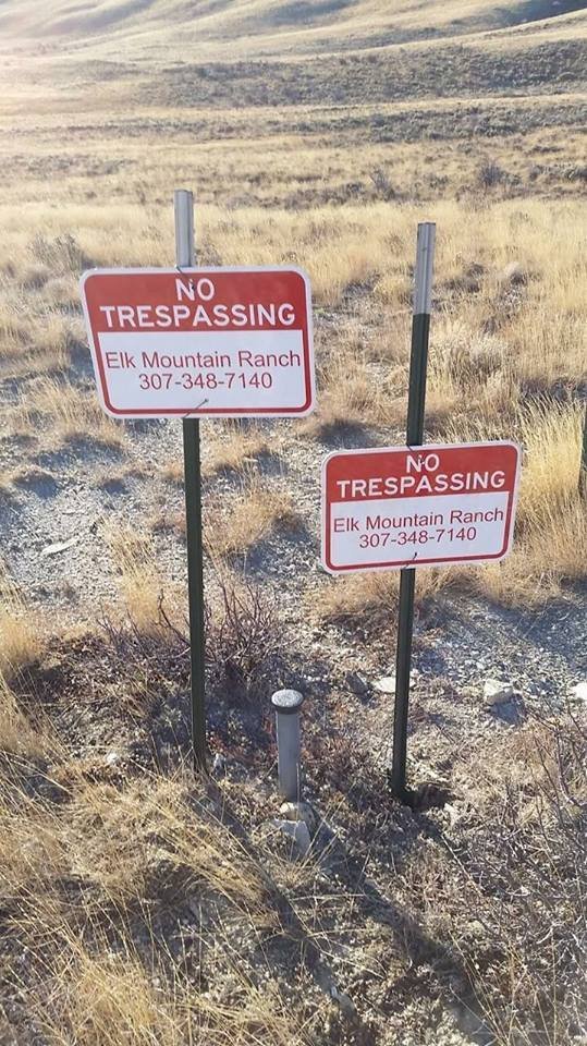
This photo is one of the corners, on the way to Elk Mountain, that you are talking about Brent. As you can see, the landowner has made it difficult to corner cross, but some still do it. When someone crosses this corner, the G&F and Sheriff are called. The G&F refuses to write, as always, and the sheriff issues a warning. When the corner crosser insists on a ticket, the sheriff refuses.

By the way, those signs meet the required warning for criminal trespass.

Go figure...

897162024621813747408325951385420132719698434457n.jpg
 
?I got my information straight from the lips of the Chief Game Warden for the state of Wyoming, specifically addressing corner crossing the Q, in Carbon County.? You also said you have spoken with the DA which I accept but also realise the DA is an elected official and his loyalty?s can and do change along with being replaced in a subsequent election. The State attorney General has issued counter opinions. The Wyoming G & F has stepped out of the corner hopping arena for now until it's more settled and established law. It is just not worth the harassment and grief until something changes, just my 2 cents. Numerous Federal court cases have established landowners own the airspace above their lands. When you penetrate that airspace some will argue it is a penetration of that air which is trespassing. I agree it's a difficult prosecution but in my position it's just not worth the grief and the amount of time and money you would spend fighting rich Billionaire landowners with deep pockets and numerous patrolling security guards while out hunting. If you want to do it be my guest and for all public access hunters I hope and wish you are successful in establishing a public access precedent and established law. It goes without saying the original legislators probably never in their wildest dreams believed it would create such a long lasting obstacle and difficulty when they divided up those lands during the early railroad days. My intent of this thread was never about corner hopping, simply trying to ascertain what roads are public accessible and apologise it has rambled into a corner hopping debacle. Spaz if you would share your knowledge of any of the yellow roads which cannot be accessed please share for all. Thanks.
 
>Top gun, you know very little
>about hunting in Wyoming as
>is obvious by your uniformed
>and unintelligent drivel about maps
>and hunting. I have
>corrected your errors and poor
>knowledge of Wyoming maps, hunting
>and access throughout this post.
> Be a man and
>admit your information was lacking,
>and poor at best.
>I agree corner hopping is
>a very difficult case to
>prosecute and that was never
>the intent of this thread
>as I posted numerous times.
> If you're such a
>self professed expert I invite
>you to demonstrate your corner
>hopping ability and set the
>precedent for the rest of
>us who don't want to
>go that route until the
>Legislature or courts act
>
>which up until now have had
>numerous attempts to try and
>solidify the policy but we're
>always unsuccessful.


Please show me one incorrect thing in any post that I have made in this thread or STHeckU! If you didn't know that red lines on a BLM map don't mean squat as far as meaning legal access to public land, which was the question you asked in your first post, then everything after that was what was pure drivel on your part, including the absolutely incorrect, stupid comment you made about these rich guys going to civil court on trespassing. Man, you need to stop making a fool of yourself and quit posting all this incorrect stuff and now you tell me I'm wrong, LOL!
 
>LAST EDITED ON Jul-31-18
>AT 07:44?PM (MST)

>
>LAST EDITED ON Jul-31-18
>AT 07:43?PM (MST)

>
>This photo is one of the
>corners, on the way to
>Elk Mountain, that you are
>talking about Brent. As you
>can see, the landowner has
>made it difficult to corner
>cross, but some still do
>it. When someone crosses this
>corner, the G&F and Sheriff
>are called. The G&F refuses
>to write, as always, and
>the sheriff issues a warning.
>When the corner crosser insists
>on a ticket, the sheriff
>refuses.
>
>By the way, those signs meet
>the required warning for criminal
>trespass.
>
>Go figure...
>
>
897162024621813747408325951385420132719698434457n.jpg

From that picture where is the public ground ?
 
?By the way, those signs meet the required warning for criminal trespass.? Difficult to ascertain but someone could make the case these signs are trespassing against the public sections if they hang out over the edges into public air above the public sections. Signs are actually established law as trespassing as someone tried to hang a billboard out which crossed over into a neighbors air above his land and he won the case. JM77 I think it would be appropriate to investigate and pass along to the DA in Carbon County that the Elk Mountain ranch is in violation of the trespassing statute.
 
>>LAST EDITED ON Jul-31-18
>>AT 07:44?PM (MST)

>>
>>LAST EDITED ON Jul-31-18
>>AT 07:43?PM (MST)

>>
>>This photo is one of the
>>corners, on the way to
>>Elk Mountain, that you are
>>talking about Brent. As you
>>can see, the landowner has
>>made it difficult to corner
>>cross, but some still do
>>it. When someone crosses this
>>corner, the G&F and Sheriff
>>are called. The G&F refuses
>>to write, as always, and
>>the sheriff issues a warning.
>>When the corner crosser insists
>>on a ticket, the sheriff
>>refuses.
>>
>>By the way, those signs meet
>>the required warning for criminal
>>trespass.
>>
>>Go figure...
>>
>>
897162024621813747408325951385420132719698434457n.jpg

>From that picture where is the
>public ground ?


You are standing on it and looking at it.
 
?Please show me one incorrect thing in any post that I have made?

?It seems as though some are making some of this a whole lot harder than it really is. A good county map right off their website will show the public roads so all you have to do is match them up to your BLM map to see if they touch or go through public land. Generally the BLM maps will have red solid lines for the roads and if one goes through private land and it isn't a state or county road it will either be illegal to go on the private land or the map will have a wider brown color over the red on the private piece? This is False and the county website only shows county and state roads not BLM roads. On the Medicine Bow BLM map there are no numbered roads just solid or dashed line roads. The Wyoming Carbon County tourism clearly demonstrates which roads have public access as the legend defines it. This closely mirrors the solid red line roads on the BLM map Medicine Bow although not 100% as Spaz has claimed and also the BLM official said there are a few exceptions and they have hard copy maps in the Rawlins office. Your unintelligent drivel, poor information and lack of knowledge make you a poor source of information leaving out vast amounts of publicly accessible lands. Just take a look at all those yellow roads on the tourism website someone like you would not have shared or passed along due to your Ignorance.
 
I suggest you stop in the Rawlins BLM office with a marker and your paper map prior to traveling on "all those yellow roads".
 
>?Please show me one incorrect thing
>in any post that I
>have made?
>
>?It seems as though some are
>making some of this a
>whole lot harder than it
>really is. A good county
>map right off their website
>will show the public roads
>so all you have to
>do is match them up
>to your BLM map to
>see if they touch or
>go through public land. Generally
>the BLM maps will have
>red solid lines for the
>roads and if one goes
>through private land and it
>isn't a state or county
>road it will either be
>illegal to go on the
>private land or the map
>will have a wider brown
>color over the red on
>the private piece?
> This is False
>and the county website only
>shows county and state roads
>not BLM roads. On
>the Medicine Bow BLM map
>there are no numbered roads
>just solid or dashed line
>roads. The Wyoming Carbon
>County tourism clearly demonstrates which
>roads have public access as
>the legend defines it.
>This closely mirrors the solid
>red line roads on the
>BLM map Medicine Bow although
>not 100% as Spaz has
>claimed and also the BLM
>official said there are a
>few exceptions and they have
>hard copy maps in the
>Rawlins office. Your
>unintelligent drivel, poor information and
>lack of knowledge make you
>a poor source of information
>leaving out vast amounts of
>publicly accessible lands. Just
>take a look at all
>those yellow roads on the
>tourism website someone like you
>would not have shared or
>passed along due to your
>Ignorance.

You really need to get your head out of your posterior and learn some reading comprehension because everything you just quoted of mine is correct and right on the button. Red lines don't mean squat on a BLM map as far as meaning they are legal access UNLESS they are a MARKED state, county, or BLM road. Each of those is numbered and in a particular type of designated box on those maps depending on what they are. BLM roads that go through private land are legally accessible IF they have that brown overlay covering the red to show that the BLM has negotiated legal access through that private property. If it doesn't have that brown overlay, then it is illegal to drive on that private land without the owner's permission. That is all I posted to answer your question and nothing else was mentioned that you say I left out as far as helping people gain legal access because everything else that wasn't mentioned was not asked for in your question. I also didn't say anything about the county maps having the BLM roads on them because they don't. I also told you why there are no numbered BLM roads on your particular map because there are none, DUH! Now come back with some more stupid comments, as you're very good at it!
 
LAST EDITED ON Jul-31-18 AT 08:51PM (MST)[p]LAST EDITED ON Jul-31-18 AT 08:49?PM (MST)

? I also didn't say anything about the county maps having the BLM roads on them because they don't.? Yes and this is a huge, huge lack of information someone would ascertain by your Ignorance, drivel and poor knowledge of Wyoming public access. Your statements about solid red line roads are also incorrect as evidenced by the Wyoming tourism website which is almost a mirror image of the solid red line roads on the BLM maps. Stop passing your poor advice on here if you don't know what you're talking about which is becoming more and more evident and apparent as you poorly pontificate, backpedal and demonstrate more ignorance. The Medicine Bow map has no numbered roads but hundreds of solid red line fully public accessible roads. Your Ignorance of Civil lawsuits is also apparent.

Trespassing may be considered a crime, a civil wrong, or both depending on where the trespassing occurs and the laws in that particular state. A landowner can sue under certain circumstances under Civil Tort Law. Billionaire landowners will do everything in their power to try and keep their little private checkerboard lands tied up. Your ignorance and drivel and poor knowledge of Wyoming are becoming readily apparent.
 
>
>? I also didn't say anything
>about the county maps having
>the BLM roads on them
>because they don't.? Yes
>and this is a huge,
>huge lack of information someone
>would ascertain by your Ignorance,
>drivel and poor knowledge of
>Wyoming public access. Your
>statements about solid red line
>roads are also incorrect as
>evidenced by the Wyoming tourism
>website which is almost a
>mirror image of the solid
>red line roads on the
>BLM maps. Stop passing
>your poor advice on here
>if you don't know what
>you're talking about which is
>becoming more and more evident
>and apparent as you poorly
>pontificate, backpedal and demonstrate more
>ignorance. The Medicine Bow
>map has no numbered roads
>but hundreds of solid red
>line fully public accessible roads.
> Zymurgy Ignorance of Civil
>lawsuits is also apparent.
>
>Trespassing may be considered a
>crime, a civil wrong, or
>both depending on where the
>trespassing occurs and the laws
>in that particular state. A
>landowner can sue under certain
>circumstances under Civil Tort Law.
> Billionaire landowners will do
>everything in their power to
>try and keep their little
>private checkerboard lands tied up.
> Your ignorance and drivel
>and poor knowledge of Wyoming
>are becoming readily apparent.


You are so full of it I can smell you all the way here to MI and I will not respond to any more of your total BS because you obviously have the reading comprehension of my dead dog!
 
Fifteen landowners in Fremont County, Wyoming and Lincoln County, Wyoming have filed a civil trespass lawsuit in Wyoming District Court, Fremont County, against Western Watersheds Project, Inc. and Jonathan Ratner, WWP Director for Wyoming, Utah and Colorado, and John Does 1-10 with the Western Watersheds Project, Inc. (WWP) for intentionally and without landowner permission trespassing and entering private property. The Plaintiffs in the case are seeking a permanent injunction to stop further unauthorized trespass against their private property. The Plaintiffs are also seeking recovery of actual, nominal, and punitive damages.

http://buddfalen.com/landowners-file-trespass-lawsuit-against-western-watersheds-project/
 
>Fifteen landowners in Fremont County, Wyoming
>and Lincoln County, Wyoming have
>filed a civil trespass lawsuit
>in Wyoming District Court, Fremont
>County, against Western Watersheds Project,
>Inc. and Jonathan Ratner, WWP
>Director for Wyoming, Utah and
>Colorado, and John Does 1-10
>with the Western Watersheds Project,
>Inc. (WWP) for intentionally and
>without landowner permission trespassing and
>entering private property. The
>Plaintiffs in the case are
>seeking a permanent injunction to
>stop further unauthorized trespass against
>their private property. The
>Plaintiffs are also seeking recovery
>of actual, nominal, and punitive
>damages.
>
>http://buddfalen.com/landowners-file-trespass-lawsuit-against-western-watersheds-project/

Red herrings don't suit you Brent.

By the way, off subject, but how's that aircraft ban on scouting working out for you?
 
You don't mention that the trespass allegations were for driving on roads thru private property and having collection sites wholly on private.
Not quite a corner crossing situation.
 
>You don't mention that the trespass
>allegations were for driving on
>roads thru private property and
>having collection sites wholly on
>private.
> Not quite a corner crossing
>situation.


This was in response to Topguns fallacious assertions rich Billionaires cannot sue for a civil trespassing infringement. I agree the facts would have to be explored in detail in court but again is it worth the grief to fight these guys? In my 2 cents it's not worth the grief but Bob I wish you the best in your corner hopping endeavours and hope you are successful in establishing a precedence. I do know that power and money will be thrown viciously against you if you are caught so is it worth look8ng over your shoulder constantly and worrying?
 
?By the way, off subject, but how's that aircraft ban on scouting working out for you?? There is no more 24 hour flying ban on private aircraft, you can fly into any public parcel as long as you land on an established road. The issue now is make sure you don't circle or preseason scout as that has changed and now is specifically against the law but flying for transportation can be done legally the same day.
 
>
> Do most landowners
>post there property? Sure would
>make it nice , I
>am hunting unit 57
>there is a lot of
>public ground in that unit.
>


Landowners in Wyoming are NOT required to post their land. If you don't have it I highly suggest if you hunt in 57 you have a GPS and a good map chip. The good news is in 57 the Rock Springs Grazing association and Anadarko open up their private lands to the public.
 
?Red herrings don't suit you? JM77 I don't think you have seriously considered your legal vulnerability to a Civil Trespass case.

Civil Trespass - This is a property rights issue, focused on whether or not you infringed on the property right of the adjacent landowners. Most all attorneys I have spoken to have opined that swinging your foot over the landowner's air space at that infinite intersection of the properties would constitute Civil Trespass. It's just not worth the grief having lawsuits, attorney fees, court costs, fines and judgements which could be levied against you to deal with it but if you desire, please let us know and all public hunters would gladly donate to the legal defence fund. I just don't want the risk of rich deep pocketed Billionaires squeezing me even more.
 
What's mine is mine and what's yours is mine.. the mantra of some landowners. BuzzH owns that quote.
 
>?By the way, off subject, but
>how's that aircraft ban on
>scouting working out for you??
> There is no more
>24 hour flying ban on
>private aircraft, you can fly
>into any public parcel as
>long as you land on
>an established road. The
>issue now is make sure
>you don't circle or preseason
>scout as that has changed
>and now is specifically against
>the law but flying for
>transportation can be done legally
>the same day.

Yes, I know all this, remember? You were the one who claimed transport and hunting the same day would be in jeopardy.
 
LAST EDITED ON Aug-01-18 AT 04:36PM (MST)[p]I just hope that anyone reading this thread doesn't listen to a single thing the OP has stated regarding red lines on maps and saying that they are accessible. Some are if properly marked as state, county, or BLM roads just as I mentioned. Many more are not accessible if they don't meet one of those criteria and the OP will find that out if he doesn't listen to what I've stated. He also was incorrect about Wyoming policy on corner crossing, has stretched everything when the talk turned to corner crossing to suit his purposes when he talks about crossing with horses along with the land owner pressing civil charges for egregious trespassing and trying to relate that to corner crossing! I understand that this gentleman is an orthodontist and a pilot living in the southern part of Wyoming. I hope he's a lot better in those endeavors than all the incorrect statements he has posted on this thread about public access, LOL!
 
?Some are if properly marked as state, county, or BLM roads just as I mentioned.? Topgun you just keep displaying your ignorance, drivel and lack of knowledge of Wyoming maps and hunting. You really should just stop spreading your lies and drivel as they are severely lacking. Please tell us where the numbered BLM roads are on the current Medicine Bow map? Also please compare all the yellow roads on the Wyoming Tourism Carbon County website you would be failing to pass along almost 2000 miles of roads crossing through Carbon Cointy which are fully public accessible, not State or County roads and not numbered on any BLM map. It's ok, if you are ignorant and don't know the legends of these maps and their accessibility but passing along disinformation, lies and drivel is disgusting at best and Delusional at worst. Perhaps you should immediately seek professional help. I can recommend many along those public yellow accessible roads in Carbon County, Wyoming. RTF Map legend then get back to us with your admittance you are just plain Wrong and a deflated Windbag.

https://www.wyomingcarboncounty.com/carbon-county-northern-map
 
?You were the one who claimed transport and hunting the same day would be in jeopardy.? Pilots turned out in droves at the G&F meetings and solidified our position. We now can fly and hunt same day, thanks to our pro- active involvement but there still are a few uneducated old school types who don't know the rules yet.
 
LAST EDITED ON Aug-01-18 AT 07:45PM (MST)[p]That post #61 is the best post the OP has made on this entire thread, as there's nothing in it but a big blank black box, LOL! He surely can't be that stupid when he keeps referring to a BLM map that doesn't have any BLM roads marked on it because there aren't any, but then just keeps on saying there aren't any marked ones on it, LOL! He also can't seem to understand that the tourist map he keeps referring to was not mentioned by myself other than to ask SPAZ what facts he had to show some aren't legal and I got no response. He also can't seem to understand that all I did was answer his one question that he asked in his first post as to whether all the red roads on a BLM map are accessible. They are not and if he keeps trying to say all those yellow roads on that tourist map are legally accessible with no proof that they are other than his say so he's probably going to end up getting his sorry read end one big trespassing ticket! I can't believe a resident like this guy that says he has hunted 40 years in his home state even asked that question about what a red line on a BLM map means, LOL! He also obviously won't admit he's wrong about anything because three of us have now put him in his place showing he's wrong about almost everything he's posted on several subjects and yet he just keeps coming back with more BS, LOL!!!
 
> Pilots turned out in
>droves at the G&F meetings
>and solidified our position.
>We now can fly and
>hunt same day, thanks to
>our pro- active involvement but
>there still are a few
>uneducated old school types who
>don't know the rules yet.
>

This is a funny statement, as I saw a total of one pilot comment at any of the two Commission meetings and another regulation meeting in the Casper office where the new aircraft reg was discussed.

At the final meeting, the one pilot that showed up, wanted to keep scouting from his plane. Must have been one of your "old school" guys?

I'll have to ask Buzz how many pilots showed up at the meetings in Laramie.
 
LAST EDITED ON Aug-01-18 AT 08:51PM (MST)[p]LAST EDITED ON Aug-01-18 AT 08:50?PM (MST)

At the Laramie meeting, the flight issue wasn't even brought up until I reminded Cory to discuss it. There wasn't a single pilot there that I know off. Nobody gave any public testimony at all. The droves of pilots must of showed up else where...either that or someone is full of crap. I suspect the latter.
 
>LAST EDITED ON Aug-01-18
>AT 08:51?PM (MST)

>
>LAST EDITED ON Aug-01-18
>AT 08:50?PM (MST)

>
>At the Laramie meeting, the flight
>issue wasn't even brought up
>until I reminded Cory to
>discuss it. There wasn't a
>single pilot there that I
>know off. Nobody gave any
>public testimony at all. The
>droves of pilots must of
>showed up else where...either that
>or someone is full of
>crap. I suspect the latter.
>

IMHO just about everything the OP has posted on this thread would qualify under that final crap comment in your post Buzz!
 
?This is a funny statement, as I saw a total of one pilot comment at any of the two Commission meetings? Well obviously our representation was successful. We had 3 pilots in attendance at the Green River meeting and numerous comments were submitted. Here i have the quote from Mike Choma directly to my question regarding the status of flying and hunting private aircraft.

?In both the statute and regulation language you can see the emphasis on "use of aircraft to spot or locate game or communicating with any person attempting to take wildlife". There is also a provision that clarifies these rules do not apply to commercial, commuter or other aircraft used for the sole purpose of passenger transport.

So to answer your question; this regulation does not stop any pilot who is flying solely for passenger transport. The only activity that is regulated relates to using aircraft for spotting and locating game or communicating to someone attempting to take wildlife.

I trust this answers your question. If not, let me know.?

MIke Choma
 
? I will not respond to any more of your? Topgun for someone who has been clearly debunked and proven fallacious, ignorant and demonstrating poor knowledge of public access roads in a Wyoming you keep spotting more gibberish and drivel. How?s those Civil Trespassing cases working out for you? LMAO.
 
LAST EDITED ON Aug-02-18 AT 08:38PM (MST)[p]>? I will not respond to
>any more of your?
>Topgun for someone who has
>been clearly debunked and proven
>fallacious, ignorant and demonstrating poor
>knowledge of public access roads
>in a Wyoming you keep
>spotting more gibberish and drivel.
> How?s those Civil Trespassing
>cases working out for you?
> LMAO.


I haven't responded to you since I made that statement, but I'll make an exception since you just won't shut up to go find out I'm right on everything I've stated and you're still showing that your reading comprehension sucks, LOL! Your "debunking" anything I've stated that is all correct is obviously all in your mind because not a single person has come on here to say I'm wrong and if I was I can guarantee that the guys who have already posted on this thread would tell you if I was wrong. That hasn't happened because everything I've stated, including your stupid idea that a civil case would be instituted against someone just for corner hopping based on that egregious civil trespassing case you mentioned is a real hoot. I can't believe that a guy who is a Doctor and a pilot isn't smart enough to just make a call to the local BLM Office to find out that I'm right and you're wrong regarding all the red lines on a BLM map being legally accessible like you think. How about in between straightening people's teeth tomorrow that you do that and then come back like a real man and apologize for being wrong and me knowing what I'm talking about. You probably won't though because it looks as though you'd rather keep making an azz of yourself on here. You've certainly done that regarding access that I have given you the correct answers on along with the aircraft regulation that Jeff and Buzz have schooled you on, so I'm actually the one that's LMAO! Also, if those rich guys you keep mentioning could file a civil suit against those that choose to corner hop near their corners, wouldn't you think that they would have already done so by now with some of that big money they have, duh?! You are one big joke and should quit right now while you're behind on everything you keep posting, LOL!!! Hey, when you come back the next time, and I'm sure you will, please also tell all of us what that big, blank black box in your post #61 is all about, LOL!
 
LAST EDITED ON Aug-02-18 AT 08:35PM (MST)[p]LAST EDITED ON Aug-02-18 AT 08:29?PM (MST)

highfastflyer,

The discussion you had with Choma was one Jeff and I had very early on with regard to the needed changes to scouting from the air and how it would impact transporting to landlocked BLM and State. Forest Service doesn't allow aircraft use, unless on designated airstrips.

We talked to Nesvik, Choma, and Talbott, as well as the commission well in advance of you even being aware the regulation changes were coming. It was a done deal long before you even knew, and that's a fact. Everyone was complaining about the aircraft regulations, and that's why Jeff and I stepped up. Everyone else was hiding under the bed..

We knew early on that the regulation changes we were recommending would make it legal to hunt State ground via aircraft, which was illegal prior to our getting involved. There was no way to meet the 24 hour rule legally, as there is no over-night camping allowed on State ground. So, you couldn't fly into landlocked State, spend the night, and hunt. Thanks to Jeff and I (via WYBHA), as well as the commission and the Department, now you can and the law actually makes sense.

I don't understand what point you're trying to make by acting like a complete a$$, but you and 3 pilots didn't change anything we didn't already propose.

But, at least now I know that a "drove" of pilots is 3...

BTW, you need to brush up on trespass laws and corner crossing, you're completely wrong on that issue...google it.
 
Buzz, Don?t get your panties in a wad. I didn't know you or your role but I am highly appreciative if what you claim is true and I have no reason to doubt it. I never brought this up, JM77 got us off track and I apologise for that and again a sincere thanks for helping out fellow pilots and yes I am aware of Forest Service regulations. However realise you can ask each administrator if you ever had a need to land there on Forest Service lands but landlocked Forest Service land is very small in Wyoming. Landlocked BLM and state is the bigger issue as you full well know.
 
LAST EDITED ON Aug-03-18 AT 03:41AM (MST)[p]?I haven't responded to you since I made that statement,? Again another LIE which is quite common for an ignoramus as that was 4 posts ago and you still know nothing about Wyoming land issues or access or the law and civil lawsuits yet continue to pontificate your long debunked and fallacious assertions. If we followed your drivel and gibberish hunters would not have access to over 100,000 acres of BLM and state lands in Carbon county which have public access but do not use state or county roads and the BLM map Medicine Bow shows no such numbering you Delusionally keep spouting nonsense about. Yes in your little Deluisonal head you think you are right but if you follow one of the yellow public access roads on the Carbon County Tourism OHV map you could easily get yourself some professional help and possibly some medication to control your nonsensical tirades. I have called the BLM and they have said for the most part the solid red lines on the BLM map are public accessible but there are a few exceptions as I even noted with the solid red line road which is no longer accessible on Elk Mountain. You can stop into BLM office in Rawlins and verify which roads are public accessible before going afield as they have updated and current maps.
 
Is this guy really a Doctor and pilot because if he is he must have gone to some third world country to get his degree and paid off someone to get his pilot license with the absolute BS he keeps posting that sounds more like he is still in grade school! He thinks he's schooled me on access issues, corner crossing, etc. and yet was the one that was so stupid he had to come on here and ask if all the red lines on a BLM map are legally accessible, which they aren't. Someone please come on here and tell him who is right and that it's not him on any of these issues!
 
?Is this guy really a Doctor ? If I we're I would have certainly had you committed long ago. Spreading lies and telling people fallacious information is not only dishonest it's sadly Delusional. Try following one of those solid red line roads or yellow lines so you can at least find a pharmacy to get some medication to control your tirades and mental outbursts. You know nothing about literally thousands of miles of fully accessible roads and hundreds of thousands of acres of public land you can access yet still desperately cling to your delusional assertions. Read my posts more clearly next time as I have repeatedly spelled it out for those willing to listen. Step 1 buy a BLM map, step 2 research the Medicine Bow BLM map, step 3 compare it with the Carbon County tourism OHV website which clearly shows public accessible roads in yellow and they closely match the solid red line roads on the BLM map. Step 4 compare your map at the BLM office in Rawlins with their more current and updated maps which have all public access roads in their office. I can't make it any clearer than that and you still cling to a false assertion of numbered BLM roads which do not appear on the Medicine Bow map and if you follow your advice you are missing out on literally a hundred thousand acres of fully public accessible lands. Next time Topgun take your medication before you pass along any more Deluded information and pathetically inaccurate and lacking information.
 
LAST EDITED ON Aug-04-18 AT 12:28PM (MST)[p]I have to keep this thread alive so anyone just reading it doesn't take your BS as knowing what you're talking about and getting in trouble with a trespass ticket by listening to you. I do apologize if you aren't a 38 year old Doctor/pilot who lives in Laramie and keeps putting all this BS out about maps, LOL! You keep saying I haven't considered all the yellow lines on that "Tourist" map of Carbon County you keep referring to and that there are no numbered BLM red lines on that Medicine Bow BLM map and now tell me to go get a BLM map, etc. Sir, I have numerous BLM maps of Wyoming since the early 90s when I started hunting out there, as well as a CD ROM BLM map of the entire state of Wyoming purchased directly from the Wyoming G&F. Every one of them, IF there are any BLM roads on them, have a number and are in a BLM designated legend box to show what they are. If you say there are no numbered BLM roads on the map you keep referring to, then there are either no legal BLM roads in that area or you're the one that doesn't know squat about maps by saying there are, but they aren't numbered, LOL! I have to say again that the latter is more than likely since YOU were the one who started this thread asking the stupid question if all red lines on a BLM map are legal, accessible roads for the public to drive on and is there anyone out there that knows anything about BLM maps. Then the rest of this thread YOU started is YOU telling everyone about them like you're the BLM map guru, LOL! You proved in your OP that you don't know squat about legal access anywhere when you asked that stupid question when everyone should know that they aren't, especially you that claims you're a 40 year resident hunting out there! Then you keep trying to correlate the yellow lines on a tourist map with red lines on a BLM map that aren't numbered as all being legally accessible and telling me that means the public would be missing out on accessing millions of acres of land to hunt on. Please give us the name of the BLM employee and their phone number here that is telling you all those red lines are legal access with few exceptions because they obviously also don't know squat about the maps that the agency you claim they work for puts out! Put up or shut up so that people just going on their first hunt in Wyoming don't think you know what you're talking about and get themselves a big fat trespassing ticket and that's exactly what will happen if they listen to you! It sure appears that YOU are the one that is more than delusional in your incorrect rants!
 
That Tourism map is gonna get somebody an ass chewin from a pissed off landowner. I saw 3 "yellow" roads not open to motorized public access in less than 5 seconds of looking.
 
>That Tourism map is gonna get
>somebody an ass chewin from
>a pissed off landowner. I
>saw 3 "yellow" roads not
>open to motorized public access
>in less than 5 seconds
>of looking.


Well Bob, you must be delusional, pathetically inaccurate and lacking information.

Nice job on your antelope, by the way!
 
What I don't get is the entire reason for the post...

The unit in question has a metric chit ton of accessible BLM and pronghorn.

The checkerboard is a total non-issue too...they're called HMA's.
 
LAST EDITED ON Aug-04-18 AT 01:32PM (MST)[p]>What I don't get is the
>entire reason for the post...
>
>
>The unit in question has a
>metric chit ton of accessible
>BLM and pronghorn.
>
>The checkerboard is a total non-issue
>too...they're called HMA's.


Beats the hell out of me too Buzz, as I just had time and got my BLM map up on the computer and even though it's old it has all kinds of numbered BLM roads on it within antelope unit 48 that he's talking about, so I would think his paper map should too. As you mentioned, along with a large number of county roads on it that access public land so also do a ton of two tracks that you can access from the legal numbered BLM roads in the norther half of that unit. Add in the HMAs you mentioned in the checkerboard land down south and the unit could be legally hunted forever without going on the same road twice! If the OP is a 40 year resident hunter in Wyoming like he stated, he must be dumber than a stump to have even started this thread asking his question!
 
Bob, you keep forgetting the HMA only allows 50 hunters and there are about 150 any antelope and not sure but something like another 100 doe tags. The HMA only covers the land s between Hanna and Seminoe so lots of checkerboard lands are outside of the HMA especially on the west side. You and Spaz keep referring to closed yelllow roads and I have asked numerous times if anybody has any information on any of these closed roads yet all you do is claim somebody will get a trespass ticket. It would be nice to know which if any of the roads you state are closed where they are? I do plan on stopping in at the BLM office in September but would sure be helpful earlier on to know which roads are open and which are closed.

@ Topgun, just as I suspected you are spouting your mouth giving fallacious advice without even referring to the Medicine Bow BLM map. When you do access it then you will understand it does not have the traditional numbered roads on it even though I know there are numerous public roads in that region.
 
>Bob, you keep forgetting the HMA
>only allows 50 hunters and
>there are about 150 any
>antelope and not sure but
>something like another 100 doe
>tags. The HMA only
>covers the land s between
>Hanna and Seminoe so lots
>of checkerboard lands are outside
>of the HMA especially on
>the west side. You
>and Spaz keep referring to
>closed yelllow roads and I
>have asked numerous times if
>anybody has any information on
>any of these closed roads
>yet all you do is
>claim somebody will get a
>trespass ticket. It would
>be nice to know which
>if any of the roads
>you state are closed where
>they are? I do
>plan on stopping in at
>the BLM office in September
>but would sure be helpful
>earlier on to know which
>roads are open and which
>are closed.
>
>@ Topgun, just as I suspected
>you are spouting your mouth
>giving fallacious advice without even
>referring to the Medicine Bow
>BLM map. When you
>do access it then you
>will understand it does not
>have the traditional numbered roads
>on it even though I
>know there are numerous public
>roads in that region.

First off, it was BuzzH that mentioned the HMAs in his last post and it was Bob that mentioned the yellow roads he knows aren't public on that Tourist map in just his quick look at it. If you think I'm going to buy a friggin Medicine Bow BLM map to see that there aren't any numbered BLM roads on it, you are sadly mistaken. I have no idea if/why the map doesn't have them numbered if that's the case, but they are all numbered on the CD ROM BLM map I have here on my computer and every other one of the approximately ten BLM maps I have. Have you asked someone in the BLM Office why your map doesn't have all the BLM roads numbered?
It would be a lot better than just continuing to post your BS at me because I do know what I'm talking about when I answered the one question you asked in your first post about all red lined roads being legally accessible, which they aren't as I keep telling you and the other members have now backed me on.
 
LAST EDITED ON Aug-04-18 AT 10:47PM (MST)[p]Look guys, as long as this person keeps spouting incorrect information about public access among other things like he has and that can get people that think he's correct into trouble and a possible trespassing ticket I'll keep right on posting and if you don't like it don't read them! Also, in case you haven't noticed, a couple other regular members of this Forum have also told the guy he's out to lunch regarding everything he's posted, so you guys can get a life while I keep trying to help others so they don't get into trespassing trouble on their hunts.

PS: It takes two to argue as the old saying goes!
 
Hi folks. Sorry to interrupt, just hoping to ask a few questions about the public land. I drew a 3rd choice antelope tag for unit 4, just so I knew I could hunt this year. I knew the public land was really lacking, but it was my best option. My questions are this; is all the State and BLM land open to hunting as long as it can be reached? Are these public lands ever ordered closed, and if so, do they post them as such? From the information I have found, I can spend the night on BLM, but not State land; is that correct? There is also a little bit of Grassland run by the Forest Service, is that public? Thank you very much for any information or advice.
 
>Hi folks. Sorry to interrupt, just
>hoping to ask a few
>questions about the public land.
>I drew a 3rd choice
>antelope tag for unit 4,
>just so I knew I
>could hunt this year. I
>knew the public land was
>really lacking, but it was
>my best option. My questions
>are this; is all the
>State and BLM land open
>to hunting as long as
>it can be reached? Are
>these public lands ever ordered
>closed, and if so, do
>they post them as such?
>From the information I have
>found, I can spend the
>night on BLM, but not
>State land; is that correct?
>There is also a little
>bit of Grassland run by
>the Forest Service, is that
>public? Thank you very much
>for any information or advice.
>

1---It can all be hunted if it's legally accessible from a public road.
2---It is very unusual that any of the land would be closed to hunting unless it might be because of fire or severe drought. Both instances would normally be well publicized if there were a closure for any reason.
3---Yes, to BLM land, but no camping or fires on state land.
4---The Grasslands are huntable public land if you can access them legally with out crossing private land.
 
>Thank you for your time. The
>answers are greatly appreciated.

No problem. I'm going to send you a PM on the spots you can legally access in unit 4. Make sure you have a chip in your GPS showing land ownership so you know exactly where you are at all time so you don't get a trespassing ticket.
 

Wyoming Hunting Guides & Outfitters

Badger Creek Outfitters

Offering elk, deer and pronghorn hunts on several privately owned ranches.

Urge 2 Hunt

We focus on trophy elk, mule deer, antelope and moose hunts and take B&C bucks most years.

J & J Outfitters

Offering quality fair-chase hunts for trophy mule deer, elk, and moose in Wyoming.


Yellowstone Horse Rentals - Western Wyoming Horses
Back
Top Bottom