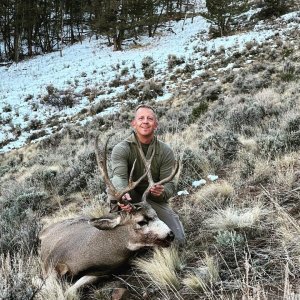
With the new Coconino road closers coming up on May 1st how many of you lucky enough with a tag are going to be effected by it? What's your thoughts?
GBA
home : latest news : latest news
Share April 27, 2012
________________________________________
4/26/2012 5:21:00 PM
New closures, camping restrictions start in Coconino Forest
Starting next week, dispersed vehicle camping in the Coconino National Forest will be permitted within 300 feet of the roadway along nearly 600 miles of designated camping corridors. Along all other open roads vehicles must remain within 30 feet of the road.
The Coconino National Forest has released a free map to the public showing what roads will remain open for on-highway and off-highway use as well as where the dispersed camping corridors are.
Steve Ayers
Staff Reporter
CAMP VERDE - The implementation of road closures and new vehicle camping restrictions on the Coconino National Forest, six years in the making, will begin on May 1.
Known as the Travel Management Rule, it will close off 3,000 miles of roads formerly accessible to the public and effectively close many favorite camping spots to RVs and travel trailers.
To ensure the public understands with new rules, the Forest Service is giving away free maps that show which roads will remain open and which corridors remain open for dispersed vehicle camping.
Copies of the map are now available at the Verde Ranger Station in Camp Verde, Red Rock Ranger Station south of the Village of Oak Creek, Happy Jack Ranger Station and the CNF offices in Flagstaff.
"We don't expect everyone is going to be able to follow the map 100 percent. We kind of see the map as the speed limit, the purpose of which is to provide an incentive to do the right thing," says Mike Dechter, travel management rule coordinator for the CNF.
The two-sided, three-by-five foot map, delineates the 3,000 miles of open roads, showing which ones are open only to highway licensed vehicles and which ones are open to all vehicles, including ATVs, along with the 600 miles of corridors open to camping.
A downloadable version of the map for Garmin GPS units is also available free on the CNF websites as well as one for use with smart phones. Go to www.fs.usda.gov/Coconino and click on the "Travel Management Rule" link.
Under the new rules, vehicle camping in RVs is allowed within 300 feet of the road in any of the designated camping corridors. Outside of the camping corridors, vehicles must stay within 30 feet of the roadway.
"There appears to be some confusion when it comes to camping restrictions," Dechter says. "Actually the entire forest is open to camping. The only restriction is on where motor vehicles can go."
The Coconino National Forest will not post signs notifying visitors of roads that have been closed. Instead they will rely on the maps.
"Over the past five years we have worked really, really hard to get route-marker signs up, which tell you what road you are on," Dechter says. "It's actually national policy not to put closure signs out because in the past it has backfired.
"It has provided an incentive for people to tear down and vandalize those signs. They are very good at it, much better than we are at keeping them up."
Dechter says that over time the roads being closed off will be obliterated, a gate installed or some sort of roadblock put in place to discourage traffic.