LAST EDITED ON Jan-15-12 AT 08:19PM (MST)[p]Read the
www.azgfd.gov unit description of 3a\3c
on the right hand side click hunting, then where to hunt, this should bring up a map of all az units, each unit has a description of the game in that unit and some places to start hunting from
here its is from azgfd
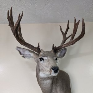
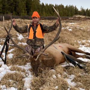
Elk
Overview: Elk can be found throughout Unit 3C in both the pine forest and pinyon/juniper woodlands. Elevations range from 5,600 feet in Taylor to over 7,200 feet on the Mogollon Rim. Elk densities are higher south of Highway 260 than north of the highway. Generally, the highest elk density in the unit is south of Highway 260 and west of Decker Wash, but this can change, depending on precipitation patterns.
This unit has a moderate number of antlered permits available each year, and, since the Rodeo-Chediski Fire, has had high numbers of antlerless permits. The early season antlered tags in Unit 3C are highly coveted by hunters.
Land status: The majority of the unit is situated within the Black Mesa and Lakeside Ranger Districts of the Apache-Sitgreaves National Forests, consequently access to hunting areas is not a problem. A Forest map can be purchased at any Apache-Sitgreaves National Forest District Office, located in Overgaard, Lakeside, Springerville and Alpine, or at the Arizona Game and Fish Region I office in Pinetop.
On the early hunts, check to make sure that there are no fire restrictions in effect. In addition, residential developments and homes are scattered in the unit. Remember that you must be at least ? mile from any building before discharging a firearm.
On early hunts, weather can range from moderately hot to wet, with snow being a possibility. Because of warmer temperatures on early hunts, it is suggested that you locate a meat processor or butcher who will provide a location to hang and cool meat before going hunting. There are game processors in Heber, Taylor, Lakeside and Wagon Wheel (between Show Low and Lakeside).
On late hunts, weather ranges from moderate to severe, with snow and cold temperatures likely. Be prepared for winter conditions by bringing appropriate clothing and vehicles. Four-wheel drive vehicles are recommended on the late hunts because of potential snow and very muddy roads. Please help minimize damage to wet roads. You are liable for any damage or ruts you create. This is considered habitat damage by the Forest Service and the Game and Fish Department.
The majority of the unit is bounded on the south by the Fort Apache Indian Reservation. Your permit does not allow you to enter the Reservation to hunt or recover game. Do not trespass on the Reservation for any reason without tribal permission. If you shoot an animal that travels onto the Reservation, contact the White Mountain Apache Game and Fish Department to obtain permission to go after the animal.
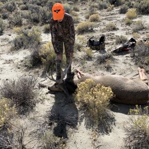
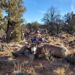
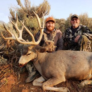
Pre-season scouting is important to locating animals, especially on later hunts when bulls are not bugling. Success on the late bull hunt is largely dependent upon scouting. Some trophy-quality bulls are still available on the late hunt, but they are much more difficult to locate.
During the rut hunts, use an artificial bugle to locate bulls (this isn't necessary if they are already bugling), and then stalk until you are within range to shoot or set up and use cow calls to entice the bull within range. Watching stock ponds and wildlife drinkers may also be productive, especially in dry years. In more open areas, glassing can be an effective technique if high points are located prior to hunting. On the antlerless hunts, take enough time to positively identify your target and triple check to make sure the animal you intend to harvest does not have antlers.
Areas: Elk populations in Unit 3C are scattered throughout the entire unit. However, since the Rodeo-Chediski Fire, elk densities are higher south of Highway 260 (which bisects the unit). For antlered and antlerless elk, good hunting areas the past few years include: Telephone Lake and White Lake just north of Show Low (accessed from Hwy 77), Juniper Ridge (FR 143) west of Show Low/Linden, Pinedale Ridge (FR 132) south of Clay Springs, near Deer Springs (FR 107, 161 and 145) Lookout Tower, the Aripine area (FR 332), the area between Phoenix Park Wash and Decker Wash (FR 146), the area around the Gentry Lookout Tower, and anywhere near Black Canyon Lake (accessed via FR 86 or from Highway 260). Scouting is critical to locating animals for your hunt.
A number of ranchers and farmers in the Linden, Burton, and Show Low areas will allow access to their private land to hunters, but you need to obtain permission first.