Elk Landowner List

vthokee

Active Member
Messages
109
How exactly does the elk landowner list work? I know it says that if it's a UW tag you do not have to get written permission. How do you find out where the property is? Do you just call the ranch owner and talk with them?
 
You can either call the L.O. or write to game and fish for properties you might be interested it. I did both. Some numbers for land owners were disconnected or had changed, or went unanswered (did talk to a few who were very helpful, though). Probably better to go direct to Game and Fish. Either write the E-PLUS coordinator, or (quicker) file a public records request.
http://www.wildlife.state.nm.us/documents/IPRA.html

You'll get maps of varying quality for your efforts.

Here's my experience:
http://www.monstermuleys.info/cgi-b...05&forum=DCForumID34&archive=yes#.UeyDeayndPY

In the end, for me, it was worth it to find some seams between the public lands that allowed for more direct access to a few areas.
 
Thanks for the response. I will contact G&F tomorrow while at work and see what they have to say this year.
 
You can also use Garmin Map Chip Hunting GPS Maps.com, which shows property boundary and landowner name. Can be very handy.
 
The problem is not all of the ranch needs to be enrolled and only the enrolled lands can be accessed. Unfortunately, they need to be sued and forced to do their jobs. All enrolled properties are required by law to have current maps on file. The "we don't have time or people" excuse I got years ago is crap.
 
LAST EDITED ON Jul-22-13 AT 11:27AM (MST)[p]Agreed. Last year my request had several "not on file" properties. When I pressed the issue, I received a very useful map custom generated out of the regional office that had each property on one map with the boundary very obviously defined. They clearly knew the boundaries of each property that was enrolled. Contrast this with the haphazard land-owner provided maps that you receive from the office in Santa Fe.

There is obviously two standards: one for internal use and one for the public who is filing a records request.
 
When applying to get into the LO program you must submit deeded acreage property info as well as plot maps.I even submitted a custom USGS topo and BLM map.
I know some ranches are claiming leased lands as well as deeded.

There does seem to be 2 worlds G&F is working in.One with access and files that are accurate and one that is incomplete.....both only accessable online now somehow.Same with reg.s and all ,just have to know where to find it.

I use the huntinggpsmaps system now too, but it also not accurate as to currant owners or or in the case of Catron county,blank. It does show the boudaries of state/blm lands tho.
 

New Mexico Guides & Outfitters

H & A Outfitters

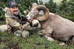
Private and public land hunts since 1992 for elk, mule deer, sheep, pronghorn, black Bear & lion hunts.

505 Outfitters

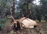
Public and private land big game hunts. Rifle, muzzleloader and archery hunts available. Free Draw Application Service!

Sierra Blanca Outfitters

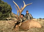
Offering a wide array of hunt opportunities and putting clients in prime position to bag a trophy.

Urge 2 Hunt

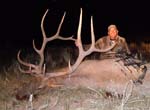
Hunts in New Mexico on private ranches and remote public land in the top units. Elk vouchers available.

Mangas Outfitters

Landowner tags available! Hunt big bulls and bucks. Any season and multiple hunt units to choose from.

Back
Top Bottom