You are using an out of date browser. It may not display this or other websites correctly.
You should upgrade or use an alternative browser.
You should upgrade or use an alternative browser.
Fire in 16D
- Thread starter shedneck
- Start date
bobby
Active Member
- Messages
- 322
here is the link to keep tabs https://inciweb.nwcg.gov/incident/5171/
looks small in size at this point.
Update on Kerr Fire, May 4, 2017 at 0900
Incident: Kerr Fire Wildfire
Released: 1:25 hrs. ago
Location:
Reserve Ranger District on the Gila National Forest
John Kerr Peak, 17 miles northeast of Reserve
Catron County, New Mexico
Start Date: May 1, 2017 Size: 175 acres Cause: Lightning
Vegetation: Ponderosa Pine, Gamble Oak, Pinon/Juniper
Smoke: Smoke may be visible within the surrounding area of Apache Creek, Cruzville, Aragon, and Reserve, NM
Resources: 3 engines, Gila Hotshots Incident Commander: Joe Aragon, IC-4
Summary: The Kerr Fire is burning on National Forest lands. Values at risk include Continental Divide trail which is located east of the fire, range improvement infrastructure and Mexican Spotted Owl habitat. CDT hikers in the area are advised to check in with the Reserve Ranger District office at 575.533.6232 for alternate routes in order to avoid fire activity. Maps of alternative routes are available at the district office, on the Gila NF website and on Inciweb at https://inciweb.nwcg.gov/incident/5171/.
Fire operations continued yesterday evening along the ridgetop and went well. All fences within the area are prepped. Minimal isolated torching has occurred. Today?s operations are planned to continue firing from FR 289B towards Fr 7037N. This fire is reducing the fuel load and helping with restoring healthy regrowth and watershed restoration.
For information on the Gila National Forest, check out our website at http://www.fs.usda.gov/gila or join the conversation on Facebook at www.facebook.com/GilaNForest/ or follow us on Twitter @GilaNForest.
mozey
Long Time Member
- Messages
- 3,107
Interesting that I just checked the link and it said it was lightning caused. When I was driving around 16C/16E on Friday and Saturday I came across a couple of signs that said Prescribed Burn, but the only smoke that I could see was coming from 16D, so I assumed that it was the prescribed burn. Things looked pretty dry, so that fire could end up burning a long time.
shedneck
Active Member
- Messages
- 589
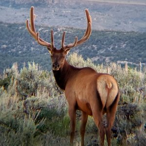
I'mm definitely not an expert on fires or habitat restoration after a fire, but I think it's safe to assume that the benefits of fire to elk and habitat won't be seen out of this fire until at least next hunting season. Thoughts? I also can imagine that the fire will displace some elk into neighboring units. Anyone have any thoughts on that? Because I've never been in 16D before, it's tough for me to get a good sense of how much of the unit this fire is consuming.
mozey
Long Time Member
- Messages
- 3,107
I think it depends on how hot the fire burns. If it burns hot enough to sterilize several inches of top soil, it will be several years. On the other hand, I've seen elk move almost immediately back into a "not-so-hot" burned area, going after the new growth. This was within a couple weeks after the fire was out.
mozey
Long Time Member
- Messages
- 3,107
Unfortunately, your biggest concern will probably not be what the elk do, but whether the FS decides to close the area "for your own safety." That's what happened following the Los Conchas fire in 6C in 2011. Immediately after that fire I was able to scout some decent bulls that had moved right back into some less burned areas (there were still some smoldering trees). About a week before my archery hunt, I got a notice in the mail from G&F telling me that particular section of the unit was closed due to the danger of falling trees and rolling rocks. Yes, there were some really damaged draws that would have been pretty dangerous to be in. But for what I suspect was more for ease of trespass enforcement, the FS drew much wider boundaries to also include areas that held the bulls that I scouted. If I remember right, G&F did offer to refund my license if I decided not to hunt, but there was no way I was going for that, so I took the opportunity to explore some new areas within the unit during my hunt. As you might expect, most of the rest hunters had the same thoughts, and we all ended up hunting on top of each other. Not one of my fondest memories...
muleywhisperer
Active Member
- Messages
- 196
I just got a email from fish and game offering a full refund because all hunts in 16-D are cancelled because of the fire and the danger of dead fall!
Oh well maybe next year!
Don't worry the elk got a reverse 911 and advised them to seek shelter in unit 22 because even fire won't touch that area much less a hunter!
Oh well maybe next year!
Don't worry the elk got a reverse 911 and advised them to seek shelter in unit 22 because even fire won't touch that area much less a hunter!
LAST EDITED ON May-09-17 AT 09:13AM (MST)[p]This fire is nothing like the big fires we have had lately.
As Mozey said they burnt & glazed the ground in places they burned so hot. Whole mountains of conifers gone instead of bands.
Now there is aspen & other plants coming up.Aspens & oaks so thick you can't glass some places.
Light rain again last night.
I doubt they will close much of this area,but I agree FS goes overboard at times. Seen areas open for hiking before hunting season suddenly closed.It's usually for fear of erosion from vehicles & widowmakers & deadfalls.
Flash floods do happen,so stay out of stream beds camping...
muleybeast
Active Member
- Messages
- 657
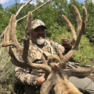
Gonna green up nice by August. If I had a tag in there that's where I would be.
Similar threads
New Mexico Guides & Outfitters
 H & A Outfitters
Private and public land hunts since 1992 for elk, mule deer, sheep, pronghorn, black Bear & lion hunts.
 505 Outfitters
Public and private land big game hunts. Rifle, muzzleloader and archery hunts available. Free Draw Application Service!
 Sierra Blanca Outfitters
Offering a wide array of hunt opportunities and putting clients in prime position to bag a trophy.
 Urge 2 Hunt
Hunts in New Mexico on private ranches and remote public land in the top units. Elk vouchers available.
 Mangas Outfitters
Landowner tags available! Hunt big bulls and bucks. Any season and multiple hunt units to choose from.